Opis
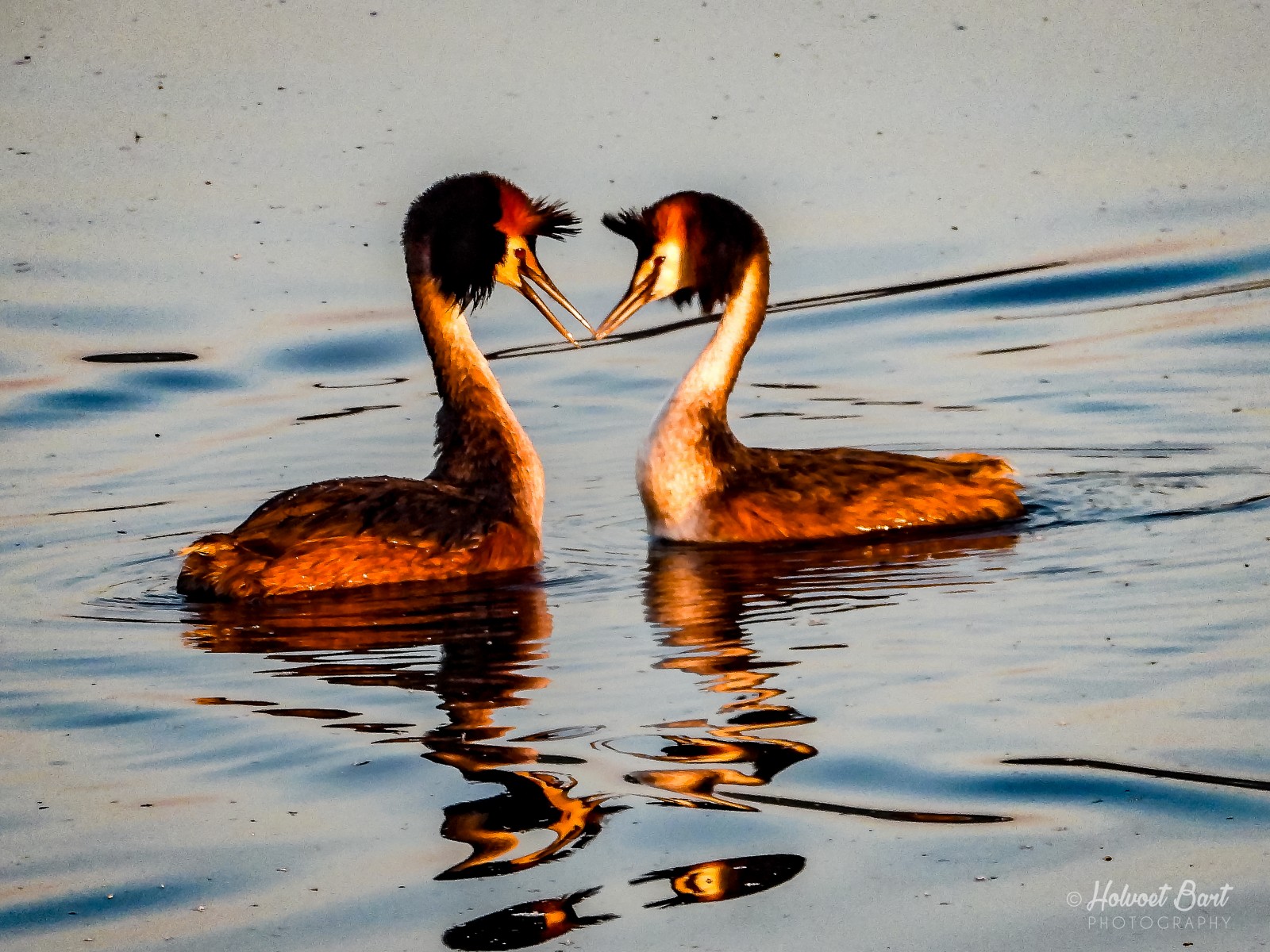
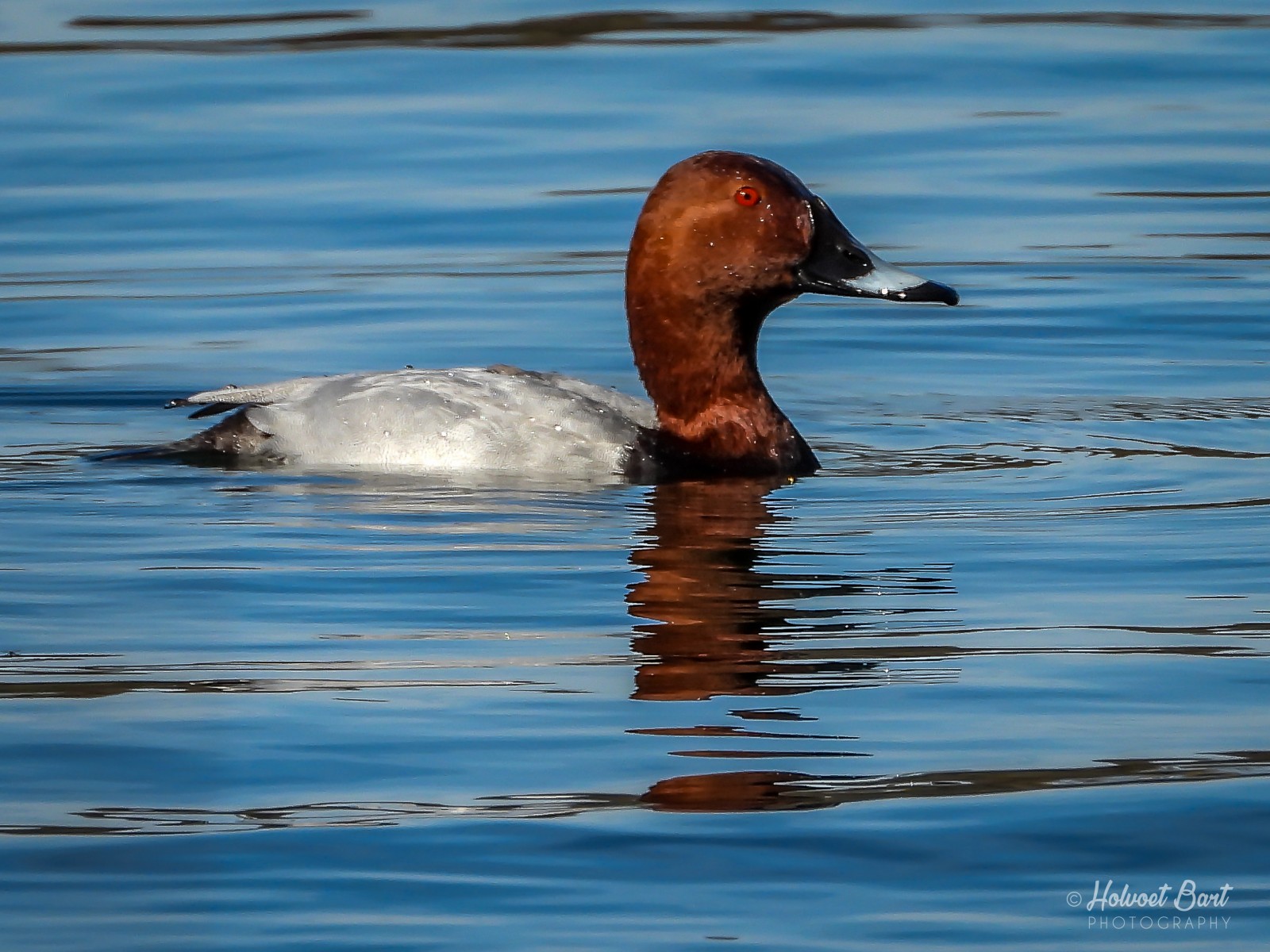
De Gavers is a former sand extraction pit and with 192 hectares the largest nature and recreation area in South West Flanders. A mix of afforestation, nature development projects and recreation. In the center of the domain is a pond of approximately 65 ha with crystal clear water and locally up to 15 meters deep. The area has good paths and there is also a bird hide. Among the birds you can see here are: perkoz dwuczuby, gęgawa, bernikla kanadyjska, łabędź niemy, gęsiówka egipska, krakwa, świstun, cyraneczka, głowienka, czernica. See the extended birdlist below.
_________________________
Nederlands: De Gavers is een voormalige zandwinningsput en met 192 ha het grootste natuur- en recreatiedomein van Zuid-West-Vlaanderen. Een mix van bebossingen, natuuronwikkelingsprojecten en recreatie. Centraal in het domein ligt een vijver van ongeveer 65 ha met glashelder water en plaatselijk tot 15 meter diep. Het gebied heeft goed begaanbare paden en er is ook een schuilhut. Enkele van de vogels die er te zijn: perkoz dwuczuby, gęgawa, bernikla kanadyjska, łabędź niemy, gęsiówka egipska, krakwa, świstun, cyraneczka, głowienka, czernica. Scroll naar beneden voor een uitgebreide vogellijst.
Szczegóły
Dostęp
Ample parking is provided. From the center of Harelbeke, follow the arrows "Provincial domain De Gavers". Park the car in parking "South", near the Koutermolen.
_________________________
Nederlands: Ruime parking is voorzien. Volg vanuit het centrum van Harelbeke de pijltjes "Provinciaal domein De Gavers". Parkeer de wagen op parking "Zuid", nabij de Koutermolen.


 ) aby wstawić nazwy ptaków w swoim języku ojczystym. Nazwy ptaków zostaną automatycznie przetłumaczone dla innych użytkowników!