

Opis
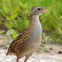
The south shore of the lake Zeller See harbours a vast moorland amidst a stunning alpine scenery. The WiesenKönigReich wetlands with its lowland moor and wetland meadows give shelter to a variety of plants and animals. Lake Zeller See and the vast wet meadows on its south shore are an important resting place for migratory birds and overwintering bird species. Every year thousands of birds are crossing the Alps on their way to the breeding sites in the north of Europe. A good resting place close to the main Alpine ridge is this reserve on the southern shore of Lake Zeller See. Among the breeding birds are ohar, perkozek, derkacz, kszyk, pokląskwa, skowronek and pliszka żółta. Herons and egrets are foraging in the area, a czapla siwa colony is found in the vicinity of Bruckberg.
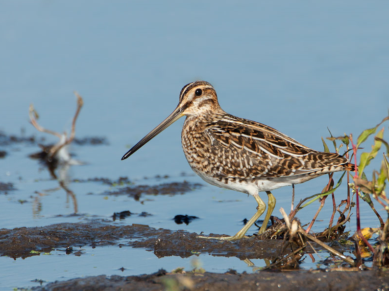
During migration you can see waders like biegus rdzawy, biegus zmienny and samotnik and sometimes rarities. edredon, świstun, rożeniec, głowienka and szlachar can be observed in winter. kormoran are migrating through. Especially in winter one can observe larger groups. Other birds that can be seen are błotniak stawowy, rybitwa czarna, gąsiorek, białorzytka, muchołówka żałobna, mazurek and kowalik.
Szczegóły
Dostęp
WiesenKönigReich Zell am See is located on the southern shores of the lake Zeller See. There is a free parking (see the P on the map or click on the P to get directions). You can explore the area on foot or by bike. The route that is shown on the map is about 5 km.


 ) aby wstawić nazwy ptaków w swoim języku ojczystym. Nazwy ptaków zostaną automatycznie przetłumaczone dla innych użytkowników!