.JPG)
.JPG)
.JPG)
Opis
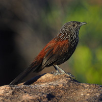
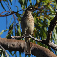
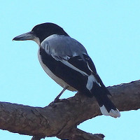
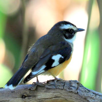
This iconic 4WD destination is home to one of Oz's most sought after birds, Black Grasswren and is also to the similarly locally restricted Kimberley Honeyeater. Other targets here include Partridge Pigeon, Buff-sided Robin, Sandstone Shrikethrush and White-quilled Rock-Pigeon.
Spectacular Mitchell Falls via Little Mertons and Mertons Falls is arrived at via a fairly challenging nine km walk from the Park camping area. Birding for sandstone loving species is available throughout this walk.
From the Parks and Wildlfe page - see link: "allow four to six hours for the moderate to difficult 8.6km round trip to Mitchell Falls so that time can be spent at the falls. The walk is over rough country but the track is marked and is reasonably well-worn. If in doubt, walk in close vicinity to the creek. Take care near the many cliffs.
You can stop and view Little Mertens Falls 800m from the camping area on the way to Mitchell Falls. Swimming is not permitted below the falls, due to the possible presence of saltwater crocodiles.
Mertens Gorge - large and dramatic falls en-route to the Mitchell Falls which plunge into a narrow chasm known as Big Mertens Falls 2.5km from the camping area. Take care near the rocky cliffs.
Visitors must buy an Uunguu Visitor Pass online at wunambalgaambera.org.au before arriving as there is no public internet/phone access on Wunambal Gaambera Country".
Szczegóły
Dostęp
To get to Mitchell Falls, located in Mitchell River National Park in Western Australia, you'll need a 4WD vehicle and follow the Kalumburu Road turnoff from the Gibb River Road. From there, take Port Warrender Road to reach the Mitchell Falls carpark.
Consider camping at Munurru Campground near the junction of Kalumburu Road and Port Warrender Road before continuing. You can also opt for scenic flights and helicopter transfers for a different perspective.
Note, this is a very remote region; distances are vast and roads are rough and only traversable in the dry season. It's about 300 km to Port Warrender Road from Kalumburu or about 400 km from Derby; then another 240 km north to reach the camping ground. Visitors travelling under their 'own steam' must have a high clearance 4WD vehicle and be fully provisioned for extended touring.
Press P on the map to access Google mapping.

 ) aby wstawić nazwy ptaków w swoim języku ojczystym. Nazwy ptaków zostaną automatycznie przetłumaczone dla innych użytkowników!