Opis
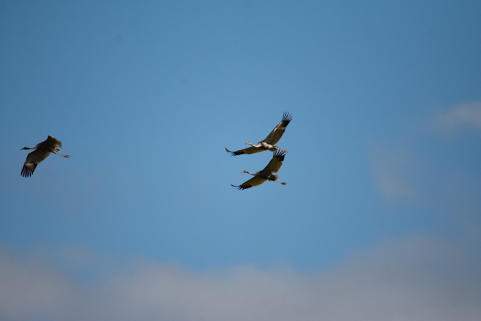
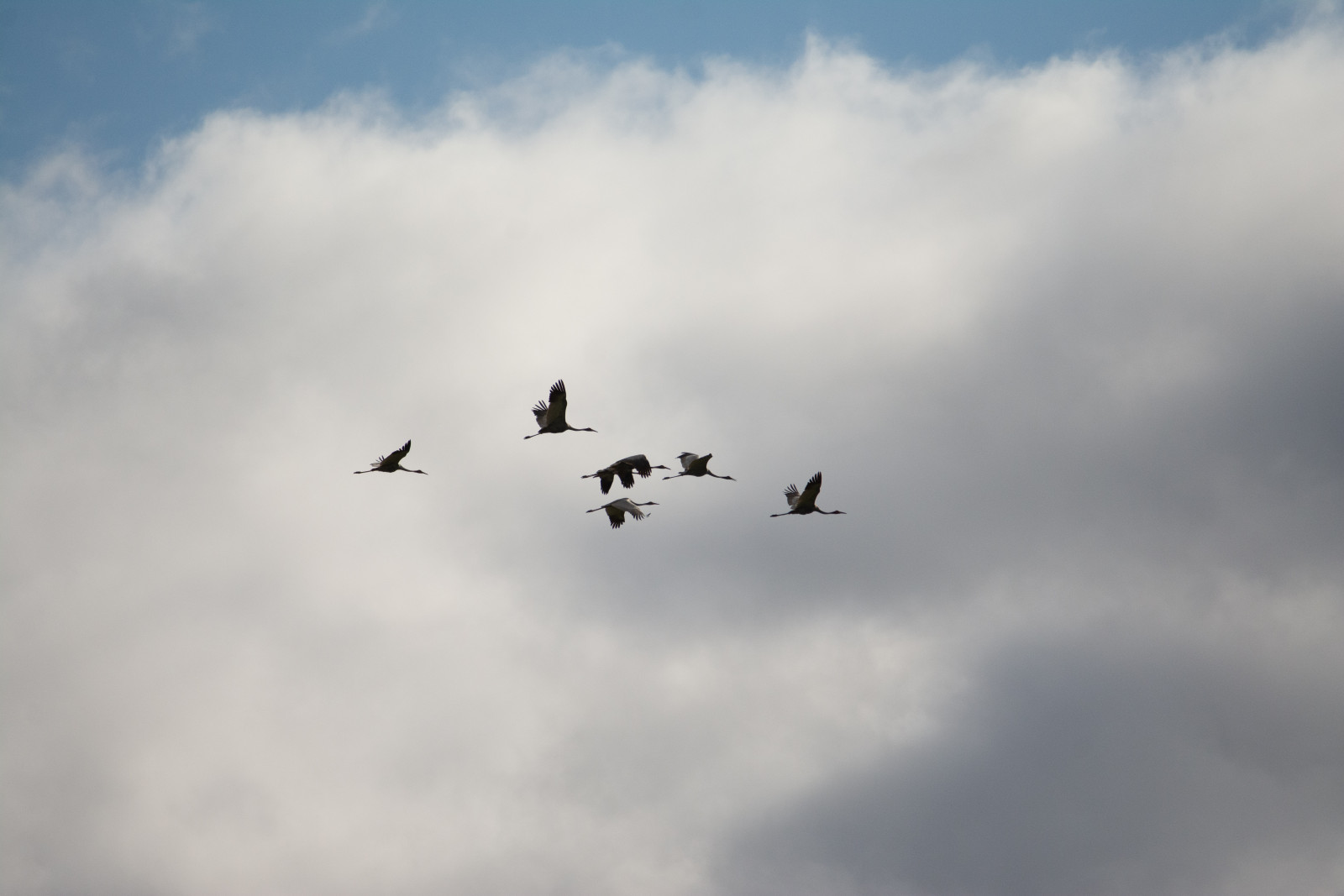
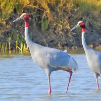
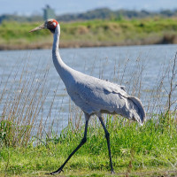
Bromfield Swamp viewing point, while it may not be overflowing with birds, at sunset in winter it provides a fantastic opportunity to see large flocks of both Sarus Crane and Brolga coming into roost from all over the Tablelands. This alone makes it a worthwhile detour one evening and a great place to visit.
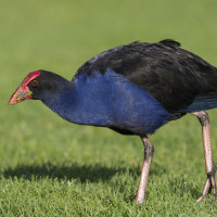
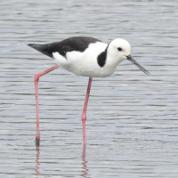
During the daytime in winter the wetland can have some Brolga and Sarus Crane remaining as well as other water birds such as Magpie Goose, Australasian Swamphen and Pied Stilt. The surrounding agricultural land lends to raptors soaring overhead and other birds such as Black-faced Cuckooshrike being in the area.
Records indicate at least 150 species being recorded here over the years. A scope is recommended here as it will improve viewing but a lot can be still seen with binoculars
Szczegóły
Dostęp
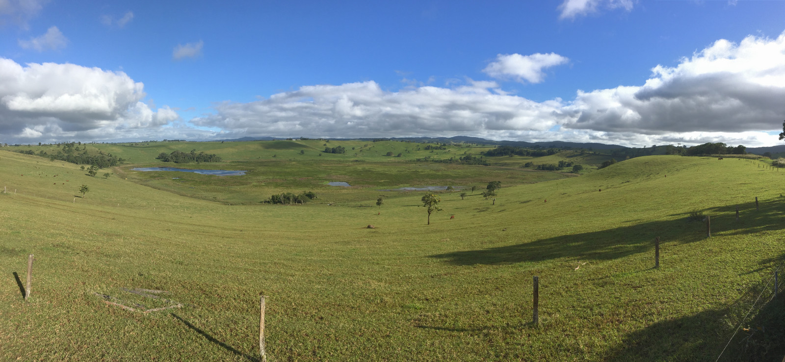
Access is along Upper Barron Rd the first turning on the left as you leave Malanda on the Malanda Atherton Rd. Follow the road for approx 5 km until you see a viewing area and a pull in on the left hand side of the road. Click on the P in the map for directions or coordinates. There is no access into the swamp as it is private land and cattle are grazed in the paddocks surrounding it. This is not a walk more of a viewing area, so suited to those less mobile.
There are no facilities or shelter here but the nearby town of Malanda has cafes, shops and public restrooms. While it is not designed for wheelchair users it is a relatively large parking area and the ground is flat so could be suitable.
Teren i siedlisko
Tereny podmokłe , Rolnictwo/uprawy , DolinaWarunki
Otwarty krajobraz , PłaskiTrasa dookoła
NieCzy luneta będzie przydatna ?
Może być przydatnaUdany sezon obserwacyjny
ZimaNajlepszy czas na wizytę
ZimaTrasa
Droga utwardzona , Droga nieutwardzonaPoziom trudności szlaku pieszego
ŁatwyDostępne
Samochód , Wózek inwalidzki , RowerCzatownia/platforma obserwacyjna
TakDodatkowe informacje
Its a raised ramp that gives you a little more height to look down into the crater.

 ) aby wstawić nazwy ptaków w swoim języku ojczystym. Nazwy ptaków zostaną automatycznie przetłumaczone dla innych użytkowników!