Opis
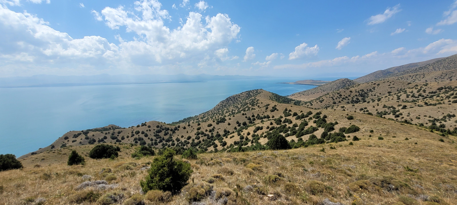
Artanish peninsula can be devided on three main zones.
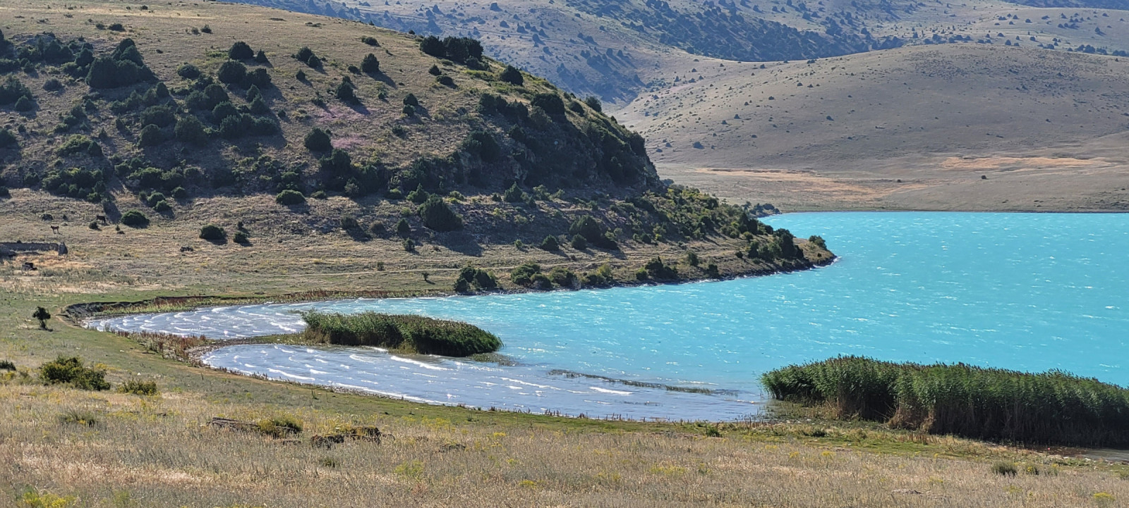
1. Open water, with reedy coast. You can find perkoz dwuczuby, łyska, mewa armenska and czapla siwa there.
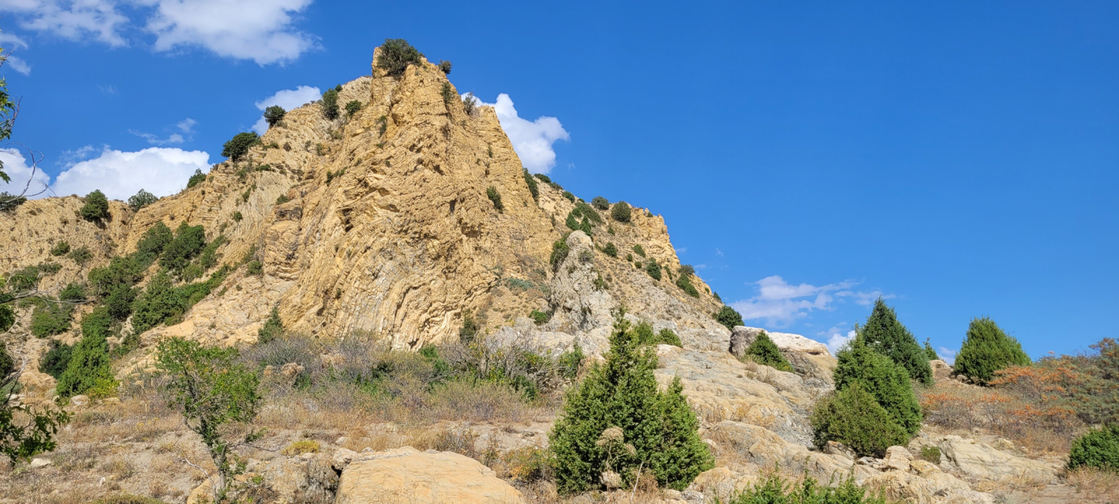
2. Artificial plantations of pines and buckthorn under high (up to 50 meters) cliffs of sedimental rocks. Where colonies of oknówka are nesting and a lot of passerines live. You also can find predators like kurhannik or krogulec there.
3. Semi-arid steppe with sparce juniper trees. kuropatwa, góropatwa azjatycka and dudek could be found there. During autumn migration (from august to November) you can encounter harriers, orzeł stepowy and more predators here.
Szczegóły
Dostęp
Artanish peninsula is at the north coast of lake Sevan. The best way to get there is by car (or taxi). Go along the H-7 road (from Tsovagyugh to Vardenis) to east. Press a P on the map for directions.
You can enter Artanish peninsula just after the village of Shorja - turn right on the unpaved road (it's absolutely flat and firm) and follow it about 5 km to the artificial pine forest. You can leave car or taxi there and then go on foot.
The second way to enter the peninsula is an unpaved road. This road starts to the right from the highway about 6- 6,5 km after the village of Shorja "End sign". You go through arid pasture and then follow the road that repeats Sevan coast. It is suitable for the most types of cars. You can leave your car anywhere you like and then go by foot.
Artanish peninsula is the part of Sevan National park, so you can meet rangers who ask you to pay. The entrance fee is 3000 AMD (2024).
The perfect route to see all habitats is about 7-10 km with elevation difference about 200-300 m, so it will take about 3-5 hours.


 ) aby wstawić nazwy ptaków w swoim języku ojczystym. Nazwy ptaków zostaną automatycznie przetłumaczone dla innych użytkowników!