Description
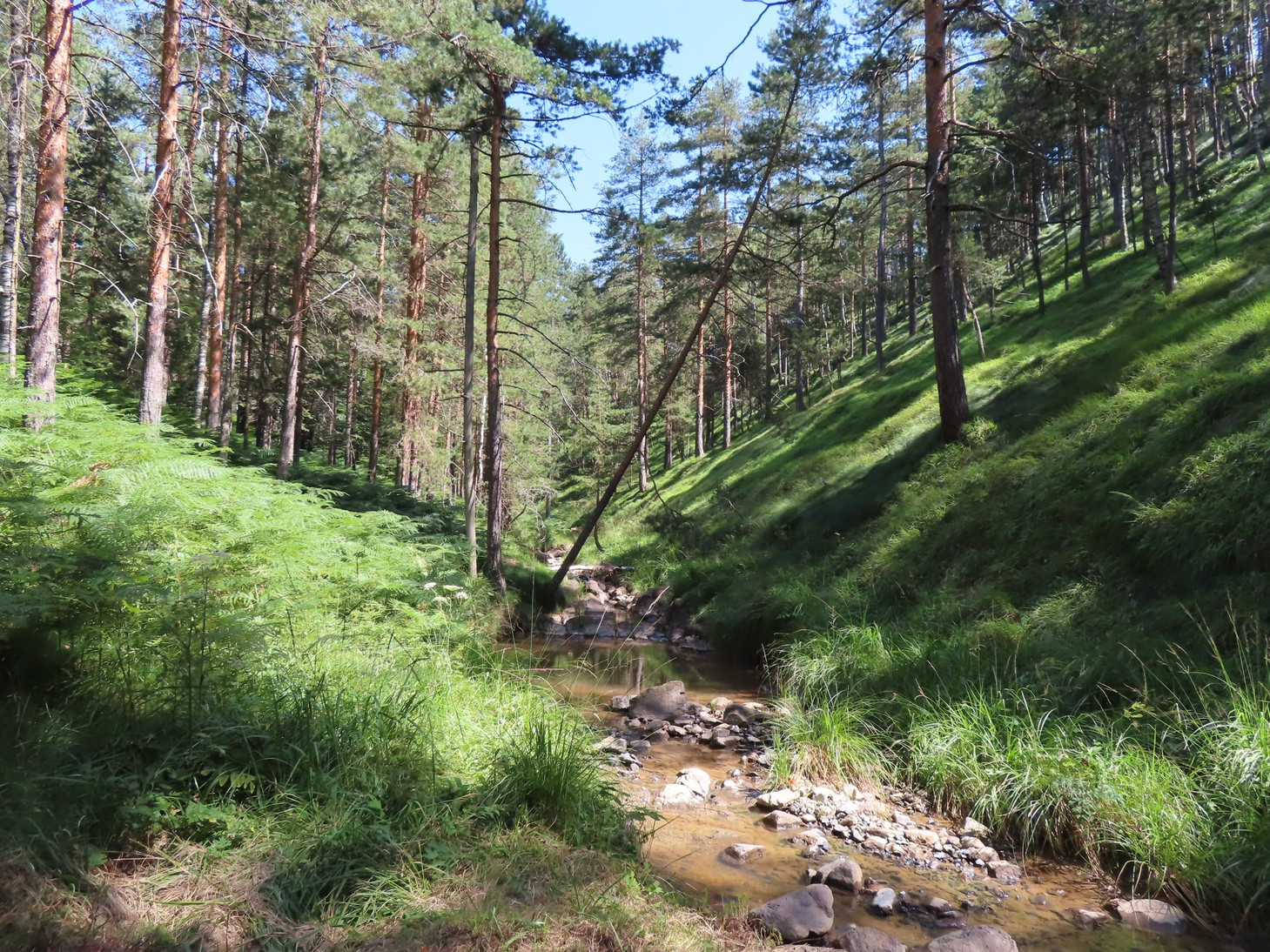
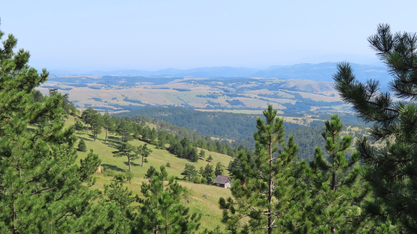
Divčibare and Maljen are at the center of the Valjevske Mountains range, situated between the Povlen and Suvobor mountains. Divčibare is on the 980m highland plateau covered with pine forest. The highland is surrounded by several Maljen peaks, like Kraljev Sto ("King's Dish") at 1104m, Crni Vrh ("Black Summit") at 1096m, Paljba ("Shooting") at 1051m, and Golubac at 1056m. Two mountain streams, Bela and Crna Kamenica ("White and Black Stonestream") pass through the plateau, carving deep cuts through the Maljen mountain. The two Kamenica streams flow to the southeast and eventually join into the Kamenica River in the Tometino Polje village, on the southern Maljen slopes.
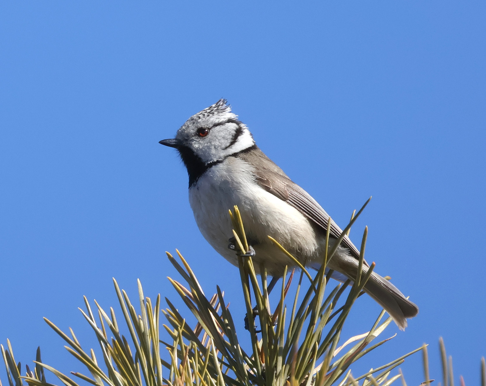
The pine forest that dominates the plateau is inhabited by numerous Toppmeis and Svartmeis, while the deciduous forest on the steep northern slopes hosts many thrush and woodpecker species. Between these two habitats, there are patches of mixed spruce and birch forest where Granmeis can be found. The southern slopes of Tometino Polje are milder and only partly covered with pine forest, with a lot of steppe, scrubby, and grassland slopes inhabited with Trelerke, Sanglerke, Tornskate, Buskskvett, Svartstrupe, Hortulan, Klippespurv, Gulspurv, Markpiplerke, and patrolled by Musvåk, Vepsevåk, and Slangeørn. One pair of Kongeørn nests on the northern Divčibare slopes. Amursvale can be found near the bridges in the upper course of the Kamenica stream.
The area is part of the IBA Valjevske Mountains.
Details
Access
Divčibare is accessible via well-maintained roads from the northwest (Valjevo), northeast (Mionica), and south (Požega). Click on the 'P' markings for directions. Note: there is a military camp near the very peak of Maljen, Kraljev Sto, be sure not to take photographs or use binoculars in its vicinity.
Terrain and Habitat
Forest , Plateau , Mountain , Steppe , Scattered trees and bushesConditions
Hilly , Mountainous , Open landscapeCircular trail
YesIs a telescope useful?
Can be usefulGood birding season
Spring , SummerBest time to visit
Spring , SummerRoute
Wide path , Narrow trailDifficulty walking trail
StrenuousAccessible by
FootBirdwatching hide / platform
NoLinks
- 'Divčibare' eBird hotspot
- 'Tometino polje' eBird hotspot
- 'Tometino polje--Orlovo gnezdo' eBird hotspot
- 'Divčibare--vidikovac Paljba' eBird hotspot
- 'Maljen i Divčibare (general area)' eBird hotspot
- eBird barchart of all hotspots
- IBA Valjevske Mountains


 ) to insert bird names in your own language. The birdnames will automatically be translated for other users!