
Description
Carska bara (Tsar’s Marsh) is located on the alluvial plain between the Tisza and the Begej rivers, east of the Belo Blato Village and on the north side encircled by the Ečka fish farm lakes. Ečka fish farm represents the largest inland fish farm in Europe.
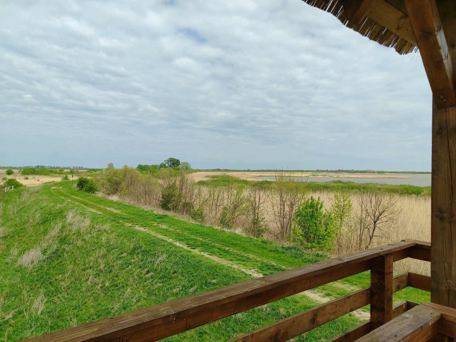
Carska Bara Nature Reserve consists of marshy lakes of Carska bara (1), Tiganjica (2), Perleska bara (4), Traktor bara (3), Botoški (8) and Farkaždinski rit (9), plus the 8 km long old arm of the Begej River (5). The Begej is 2 to 3 m deep in this area, while the marsh itself is only 80 cm deep. Habitat includes lakes, reedbeds, alkaline meadows and softwood forests. Vegetation mostly consists of reeds and rushes, willow and poplar riverine forests. The reserve holds some 30 mammal species (otter, wild cat, wild boar, roe deer, brown hare, etc.), but is best known for its abundant birdlife—about 240 bird species.
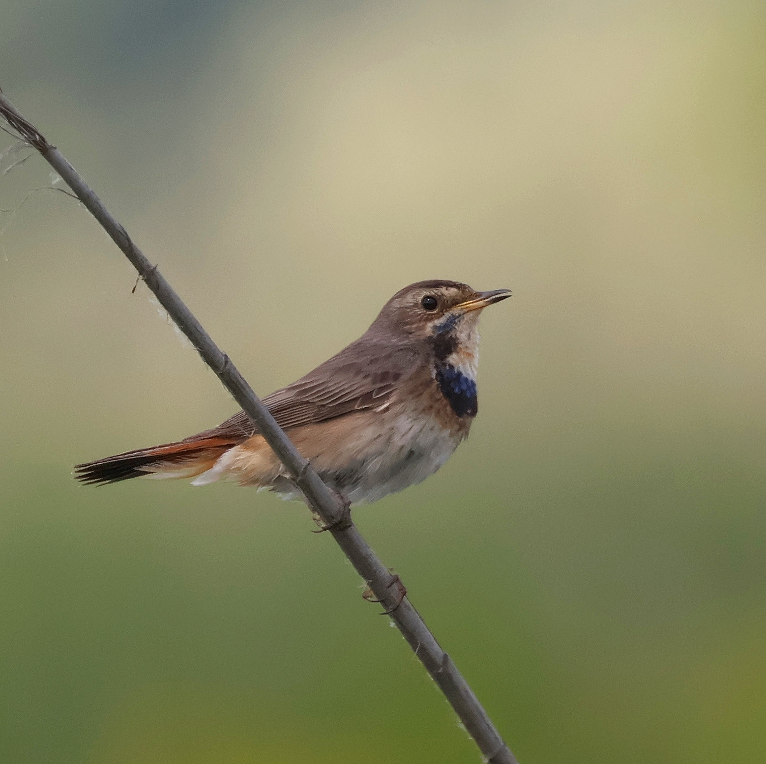
There are thriving colonies of herons and egrets (all European species breed in the reserve, in some years up to a 1000 pairs) and cormorants (including Dvergskarv), Knekkand, Hvitøyeand, several pairs of Havørn, Hvitkinnsvartterne, Blåstrupe, Pungmeis, Skjeggmeis, Trostesanger, Myrsanger, Elvesanger, Sumpsanger, and sometimes rare Cettisanger and Gresshoppesanger.
Among the wintering ducks are Skjeand, Brunnakke, and Hvitøyeand. Havørn, Sivhauk and Myrhauk, Dvergfalk and Vandrefalk patrol the area. Surrounding bushes, scrub and fields hold Bjørkefink, finches, pipits, Sivspurv, Varsler, and Gråtrost. Trane can be present.
Photos by Mileta Cekovic and Javna ustanova "Rezervati prirode" Zrenjanin (Nature Reserves Board, Zrenjanin).
Details
Access
The area is accessible via the regional Belgrade – Zrenjanin road; it is 55 km (1 hr) north of Belgrade, or 15 km south of Zrenjanin. For driving directions, zoom in on the map and click on the "P" (car park) sign. Behind the car park lies Hotel Sibila, currently not operational.
From the beginning of the trail to the village of Belo Blato, the westernmost levee route (6) is about five and a half kilometres long. No driving is allowed on the levee (the barriers are closed and locked), only walking or cycling. Park in the shade by the closed hotel, climb the levee and explore further on foot. There is hardly any shade on the levee—carry plenty of water on hot days.
Terrain and Habitat
Wetland , Lake , Mud flats , Agriculture , Scattered trees and bushes , Reedbeds , ForestConditions
No shadow , Open landscapeCircular trail
NoIs a telescope useful?
Can be usefulGood birding season
All year roundBest time to visit
Winter , Spring migration , Autumn migration , SpringRoute
Wide path , Unpaved roadDifficulty walking trail
Average walkAccessible by
Foot , BicycleBirdwatching hide / platform
YesExtra info
Against a small entrance fee (about 1 Eur per person), along the course of the Stari Begej there is a self-guided trail (I deliberately omitted this, more touristy trail (7), but zoom in on the map until the "Staza zdravlja" becomes visible), open to visitors from 9 a.m. to 6 p.m. throughout the year. There are no organized walking tours, but visitors can walk on their own along the 4.8 km long trail, where a new observation tower awaits among the trees, hence you can observe the reedbeds directly in front of it (also, there is a boardwalk through the reeds), but hardly the somewhat distant lake (for photos, check the management authority web-site among the links). The habitats are good, but you have to arrive well before the official opening hours so the tourists won't disturb your birds.
Links
- eBird--Carska bara, Perleska bara and Stari Begej
- eBird--Traktor-bara and Tiganjica marsh
- Some infrastructure photos are available at the management authority web-site (in Serbian only)


 ) to insert bird names in your own language. The birdnames will automatically be translated for other users!