

Beschrijving
Seaton (not to be confused with the town of the same name in East Devon) was a very busy Summer seaside destination in the 60's/70's, mainly due to the Seaton Valley Holiday Camp. This Holiday Camp is now long gone and Cornwall County Council runs the area as a Country Park.
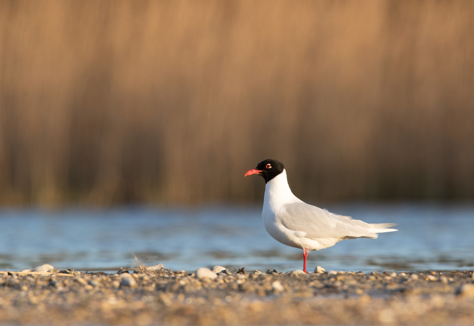
(*1), (press STAR on map), Seaton Beach. In the 1960's the low lying Seaton Beach still had remnants of the Second World War, namely a long row of 'Dragon's Teeth' tank traps along the seaward side of the B3247 road, these are now gone being replaced in part by a beach side car park (fee payable). The beach itself comprises of a mixture of sand and small stones. The River Seaton enters the sea on it's Western end, this river often changes it's course crossing the beach depending on rainfall and can be quite deep. At extreme low tide the beach profile changes, beyond the sand/stone beach there is a large area of flat sand, that is still one of the best areas in South East Cornwall for Lugworm (Arenicola marina), in Spring Regenwulp can often be seen at low tide feeding in this area, year round both Wulp and Scholekster can also be seen feeding here. The East and West ends of the beach are more rockier with rock pools at low tide, a favourite spot for Steenloper and Oeverpieper, especially during Autumn/Winter. For those that have remembered to bring a telescope Jan-van-gent and Noordse Pijlstormvogel are often seen passing offshore especially May-August, on a good day in Mid Summer with onshore winds the increasingly rare Vale Pijlstormvogel can be seen sometimes in double figures. During Winter good numbers of IJsduiker and smaller numbers of Roodkeelduiker can be seen sometimes quite close to shore. Both Eider and Zwarte Zee-eend, the later occasionally reaching 'rafts' of over 40 individuals, they can be highly mobile and sometimes move further to the East. On days of calmer seas especially in Autumn Visdief and a possibility of Dwergstern can be seen fishing offshore.
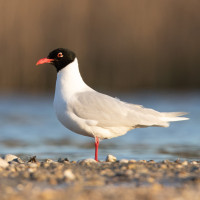
(*2), River Seaton and Ponds. The River still holds a number of Sea Trout (Salmo trutta trutta) and Brown Trout (Salmo trutta) some of which can be seen occasionally under the B3247 road bridge. The ponds, one of which often dries up during periods without rain, often hold resting/bathing Gulls (Laridae), always worth checking for the odd Zwartkopmeeuw amongst the usual Kokmeeuw. Rietgors can be found around the reedbeds.
(*3), The Wooded Valley, has reasonably good footpaths, but some nearer the River can be wet/flooded and slippery especially following heavy rain. Whilst the valley holds mostly commoner species Zwartkop and Tjiftjaf do overwinter. Throughout the year the increasingly rare Glanskop can also be found. During August 2024 the valley had a brief visit of a Ooievaar from the Knapp Castle (Estate) Reintroduction Project.
Details
Toegang
The A374 road from the City of Plymouth (to the East) to Trerulefoot Roundabout (to the West A38) runs to the North. From Plymouth direction catch Torpoint Car Ferry and continue on A374 to the village of Anthony. In Anthony take Left turn signed Millbrook/Seaton B3247, at next junction take Right turn signed Crafthole/Portwrinkle/Downderry. Continue on B3247 and at village of Crafthole take first exit on mini roundabout (not signed), continue on B3247 eventually going around sharp Left bend signed Downderry/Hessenford/Seaton B3247. Note this road eventually becomes steep with a sharp hairpin bend at the bottom, continue passing through Downderry to Seaton car parks.
From Trerulefoot Roundabout (A38) take exit signed Looe/Torpoint/Plymouth A374, continue on A374 road and take first Right (NOTE first turning is a farm entrance only) signed Looe/Hessenford/Seaton/Downderry A387, continue on this A387 following signs for Looe/Seaton/Hessenford, on reaching Hessenford take Left turn signed Seaton/Downderry onto B3247, continue on this wooded valley road until reaching Seaton.


 ) om vogelnamen snel in te voeren via een aanklikbare lijst.