

Beschrijving
The area runs from Porlock Weir in the West to Hurlstone Point (sometimes called Bossington Point) in the East, between the two runs a long shingle ridge partially protecting an extensive salt marsh. Porlock Weir is a seawatching point, once more famously known as a Salmon and Oyster fishery, today is more of a holiday destination.
Porlock Beach/Bossington Beach shingle ridge (formed 8000 years ago) one time protected an extensive freshwater grazing meadow. During the major storm of October 1996, caused by the 'tail end' of hurricane Lili, a large breach of the ridge caused major ingress of salt water, leaving the marsh today to turn into saltmarsh. The beach and saltmarsh are constantly changing by each high tide mainly due to the extremely strong offshore currents. The ingress of salt water has changed the geography of the area, with the loss of a reedbed and many trees (some still standing as 'skeletons') along with some bird species.
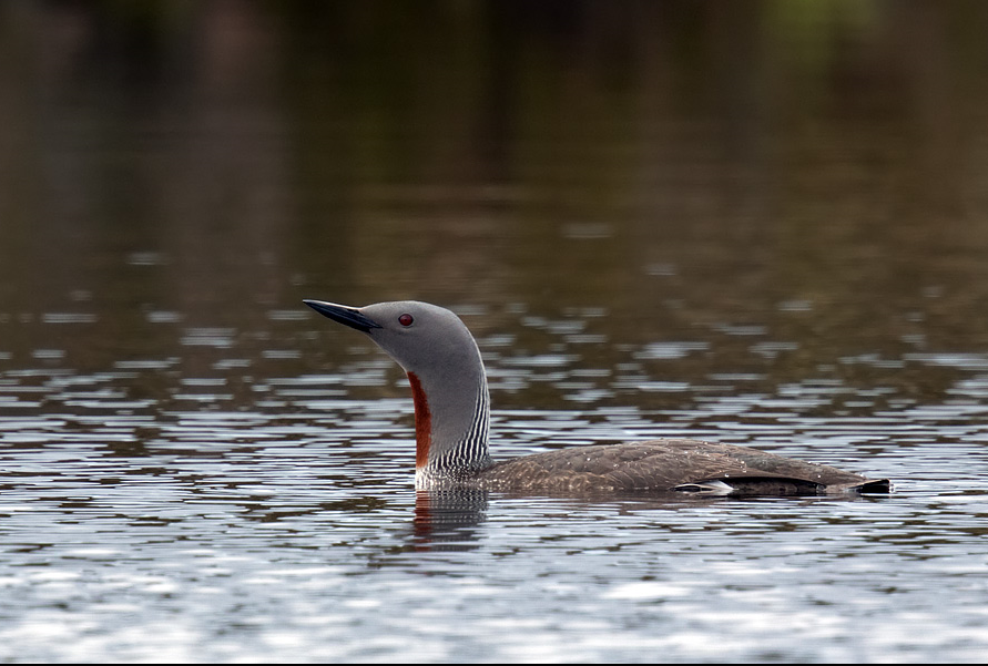
Hurlstone Point is known as a better seawatching point than Porlock Weir. You can expect a good selection of land/seabird and wader species, in the near past Strandleeuwerik, Sneeuwgors and Klapekster have been seen. More regular are Roodkeelduiker, Parelduiker, IJsduiker, Noordse Pijlstormvogel, Kleine Alk, Zeekoet, Alk, Lepelaar, Wulp, Scholekster, Tureluur and Bergeend amongst many others.
Details
Toegang
The A39 runs East to West through the town of Porlock, for Porlock Weir (car park - fee payable) turn Right onto the B3225 just after the town of Porlock, for Bossington Hamlet (car park - fee payable) turn Right onto Old Lane just before the town of Porlock, this road soon becomes Bossington Lane that takes you to the car park in Bossington.
Terrein en leefgebied
Verspreide bomen en struiken , Grasland/weide , Rivier , Zee , Stad/dorp , Landbouw , Slikken , Strand , WetlandOmstandigheden
Vlak , Nat , Glad , Hoog water mogelijk , Open landschap , HeuvelachtigRondlopende wandeling mogelijk?
JaTelescoop meenemen?
JaWanneer hier vogels kijken?
Het hele jaarToptijd voor dit gebied
Winter , Lente , Herfst , Najaarstrek , Voorjaarstrek , ZomerRoute
Smal pad , Onverharde weg , Breed pad , Verharde wegZwaarte wandeling
GemiddeldToegankelijk via
Te voet , Fiets , AutoVogelkijkhut aanwezig?
NeeExtra info
WARNING due to the frequent dynamic evolving beach and saltmarsh and high tide, it may not be possible to walk the full length of the beach (CHECK HIGH TIDE TIMES). There are paths and boardwalks across the saltmarsh to take as shortcuts and for seawatching points PRESS STARS ON MAP FOR INFORMATION.


 ) om vogelnamen snel in te voeren via een aanklikbare lijst.