
Beschrijving
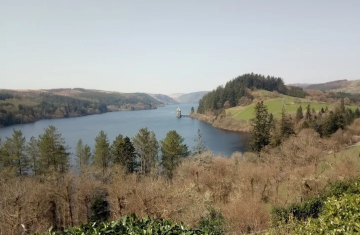
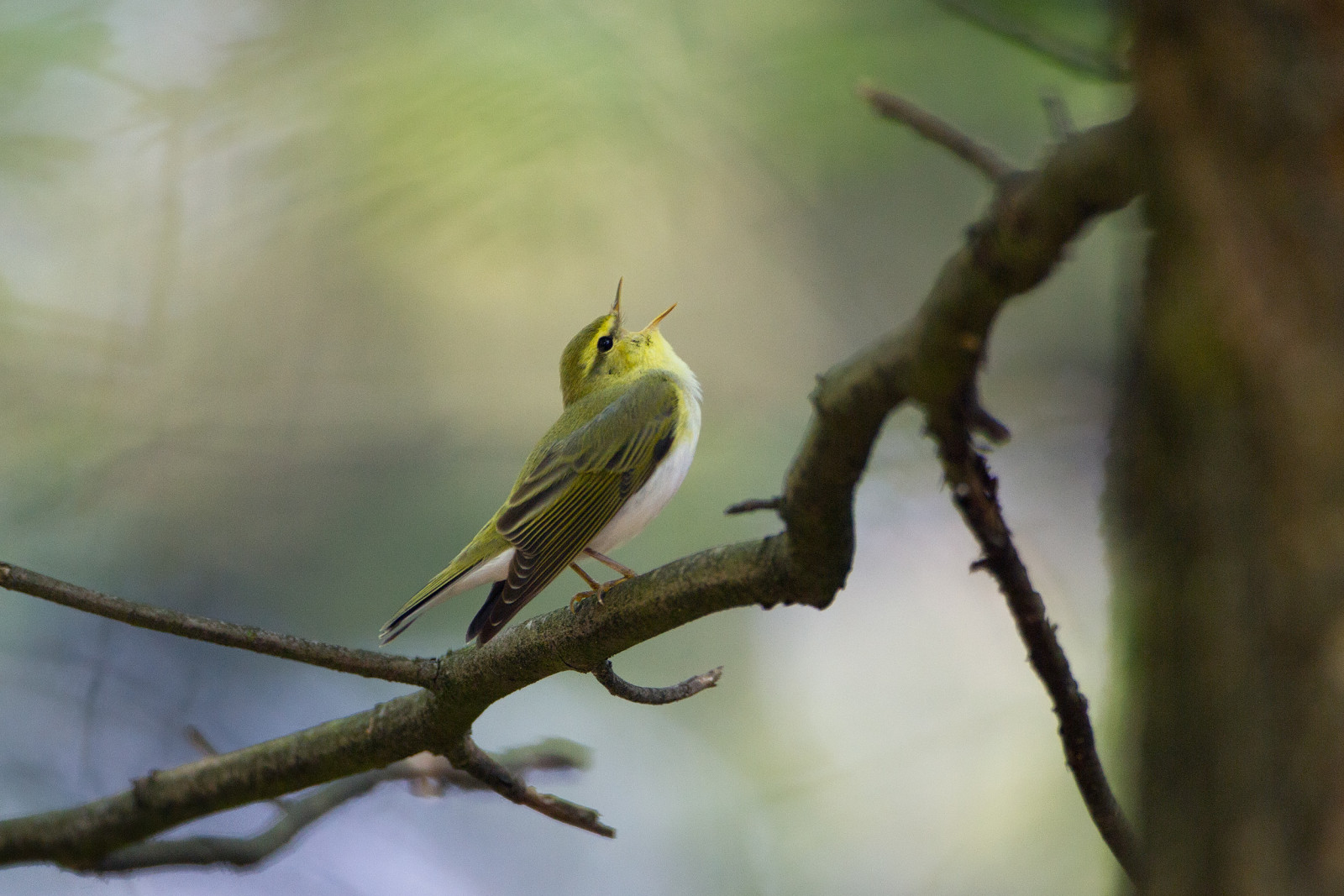
The Lake Vyrnwy Nature Reserve and Estate that is adjacent to the lake is a Site of Special Scientific Interest, a Special Protection Area, and a Special Area of Conservation. Dramatic scenery with streams harbouring Waterspreeuw and Grote Gele Kwikstaart. Bonte Vliegenvanger, Gekraagde Roodstaart and Fluiter in the forests, Fuut, migrant Visarend and Grote Zaagbek on the lake, Sijs, Zwarte Mees and wintering Keep on the feeders. Schots sneeuwhoen, Smelleken and Velduil on the moors. Circuit of reservoir by car or bicycle is 12 miles.
Details
Toegang
Midway between the towns of Dolgellau, Oswestry and Welshpool. Take minor roads as directed from A5 or A458. Click on the P in the map to get directions. Expect steep, winding and narrow.
Leaving from from the visitor centre there are two marked walks. Yellow trail: This 1 mile/1.6 km circular stroll takes you alongside the riverbank and meandering through sessile oak woodland. Blue trail (shown on the map below): A 3 mile/4.8 km circular walk along forest tracks and lanes with two fairly strenuous climbs and one steep descent. As you descend, you have a spectacular view overlooking the lake.
On the west side of the lake you find the Red trail: A 6 mile/9.6 km circular walk along forest tracks and through clearings. This steady climb with a steep descent at the end to the road will take you through conifer and birch trees. And on the northeast side of the lake you find the Purple trail: A 5 mile/8 km circular walk along forest tracks and roads with a gentle incline and great views. On the north side of the lake you find the Green trail: A 2 mile/3.2 km circular path following the river and leading to the waterfall of Rhiwargor. No steep hills but you will need to cross the stream using stepping stones.


 ) om vogelnamen snel in te voeren via een aanklikbare lijst.