

Beschrijving
The River Camel is Cornwall's longest river wholly in Cornwall, it enters the Eastern Celtic Sea near the town of Padstow, upriver is the large town of Wadebridge, the Camel Trail (formerly the North Cornwall Railway) now a walking/cycle path, runs between the two on the estuaries Southern shore. Nearer the mouth the estuary is mostly sandy with a number of large sandbanks at low tide, further up the estuary towards Wadebridge it turns to mud and saltmarsh.
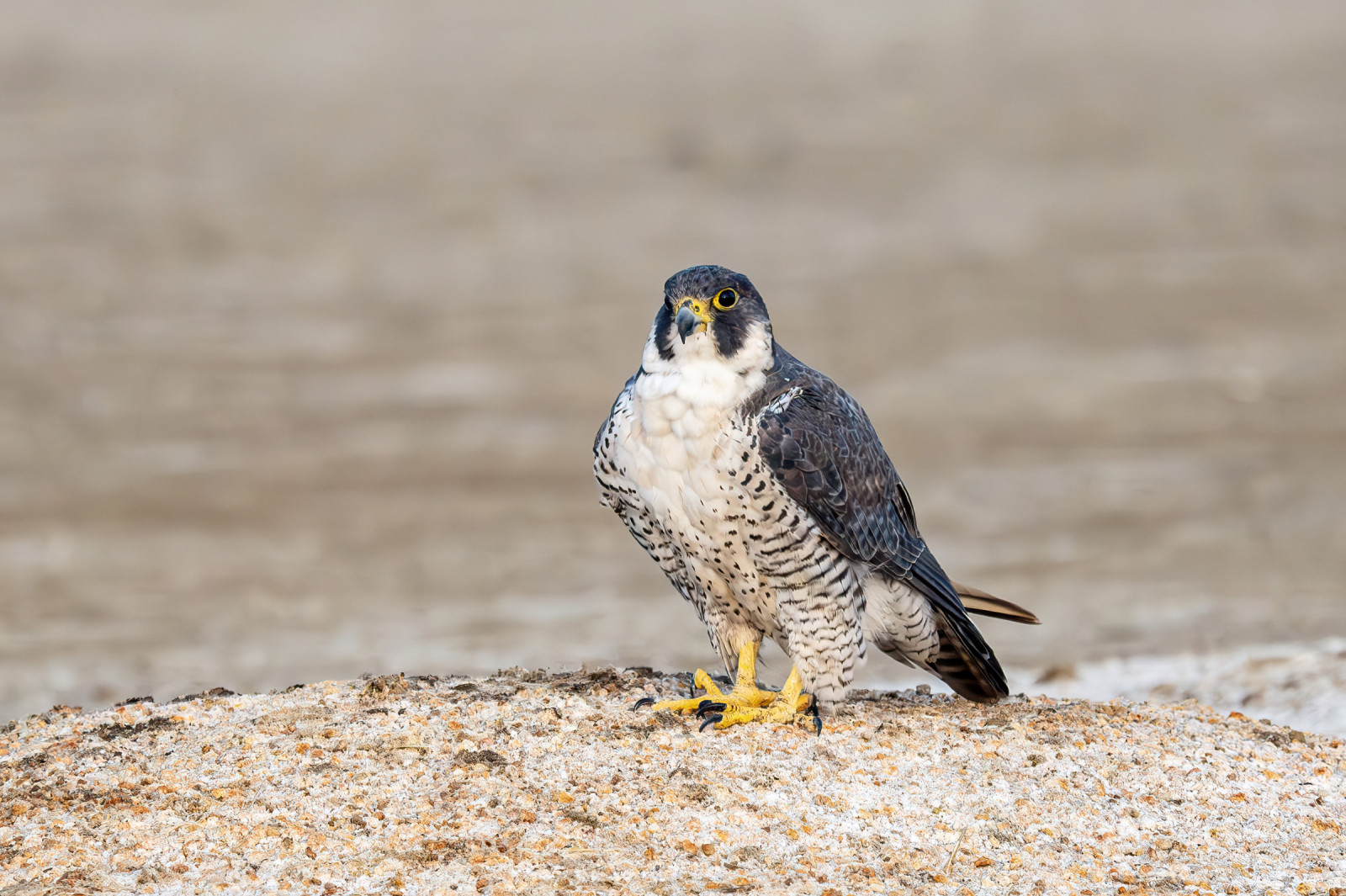
On the lower estuary Zwarte Zee-eend, IJsduiker, Kuifduiker, Roodhalsfuut, Geoorde Fuut are possible, especially during or following Winter storm conditions at sea, some years small numbers of Drieteenstrandloper frequent this area as well. Further up the estuary Wulp, Scholekster, Zilverplevier and Bontbekplevier can be found, the flock of Goudplevier tends to spend time in both sections, until disturbed by young Slechtvalk. The lower estuary can hold large numbers of Zilvermeeuw, Grote Mantelmeeuw, Kleine Mantelmeeuw, small numbers of Stormmeeuw, with the occasional Kleine Burgemeester, Grote Burgemeester and the now rarer Ringsnavelmeeuw are often seen. A large number of Zwartkopmeeuw are often gathered on the larger sandbanks. High tide roosts are difficult to observe from the trail, a large number of birds use surrounding fields at high tide, depending on how high the tides are some birds use the saltmarshes nearer Wadebridge, a council owned bird hide at Tregunna on the trail is close to this area. NOTE: a telescope is essential for birding on this estuary.
Details
Toegang
The A39 and A389 main roads meet at a large roundabout East of Wadebridge, from both main roads take exit off roundabout signed Padstow (avoiding town centre). Continue on this road A39 eventually crossing over a high bridge giving views up and down estuary. At next roundabout (called Tollgate) take first exit signed Wadebridge/Trevanson/St Breock, (*A) immediately on exiting roundabout take Left hand bend (ignoring St Breock turning sign), continue on this road passing straight through first mini roundabout, at next mini roundabout turn Left signed Town Centre/Through Traffic All HGVs/Camel Trail. Turn next Left into Trevanson Street (unsigned), on passing Fire Station (on Right) Piggy Lane car park (fee payable) is immediately ahead. If traveling from West Cornwall on A39, on approaching Wadebridge Tollgate roundabout take second exit signed Wadebridge/Trevanson/St Breock, and follow from (*A) above.
If going to Tregunna hide only, from A39/A389 follow signs to Padstow, at Tollgate roundabout take second exit signed Truro A39/Royal Cornwall Showground, almost immediately take next Right turn signed Edmonton/Quarryman Inn, (*B) on approaching small hamlet of Edmonton turn Right (unsigned) down NO THROUGH ROAD, continue on this narrow road until reaching farm, park here (limited spaces - DO NOT block farm access gates), alternatively continue past farm to end of narrow road and park near small bridge over Camel Trail, NOTE 2 spaces only, DO NOT block gate way access. If traveling from West Cornwall on A39 direction, when beside Royal Cornwall Showground (on Right) look for Left turn (unsigned from this direction) just before large Tollgate roundabout sign (press STAR on map for this turning, follow road from (*B) above.
Alternatively because of long distance between Wadebridge and Padstow you can always split estuary in two by using Padstow car park (fee payable), if entering Padstow (very busy during Summer months) BE AWARE of many NO ENTRY SIGNS in the town.


 ) om vogelnamen snel in te voeren via een aanklikbare lijst.