Beschrijving
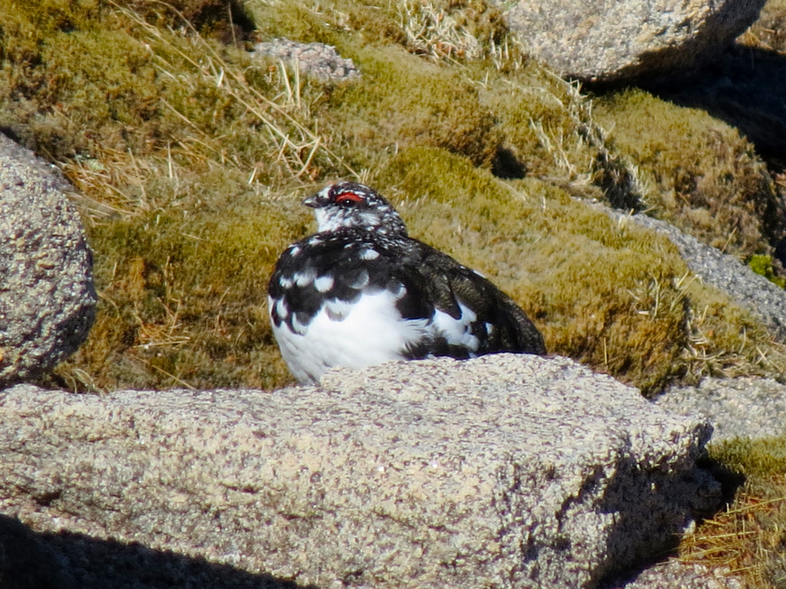
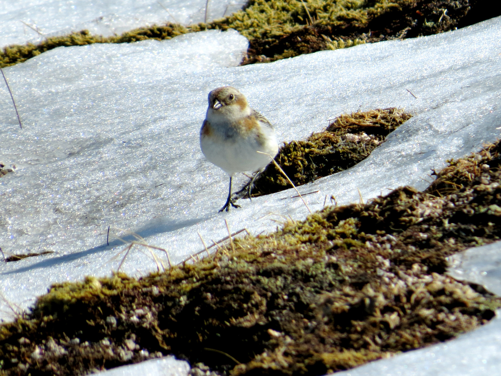
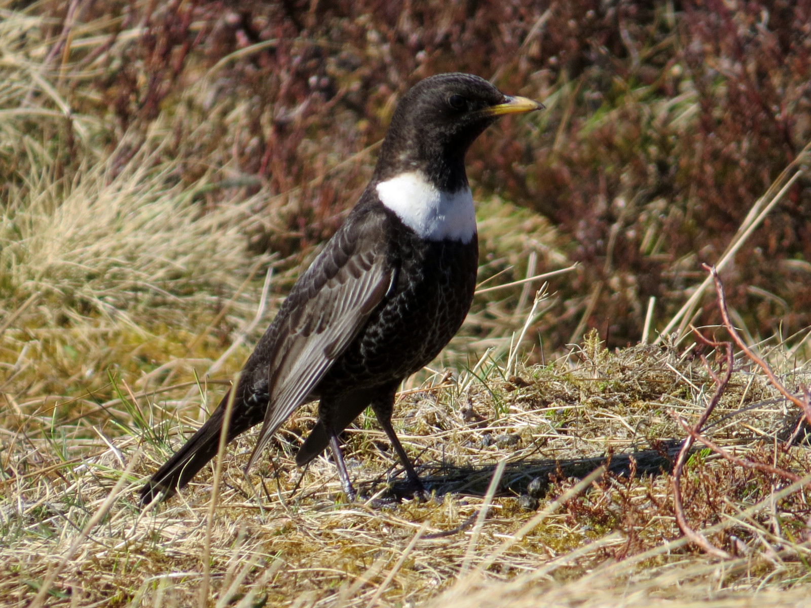
Cairn Gorm is the most accessible high mountain location in Britain. The summit can be reached by ski lift or on foot from the ski car park. The higher ground, above about 700-800 m altitude, has Alpensneeuwhoen, Sneeuwgors, Morinelplevier (summer only) and Britain's only herd of Reindeer. On the upper slopes look out for Steenarend, Beflijster, Schots sneeuwhoen and Mountain Hares (which often lie up under the ski lift stanchions). The wooded lower slopes are home to Kruisbek, Raaf and Kuifmees, while Visarend often fish at Loch Morlich.
Details
Toegang
The car park is 17 km (11 miles) southeast of Aviemore. Take the B970 road to Coylumbridge and fork right on the minor road to Glenmore passing Loch Morlich. The walk up from the ski lift car park is 4 km and 600 m of ascent. Allow plenty of time. The summit is always windy (and frequently severely so, with the UK record wind speed of 278 km/h measured here) and often extremely cold. Carry a map, mobile phone, water, rations, compass, waterproofs, and wear stout boots; be prepared for heavy snow and blizzards, even in summer. In winter, 'white-out' conditions (visibility less than 1 m in blowing snow) are regular, and extremely dangerous. Check the local mountain weather forecast. Do not wander far from the summit cafe without these precautions, and always tell someone where you are headed. The circular walk indicated on the map is about 10 km long.
Access to the summit plateau is closed from the upper 'Ptarmigan' Mountain Railway station between 1 May and 31 August, to protect breeding birds from excessive visitor numbers; if you wish to look for birds during this period, you need to either climb the 600 m from the car park, or else scan by telescope from the 'Ptarmigan' restaurant balconies. There is however a one-way door allowing people who have climbed up, to take the railway down; tickets for this can be bought at the top station.


 ) om vogelnamen snel in te voeren via een aanklikbare lijst.