

Beschrijving
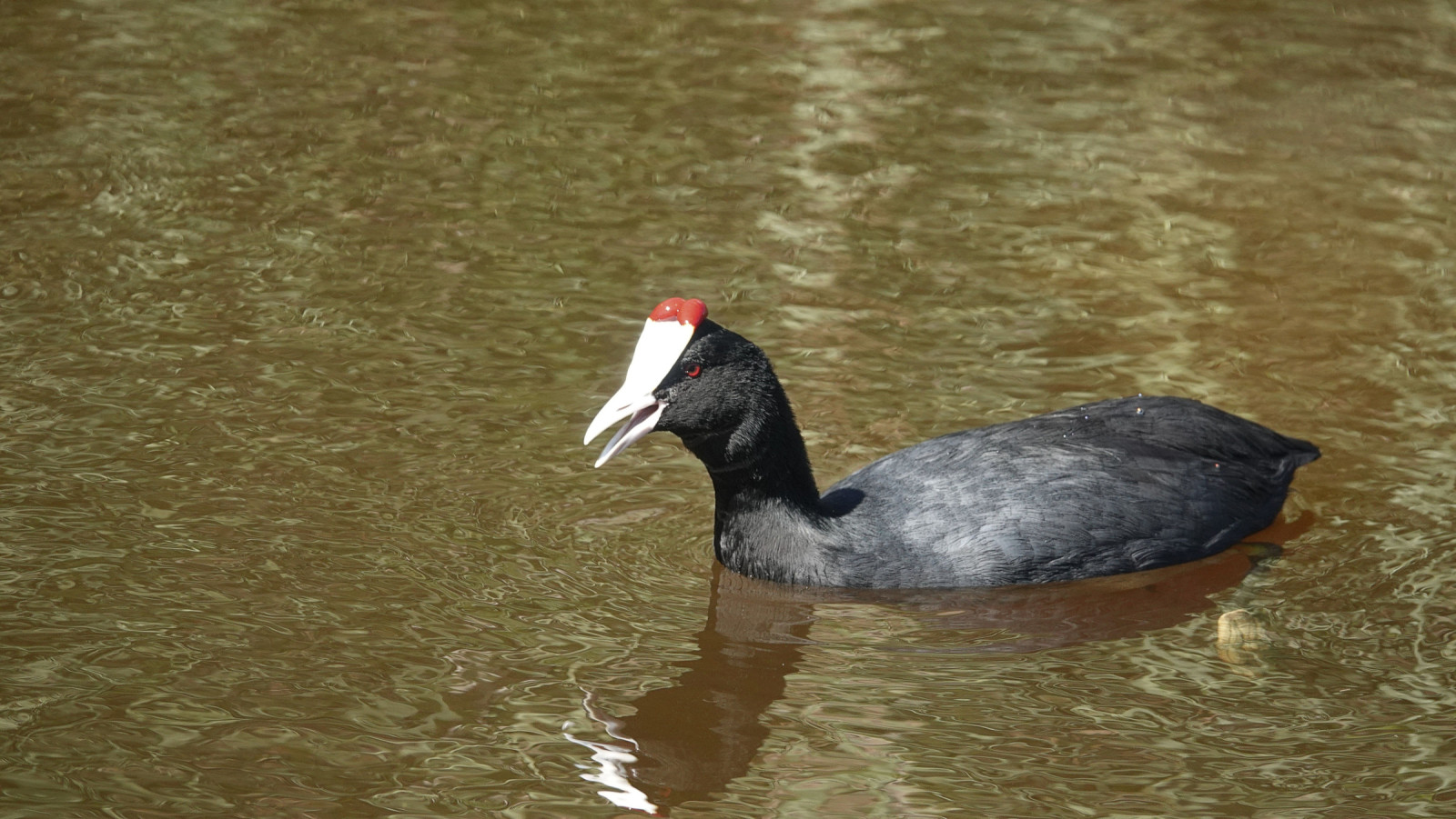
Parque natural del Marjal de Pego-Oliva is a nature reserve that has been designated as a wetland under the Ramsar Convention. The reserve is 1248 hectares and consists of swamp and surrounding rice fields. The waters in the marsh are permanent and relatively saline, due to the limited inflow of fresh water. The wetland is of great biodiversity interest. It is precisely this combination that results in a habitat for a number of internationally endangered marsh birds. Species such as Purperkoet, Ralreiger, Purperreiger, Woudaap, Zwarte Ibis, Flamingo , Lachstern, Koereiger, Zwartkoprietzanger, Steltkluut , Iberische Klapekster, Bijeneter, Vorkstaartplevier, Dwergarend, Bruine Kiekendief, Grote Karekiet, Audouins Meeuw, Witwangstern can be observed in the area. The combination with surrounding orange groves leads to the presence of, among others, Hop, Moorse Nachtzwaluw en Roodkopklauwier. Eleonora's Valk comes foraging from the mountains.
_________________________
Espagnol: La marjal de Pego-Oliva, localizada en una ensenada entre las sierras de Mostalla y de Segària, constituye el humedal costero más meridional del golfo de Valencia. Se trata de un espacio mixto, construido a partir de procesos geomorfológicos y de una acción antrópica no exenta de conflictos. La riqueza ecológica y el excepcional sistema hidrológico del marjal han propiciado una mayor sensibilidad ambiental y la declaración de 1.290 hectáreas como espacio protegido, tanto a escala autonómica como europea. La variedad de ambientes ha propiciado la aparición de distintos hábitats. La especie acuática valenciana por excelencia, el samaruc (Valencia hispanica), tiene aquí una de sus mejores poblaciones naturales. Asimismo nidifica una rica avifauna con especies como la Ardea purpurea, Marmaronetta angustirostris, Porphyrio porphyrio, Himantopus himantopus, Ixobrychus minutus, y Fulica atra como más destacados.
Details
Toegang
The Natural Park is accessed via the N-332. The Olive-Pego road skirts the northern border of the Park, whilst the El Vergel-Pego (province of Alicante) road constitutes the southern limit. There is also a bicycle lane and various rest areas. There is a road that runs through the Natural Park. The area is easily accessible on foot and by car. There is also a bicycle route.
_________________________
Espagnol: El acceso al Parque Natural se realiza desde la N-332. La carretera que va de Oliva a Pego bordea el Parque por el norte, mientras que la que une Vergel y Pego constituye el límite sur del paraje. En la misma hay un carril para la circulación de bicicletas y varias áreas de descanso. También hay una carretera que atraviesa este paraje natural. Al Parque se puede llegar con los autobuses que salen desde Gandía y pasan por Oliva, y también con los que tienen la salida en Denia y atraviesan El Verger.


 ) om vogelnamen snel in te voeren via een aanklikbare lijst.