Beschrijving
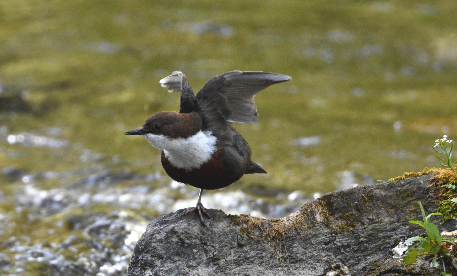
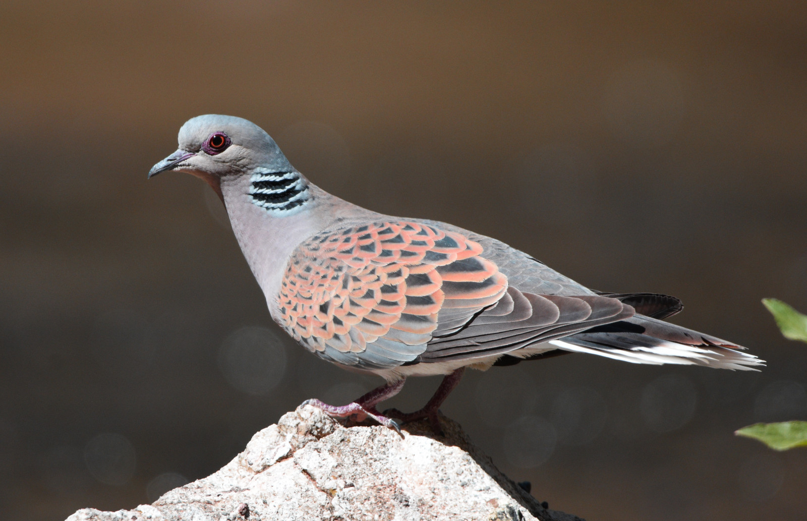
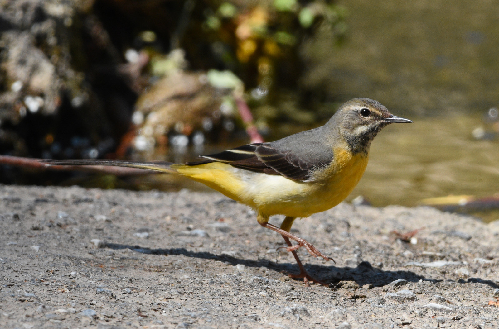
The Cabecera del Rio Genil is a green area along the river Genil, 6 km east of the city of Granada. Many birds are breeding on the wooded banks along the river. Among the birds you can encounter are Wielewaal, Zomertortel, Grote Gele Kwikstaart, Waterspreeuw, Nachtegaal, Grauwe Vliegenvanger, Bonte Vliegenvanger and Grauwe Klauwier.
_________________________
Espagnol: Zona alta del rio Genil cerca del pantano de canales bosque frondoso,caudal de agua limpia todo el año,lugar de reproduccion de numerosas aves, Anades, Ruiseñor, Mirlo Acuatico, Chochin Troglodytes, Oropendola, Jilguero, Petirrojo, Mirlo comun, Tortola Europea y Tortola Turca, Anade Real, Lavandera Cascadeña, Papamoscas, Pinzon Comun, Paloma Torcaz, Paloma Zurita,...etc largo.
Details
Toegang
The town (Pinos Genil) has numerous rural accommodations, shops, and restaurants. It is about 6 km from Granada and about 30 km from Granada's international airport. The town is crossed by the Genil River, dividing it into two halves. A bridge over the river gives access to both parts. Two dirt tracks on the riverbed give access to the forest over which the bird watching area runs, which in certain areas becomes a canopy of branches over the river where birds that feed on insects and larvae nest.
_________________________
Espagnol: El pueblo (Pinos Genil) cuenta con numerosos alojamientos rurales,tiendas ,y restaurantes esta a unos 6 km de Granada capital y a unos 30 km del aeropuerto internacional de Granada, el pueblo es atravesado por el Rio Genil dividiendose en dos mitades, un puente sobre el rio da acceso a ambas partes, pero el recorrido recomendado en el tramo al sur de dicho puente dos pistas de tierra sobre el cauce del rio dan acceso al bosque sobre el que discurre la zona de observación de aves que en determinadas zonas se convierte en una boveda de ramas sobre el rio donde anidan los pajaros que se alimentan de insectos y larvas.


 ) om vogelnamen snel in te voeren via een aanklikbare lijst.