
Beschrijving
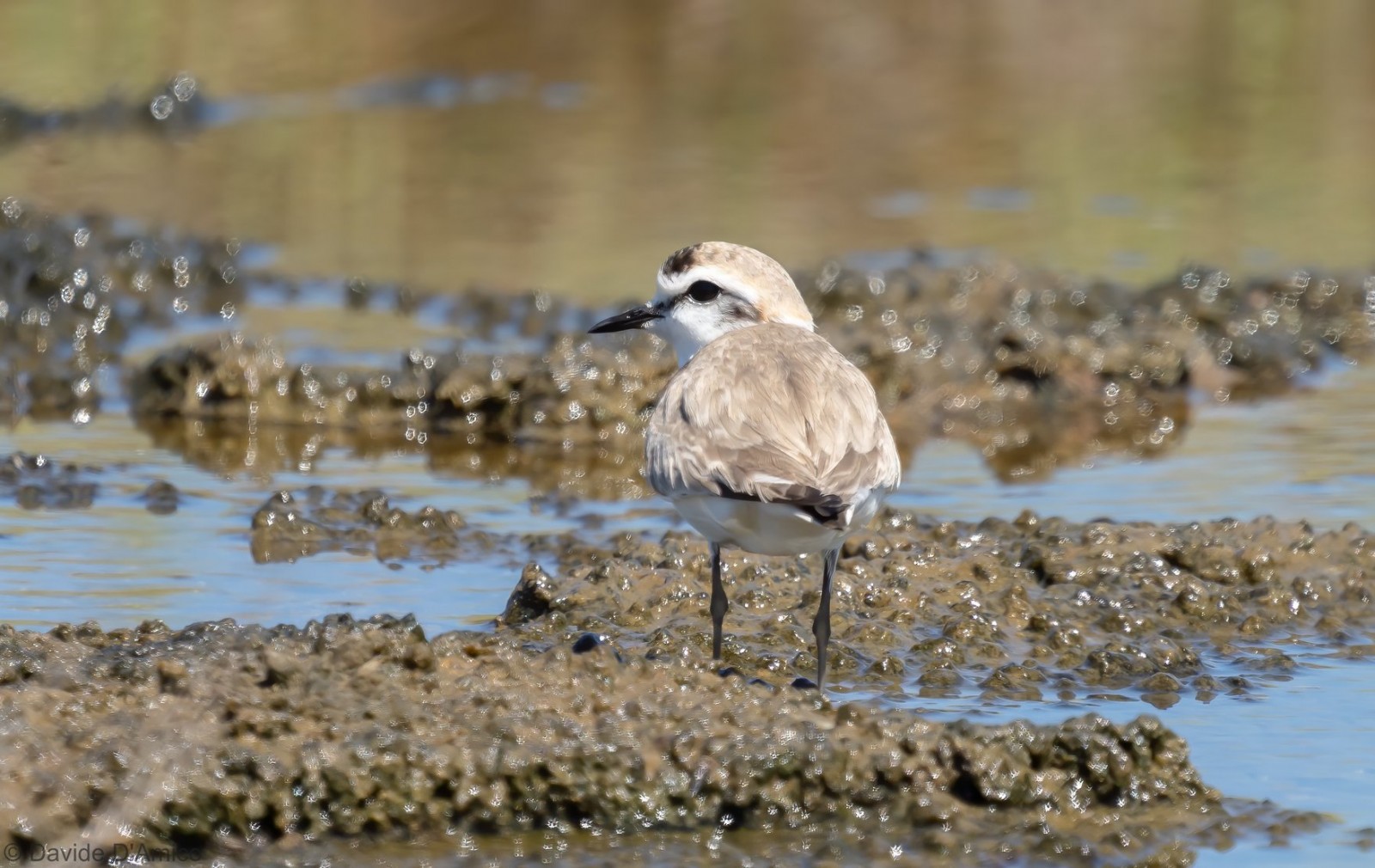
Salinella is an area of over 10 hectares with a citypark on a hill and an adjacent Mediterranean coastal wetland of Punta d'Alga. In the stretch of sea in front of it there are the remains of the ancient port dating back to Roman times. Among the birds you can see are Wulp, Kleine Zwartkop, Dunbekmeeuw, Kleine Zilverreiger, Strandplevier, Visdief and Dwergstern.
_________________________
Italiano: Il Parco della Salinella è un sito dalle forti connotazioni storiche e naturalistiche, compreso fra il Rione Sappusi e Punta d’Alga è ubicato nella zona nord di Marsala prossima all'agglomerato urbano. Un’area di oltre 10 ettari che si domina da una collinetta situata al centro del Parco che costituisce - dal punto di vista paesaggistico e panoramico - uno dei più suggestivi tratti costieri mediterranei. Nel tratto di mare antistante si trovano i resti dell'antico porto risalente ad epoca romana e quel che rimane dello sbarramento spagnolo, costruito per arginare gli assalti dei pirati saraceni. Il tratto di Punta d'Alga è costituito da banquette di Posidonia e un esteso Salicornieto.
Details
Toegang
Easy accessible from Marsala. Parking possible at the park. Click on the P in the map to get directions.
_________________________
Italiano: Facilmente raggiungibile da Marsala. Possibilità di parcheggio al parco. Clicca sulla P nella mappa per ottenere le indicazioni stradali.
Terrein en leefgebied
Wetland , Bos , Zee , Verspreide bomen en struiken , Stad/dorp , Rietvelden , Vlakte , Grasland/weideOmstandigheden
Open landschap , Nat , Vlak , Geen schaduwRondlopende wandeling mogelijk?
NeeTelescoop meenemen?
Kan handig zijnWanneer hier vogels kijken?
Het hele jaarToptijd voor dit gebied
Najaarstrek , Voorjaarstrek , LenteRoute
Breed pad , Verharde weg , Smal padZwaarte wandeling
GemakkelijkToegankelijk via
Te voet , FietsVogelkijkhut aanwezig?
NeeExtra info
With regard to the stretch of Punta d'Alga, it should be noted that the path is the only safe point to go through, since the banks can have gaps in which you can sink (in case you want to enter the banks, be careful where you step). In addition, after rains the path, in autumn and winter, often presents large pools of water and mud, so it is recommended to wear suitable shoes. It is also recommended, in this area, to take a telescope, to check the pools that are further away from the path. Unfortunately, since the end of July 2021, a part of the Punta d'Alga area has been hit by a fire that has destroyed part of the original vegetation, and the ashes have spread to the adjacent water holes. However, it seems that this has not, so far, excessively influenced the presence of birds.
_________________________
Italiano: Relativamente al tratto di Punta d'Alga, è da segnalare che il sentiero è l'unico punto sicuro da percorrere, poiché le banquette possono presentare vuoti in cui si può sprofondare (nel caso in cui ci si volesse inoltrare nella vegetazione e sulla banquette, fare attenzione a dove si mettono i piedi). Inoltre il sentiero, in autunno e in inverno, presenta spesso estese pozze d'acqua e fanghiglia, formati in seguito a eventi piovosi, per cui è consigliato indossare indumenti adatti. E' consigliato anche, in questa zona, dotarsi di un cannochiale, per controllare le pozze d'acqua lontane dal sentiero in sicurezza. Purtroppo, dalla fine di Luglio 2021, una parte della zona di Punta d'Alga è stata colpita da un'incendio che ha distrutto una parte della vegetazione originaria, e le ceneri si sono diffuse alle pozze d'acqua adiacenti. Sembra che, comunque, questo, finora, non abbia influenzato eccessivamente la presenza di uccelli.


 ) om vogelnamen snel in te voeren via een aanklikbare lijst.