Beschrijving
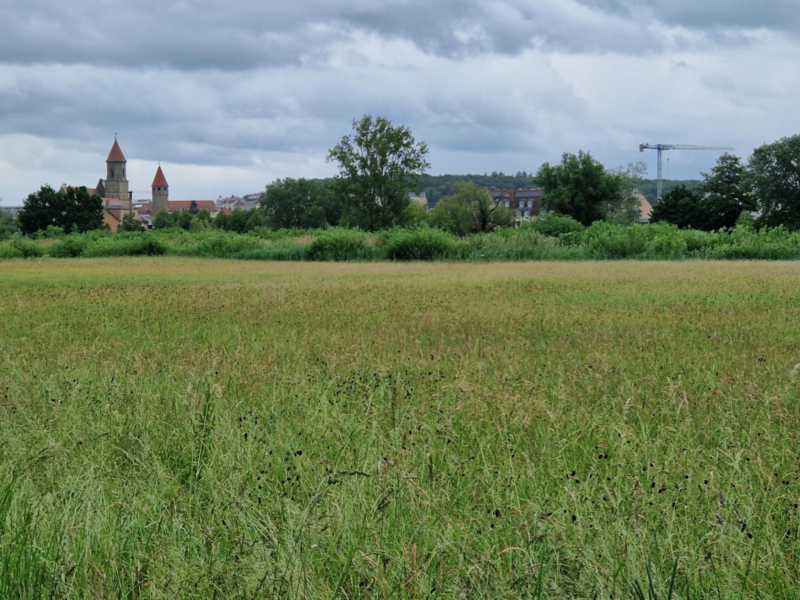
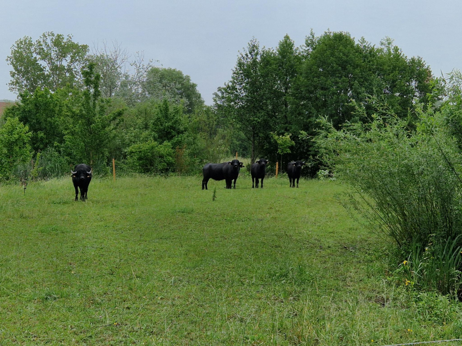
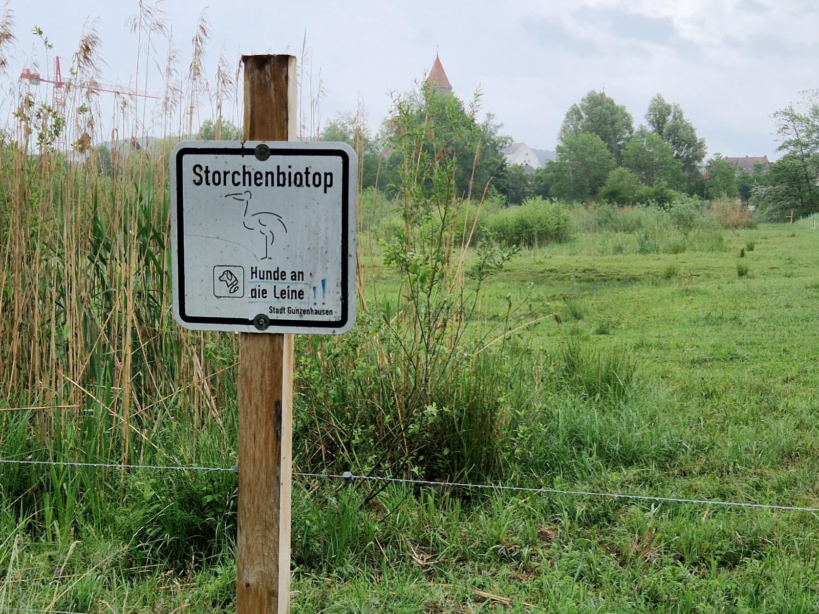
The roughly 6-hectare Ooievaar biotope is part of a renaturation project west of Gunzenhausen, which also serves as flood protection. Ponds, streams, bushes, and reed beds alternate throughout the area. The section located east of the river (1), close to the old town, is designed as a local recreation area, with a playground and an observation platform. On the western side (2), nature can unfold relatively undisturbed; since 2025, water buffalo have been grazing there to prevent scrub encroachment.
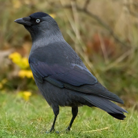
The biotope was originally created for Ooievaar, which breed on the chimney of a nearby inn (3) and find food here. At the inn, the nesting activity can even be followed via a camera. After having almost disappeared as a breeding bird in the last century, the Ooievaar has now become frequent in the region, and can be observed here particularly well. Other meadow-breeding species also readily make use of the habitat. Breeding of the Kievit has been confirmed. Within a short time, the Rietgors has also settled, and in the towers of the nearby old town, there is a breeding colony of Kauw. Observations of rarer species such as the Krekelzanger (so far one record) and meadow-breeding birds should not be long in coming – their absence up to now may simply be due to limited observation effort. Thanks to the nearby Altmühlsee (see the observation areas "Vogelinsel Altmühlsee" and "Altmühlsee - Lake Area"), there are also occasional records of lake-bound rarer species such as Kleine Zilverreiger, Kwak, and Zeearend.
The area is a small, easily accessible gem in the Altmühl Valley, which is so important for meadow-breeding birds. While not all recent political decisions were in favor of sustainable development along the Altmühl, this initiative by the city of Gunzenhausen, the landscape conservation association, and environmental organizations shows what sustainable landscape design of the future can look like.
Details
Toegang
Storchenbiotop Gunzenhausen borders directly on the town of Gunzenhausen. The area is located at a popular cycling path. There is also a parking nearby (press "P" on the map to get directions). The circular route shown on the map is about 2,5 km.
Terrein en leefgebied
Wetland , Rivier , Rietvelden , Landbouw , Verspreide bomen en struiken , Grasland/weide , Stad/dorpOmstandigheden
VlakRondlopende wandeling mogelijk?
JaTelescoop meenemen?
Kan handig zijnWanneer hier vogels kijken?
Lente , Herfst , ZomerToptijd voor dit gebied
LenteRoute
Verharde weg , Breed padZwaarte wandeling
GemakkelijkToegankelijk via
Te voet , Fiets , RolstoelVogelkijkhut aanwezig?
NeeExtra info
Those who spend more time in the region can cycle along the Altmühl from Treuchtlingen (see "Schambachried") to Ornbau (see "Wiesmet"). The stork biotope is just one of many worthwhile sites along this route.


 ) om vogelnamen snel in te voeren via een aanklikbare lijst.