
Beschrijving
The Netzbach creek flows right through the Saarkohlenwald nature reserve. Its largest body of water is the Netzbachweiher. Behind it, it flows into the stream Fischbach. This former coalmining landscape is now characterised by beech forests, refilled or rewilded ponds and streams, and some dammed fish ponds also. It is partly protected and serves largely as a leisure and recreation area.
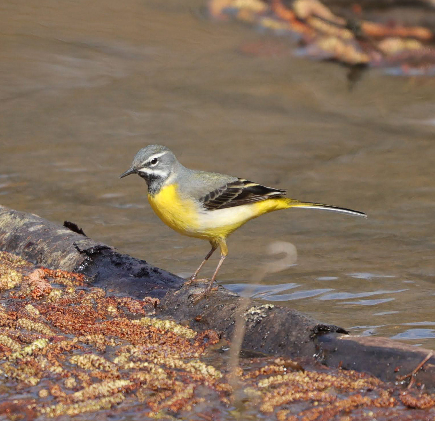
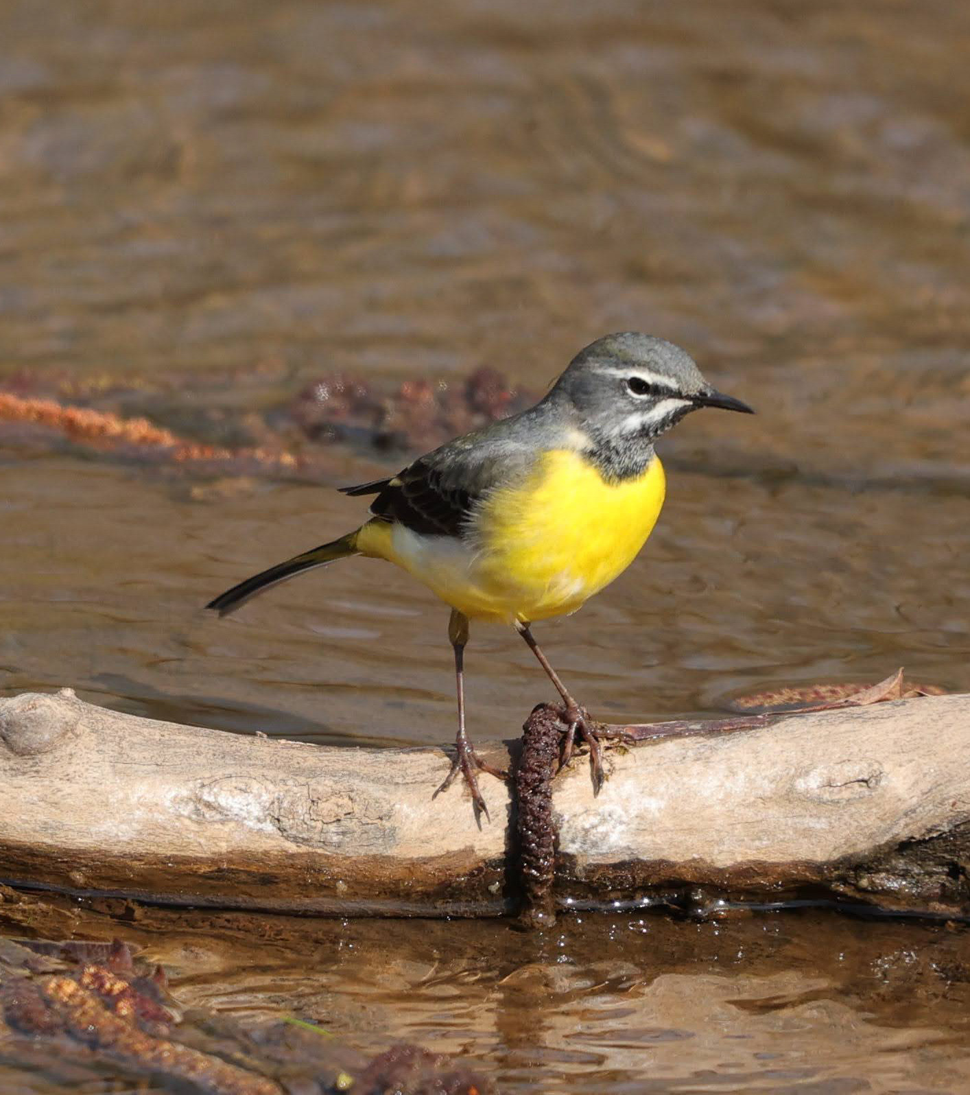
Birds found here include: IJsvogel, Middelste Bonte Specht, Zwarte Specht, Withalsvliegenvanger, Grijskopspecht, Grote Gele Kwikstaart among many others.
Details
Toegang
The Netzbach und Netzbachweiher area is located north of the city of Saarbrücken, near the town of Fischbach-Camphausen. The site can be accessed by car, bike or foot, but is best explored on foot. There is a carpark at P on the map. Press P on the map for directions.
The area can be very easily reached with public transport. From the Fischbach-Camphausen train station (see star on the map) to the Netzbachweiher pond it is a 3 km journey, 15 min by bike, or a 45 min walk.
Terrein en leefgebied
Bos , Wetland , Rivier , Rietvelden , Vijver , Verspreide bomen en struikenOmstandigheden
Vlak , Hoog water mogelijk , HeuvelachtigRondlopende wandeling mogelijk?
JaTelescoop meenemen?
NeeWanneer hier vogels kijken?
Het hele jaarToptijd voor dit gebied
LenteRoute
Breed padZwaarte wandeling
GemakkelijkToegankelijk via
Te voet , FietsVogelkijkhut aanwezig?
NeeExtra info
More detailed info on the georgraphy of the area: The Carboniferous ridges of the landscape run from southwest to northeast. They reach heights of around 350 m above sea level. In the north, they run out into the plateaus of the neighboring landscapes, while in the south, many-branched, deeply indented valleys run into the Saar valley. The mining of coal, which lies relatively close to the surface, characterizes the landscape. Mining and the clay soils that are unsuitable for agriculture have secured an almost continuous forest stand in the landscape. As a result of mining; extraction and processing plants, as well as spoil heaps and abandoned sludge ponds, characterize the landscape. The numerous natural streams and the spring meadows shaded by the forest also characterize the landscape.
The forestry areas of the landscape consist mainly of beech forests. However, alder and ash forests along streams are also typical. Many of the streams were dammed to create fish ponds and today, like large parts of the landscape in general, serve as leisure and recreational areas for the adjacent urban area. The landscape contains the nature reserves of "Steinbachtal Forest Conservation Area", "Heidhübel" and "Hölzerbachtal". Large parts of the Saarkohlenwald are registered as FFH (Fauna, Flora & Habitat) areas.
Important habitats are in particular the marsh and streamside forests, the spring meadows and the partially silted up mud ponds. In addition to larger EU bird protection, FFH and nature conservation areas, there are also nationally important areas for the biotope network in large parts of the landscape.


 ) om vogelnamen snel in te voeren via een aanklikbare lijst.