Beschrijving
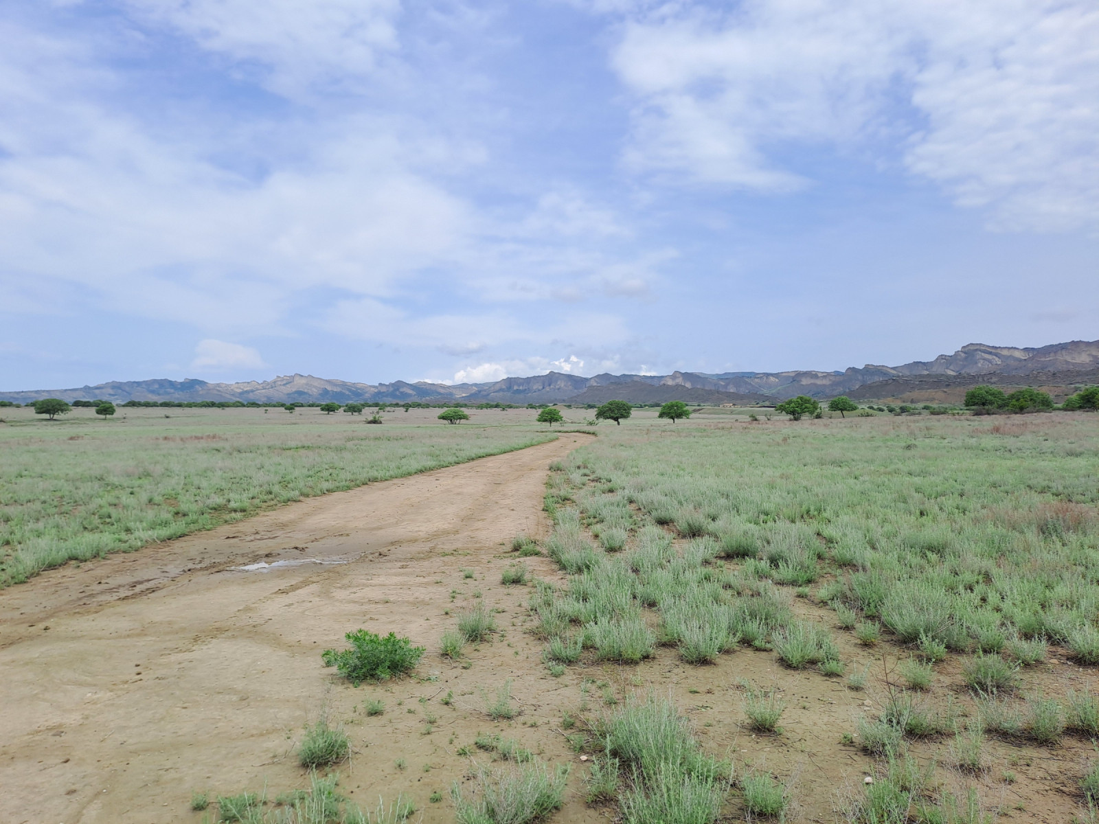
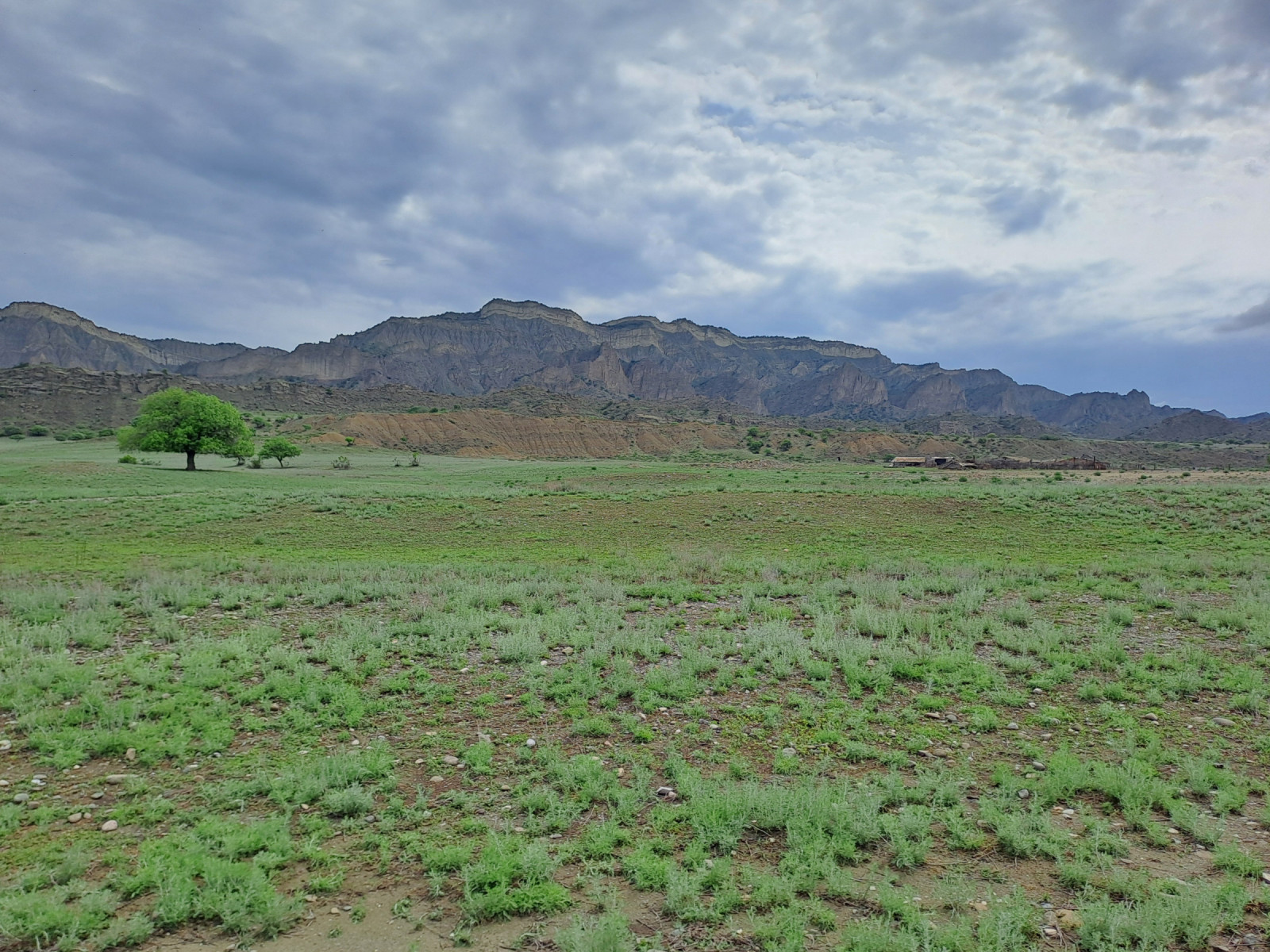
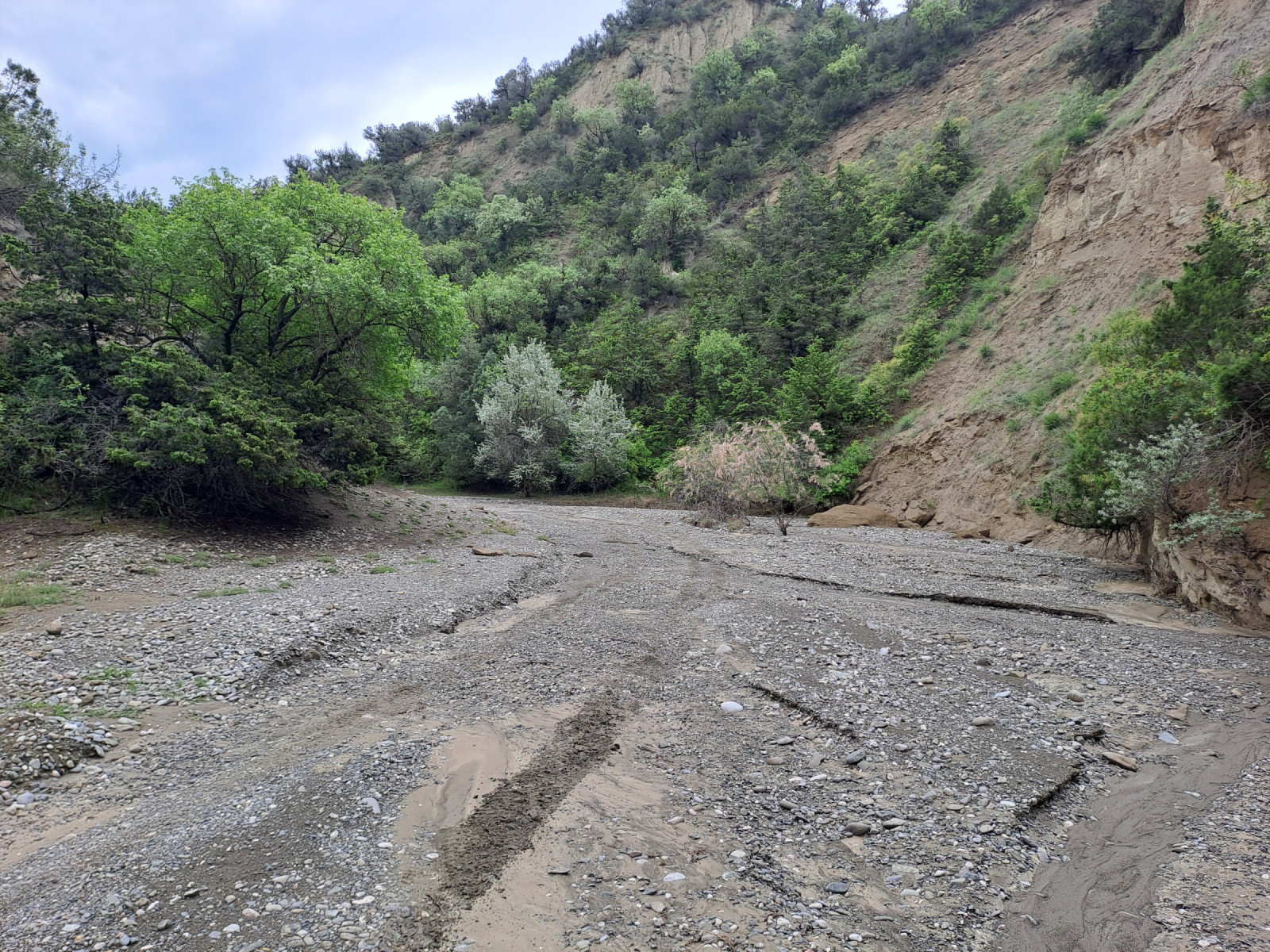
The western part of Vashlovani National Park consists of a semi-desert region dominated by steppes, small deciduous forests, dwarf shrubs, and limestone cliffs. Annual rainfall is low. The northern part of the region consists of flat, dry terrain that gives way to hills and a riverbed surrounded by canyons and juniper vegetation. On the border with Azerbaijan, a steppe extends to the southernmost point of Georgia.
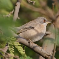
The canyons, riverbed and vegetation provide a habitat for breeding birds such as: Rotsklever, Blonde Tapuit, Aziatische Steenpatrijs, Vale Gier, Grijze Gors, Rotsmus en Rosse Waaierstaart. The riverbed ends in flat terrain that changes into sparsely vegetated steppes. Here you can find the species: Roodkopklauwier, Kleine Klapekster, Izabeltapuit Kortteenleeuwerik, Zwarte Frankolijn,Kalanderleeuwerik, Slangenarend, Grauwe Kiekendief , Keizerarend and Monniksgier. Further south in the area Ménétriés' Zwartkop can be found.
During winter, the species spectrum is less abundant, but large numbers of Kleine Trap can be present.
Details
Toegang
Vashlovani National Park is located in the Kakheti region of southeastern Georgia, near the border with Azerbaijan. The western part of Vashlovani National Park is accessible by high-clearance four-wheel drive vehicle. Be aware of muddy roads and high river water levels during heavy rainstorms.
The steppes are accessible by driving along a riverbed. From Kasristskali, take the dirt road southwest. This dirt road leads to the riverbed between the canyons (Pantishara Valley). The riverbed opens onto flat terrain, where you turn left to enter the steppe. From the steppe, you can continue driving southeast.
Terrein en leefgebied
Verspreide bomen en struiken , Steppe , Kloof/klif , RivierOmstandigheden
Heuvelachtig , Rotsachtig , Droog , Open landschap , Zanderig , Hoog water mogelijk , VlakRondlopende wandeling mogelijk?
NeeTelescoop meenemen?
Kan handig zijnWanneer hier vogels kijken?
Zomer , LenteToptijd voor dit gebied
LenteRoute
Onverharde wegZwaarte wandeling
Toegankelijk via
AutoVogelkijkhut aanwezig?
NeeExtra info
A border permit is required to enter the area. This permit can be obtained at the National Park Administration Office in Dedoplistsqaro. You may be checked by border police at various border checkpoints. You must carry your passport and border permit when exploring the area.


 ) om vogelnamen snel in te voeren via een aanklikbare lijst.