


Beschrijving
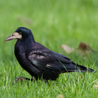
The starting point is the western end of Schrändlgasse. From here, the route leads about 200 m to the south. At a stable, turn right onto a very long, straight path. The former border watchtower can already be seen in the distance as an orientation point. Look out for Kuifleeuwerik at the beginning of this path. The route continues through an expansive meadow area, where Wulp, Kievit, Torenvalk, and Veldleeuwerik have their breeding territories. Roek and Spreeuw often forage in these meadows in large flocks.
After almost a kilometre, the ground starts to become wetter and wetter, and the area known as the Wasserstätten begins on the eastern side of the path. A wide variety of ducks and herons frequent the northern part of the area at high water levels, and Rietgors, Rietzanger, and Grote Karekiet should also easily be heard here.
The southern part of the Wasserstätten, which is also the western end of the Graurinderkoppel, is much more open and expansive, and is a great place for waders such as Kluut, Steltkluut, Grutto, Kemphaan and Zwarte Ruiter. Wintertaling and Slobeend are mostly abundant here, as are sandpipers at low water levels, while Lepelaar often forage here in quite large groups. Due to the large observation distances, it definitely pays to carry a spotting scope on this route. If possible, be on site a little before sunrise, otherwise heat shimmer and backlight can quickly make observing conditions difficult.
The route until the observation tower in the Sandeck is a beautiful mosaic of partially disused vineyards, meadows, single trees, and bushes. Zomertortel, Koekoek, Nachtegaal, Sperwergrasmus, Putter and Ringmus are just some of the species of these habitats. The little patch of forest in the Sandeck also provides habitat for Wielewaal and Hop as well as a mixed colony of Roek and Kauw. Disused Ekster nests are regularly used by Ransuil, while the white donkeys’ stable is often shared with Kerkuil – which is indicated by the black, glistening pellets on the ground. The wide expanse of the lakeshore zone is inhabited by many different waterbirds and is occasionally used as hunting grounds by Zeearend and Slechtvalk. From the tower, the reed belt of the nature reserve zone can be scanned for flying herons, Dwergaalscholver, and Bruine Kiekendief. Witoogeend and other swimming waterbirds are often spotted in the channels between the reeds.
The path northwards along the lake dune is sandy at first (bicycles are best pushed!), but quickly transitions into a normal, slightly raised dirt road that leads through vineyards and a bush-strewn landscape. Chances of seeing Sperwergrasmus, which is fairly common here, are highest in mid-May. Torenvalk, Patrijs, Hop, Grasmus, and Grauwe Klauwier are further species breeding along the lake dune.
The rest of the way to Seestraße, the route offers a good view of the lakeshore zone of Lake Neusiedl on the one side and the wet meadows around the Herrnsee on the other. Next, follow Seestraße towards Illmitz. At the signpost to the Biological Station Illmitz, turn the opposite direction – to the right – onto a dirt road that leads back to the starting point. The area between Kirchsee and Krautingsee can be a great place to observe meadow-breeding waders, particularly in wet springs.
Details
Toegang
The Sandeck is the southern-most end of the sandy lake dune stretching 25 km from Weiden am See to this point. The two access routes lead through the conservation zone of the National Park and are quite diverse, both ornithologically and regarding their landscape. Arid grassland, fallows, and small stands of bushes and trees alternate with vineyards (many of which have been disused in recent years), and wet meadows transition into expansive inundation zones and finally into the giant reed belt.
Terrein en leefgebied
Wetland , Steppe , Duinen , Rietvelden , Landbouw , Grasland/weide , Verspreide bomen en struiken , VlakteOmstandigheden
Vlak , Zanderig , Droog , Open landschapRondlopende wandeling mogelijk?
JaTelescoop meenemen?
Kan handig zijnWanneer hier vogels kijken?
Het hele jaarToptijd voor dit gebied
Zomer , LenteRoute
Onverharde weg , Breed padZwaarte wandeling
GemakkelijkToegankelijk via
Te voet , FietsVogelkijkhut aanwezig?
JaExtra info
The two 16 m-high observation towers in the southern lake- shore area (Graurinderkoppel and Sandeck) were originally Hungarian border watchtowers which were transferred to their current sites after the fall of the Iron Curtain. The upper levels can only be accessed as part of National Park excursions.


 ) om vogelnamen snel in te voeren via een aanklikbare lijst.