
Descrizione
Fort De Soto Park is a fantastic place for birding all year round and famous among US-birders and bird photographers. The area has mangroves, wetlands, hardwoods, palm hammocks, mudflats and beaches and attracts countless birds. The entire park is good for birding, but hotspots include North Beach, the East Beach Turnaround, the Arrowhead Picnic area, the Mulberry bush area and the East Beach woods. We describe these hotspots in detail below. For their location click on the stars in the map.
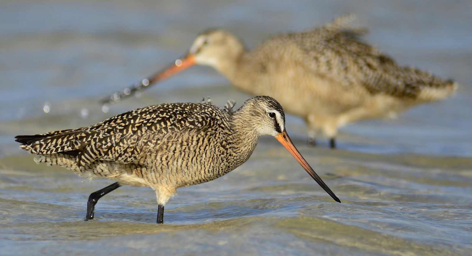
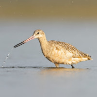
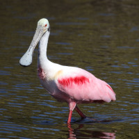
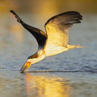
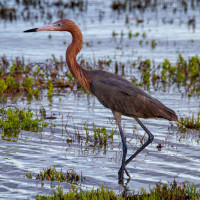
But first the birds: more than 40 species of wood-warbler have been recorded here during migration. Best spots to find these wood-warblers are the Mulberry bushes and the East Beach woods. But of course many water-depended birds can be observed. For example Brown Pelican, Double-crested Cormorant, White Ibis, Osprey and Black Skimmer. Roseate Spoonbills and Reddish Egrets feed on the flats and both night-herons hunt for fish and crabs in the wetlands and mangroves. Throughout the year you can see many species of shorebirds, gulls and terns. In the winter you can see large groups of American White Pelican in the lagoons.
Fort De Soto is also famous for attracting major rarities; in the last 15 years, Curlew Sandpiper, Razorbill, Heerman’s Gull, Thayer’s Gull, Elegant Tern, Hammond’s Flycatcher, Thick-billed Vireo, Yellow-green Vireo, MacGillivray’s Warbler, Kirtland’s Warbler, and Bananaquit have been recorded.
The mulberry trees: Just east of the Bay Pier and the ranger’s residence is a grove of mulberry trees. The mulberries ripen in April and migrant passerines seem to gravitate to them. Almost every regularly occurring migrant species has been reported here at one time or another. Expect Orchard Oriole and Eastern Kingbird, Summer and Scarlet Tanager, Rose-breasted and Blue Grosbeak.
East Beach Turnaround: A great place for close-up observations of shorebirds, waders, gulls and terns is at this easy-to-bird location. You don’t even have to leave the comfort of your vehicle. Watch for White-rumped Sandpiper and Semipalmated Sandpiper in mid May and various swallows overhead.
East Beach Woods: Just east of the Administration Building and east of the picnic grounds, is a wooded section with mature Australian pines and scattered mangroves and oaks. This area is typically very good for migrants during spring and fall migration. Expect warblers, thrushes and the unexpected.
Arrowhead Picnic area: This area contains the largest concentration of oak trees within Fort De Soto Park. Walk the parking lot and woodlands trail for warblers, thrushes and flycatchers. Check the upper branches of the tallest pines for Great Horned Owl. There’s usually something to be seen.
North Beach: This is the best place within the park for viewing the numerous shorebirds, gulls and terns that can be present during fall migration and winter. Bring your telescope as some areas are posted for the protection of nesting and resting birds, and you may not get close. Look for Piping and Snowy Plovers from July through the winter and thousands of terns from August through early October. Keep an eye to the sky for a passing Peregrine Falcon. The crowds start pouring in by midmorning, so you might want to get out there early. Or, in the fall when many terns and shorebirds are present, you may want to check in the very late afternoon as they come in to roost. The numbers can be quite impressive.
North Beach Grove: At the north end of the North Beach parking lot there is a small grove of mature oaks that can be good for warblers, vireos, cuckoos and the unexpected. Check along the ditch for Prothonotary, Hooded and Swainson’s Warblers.
Dettagli
Accesso
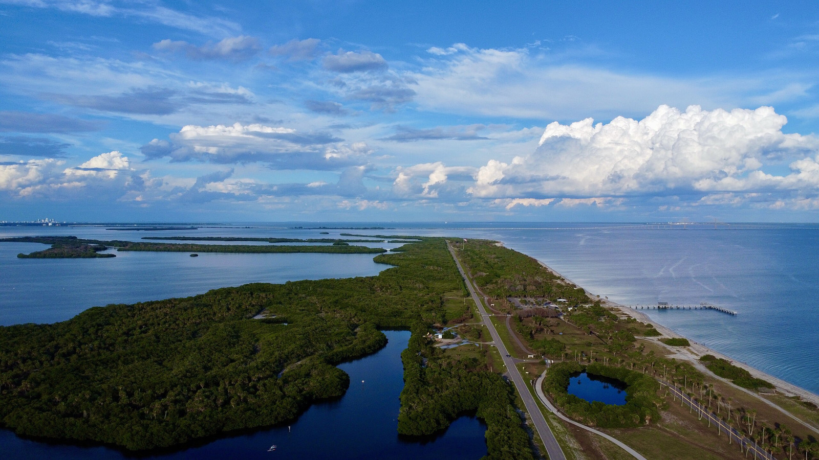
Nestled at the southern end of St. Petersburg, Fort De Soto Park is made up of five islands, with more than 1,100 acres and miles of beaches and waterfront along Mullet Key Bayou. Visitors can enjoy the paddling trail, a paved hike-and-bike trail, campground, picnic areas, two fishing piers, boat launch and ferry service to Egmont Key National Wildlife Refuge. Enter the park, drive south past the campground to the T-intersection and turn left, then immediately right to reach the visitor center. Click on a P in the map for directions (or coordinates) to a parking. In the visitor center you can check the recent sightings log and pick up a park map. The park has seven miles of paved trail connecting North Beach, East Beach, the boat ramp and the camping area.
Terreno e habitat
Foresta , Zona umida , Spiaggia , Velme , Alberi e cespugli sparsi , MareCaratteristiche dell’area
Terreno piano , Paesaggio apertoPercorso ad anello
NoÈ utile un cannocchiale?
Può essere utileBuona stagione per il BW
Tutto l'annoMiglior periodo per visitare
Migrazione primaverile , Migrazione autunnale , InvernoPercorso
Sentiero ampioGrado di difficoltà del percorso a piedi
FacileModalità di accesso
A piedi , Bicicletta , Macchina , Sedia a rotelle , BarcaCapanno/torretta di osservazione
SiInformazioni aggiuntive
Photo Fort De Soto Areal view by Catherine Amoo, CC BY-SA 4.0, https://creativecommons.org/licenses/by-sa/4.0, via Wikimedia Commons
Photo Marbled Godwit and Reddish Egret by Gareth Rasberry, CC BY-SA 3.0, https://creativecommons.org/licenses/by-sa/3.0, via Wikimedia Commons

 ) per inserire i nomi delle specie nella tua lingua. I nomi delle specie verranno automaticamente tradotti per gli altri utenti!