


Descrizione
The Bere Peninsula has the River Tamar estuary on it's Western side and the River Tavy estuary on it's South Eastern side. The site was known for Tin, Silver Lead Ore and Arsenic mining in the past and more recently better known for fruit and flower production. The walk starts by the railway station in Bere Ferrers (Bere here meaning a woodland for pigs), crossing farm fields (livestock may be present) to Thorn Point giving wide views of the Tamar estuary. The walk continues along farm wooded hedges and finishes by returning along a quiet narrow road back to the start point.
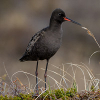
During World War II large areas of coastal East Anglia were flooded to help prevent invasion, for 100 years Avocetta were missing as a British breeding bird, in 1947 a very small number of Avocetta bred on these flooded areas for the first time, during following Winters some of those British breeding birds and continental migrants were to be found on the Tamar estuary and so it still is today. Other birds to be found in Winter are Smergo minore, Mestolone, Codone, Oca colombaccio, Fischione, Alzavola, Beccaccia di mare, Piviere dorato, Pittima reale, Pittima minore, Piovanello pancianera and Pivieressa, sometimes in small numbers but during periods of freezing conditions further North numbers can be greater.
Dettagli
Accesso
From Plymouth (to the South) leave on A386 signed Tavistock, on leaving built up area road goes through moorland. Turn Left at sign Bere Alston 2 miles/Milton Combe/Lopwell/Moristow/Nature Reserve, pass over cattle grid (WARNING open moorland livestock may be in road). At next junction follow sign to Milton Combe/Bere Alston, continue on this road and pass over cattle grid (livestock no longer in road). Road starts to narrow pass straight through next crossroads signed Buckland Monachorum/Bere Alston, at next junction turn Right and immediately Left signed Buckland Mon./Bere Alston. Continue on this road and turn Left at sign 2•0m 6'-6' Bere Alston, on reaching wooded area the road gets extremely narrow with limited passing places. At bottom of hill road bends to Left and passes over narrow Denham Bridge, road climbs through woodland, at next crossroads continue straight ahead signed Bere Ferrers 3/Bere Alston. At next junction turn Left, shortly turn Left signed Bere Ferrers (Note do not enter Bere Alston), continue on this road. On passing Bere Ferrers village sign turn Right signed Station/Tamar Valley Line, turn Right signed Clamoak/Weir Quay/Hole's Hole/Station/Tamar Valley Line, turn Left at sign Station/Tamar Valley Line, road bends to Left and park beside railway station (11 spaces).
Terreno e habitat
Alberi e cespugli sparsi , Prateria/pascolo , Valle , Fiume , Città/paese , Terreni coltivati , Velme , Spiaggia , ForestaCaratteristiche dell’area
Terreno piano , Collinoso , Roccioso , Paesaggio aperto , Acqua alta possibile , Scivoloso , PaludosoPercorso ad anello
SiÈ utile un cannocchiale?
SiBuona stagione per il BW
Tutto l'annoMiglior periodo per visitare
Inverno , Migrazione primaverile , Primavera , Autunno , Migrazione autunnalePercorso
Strada asfaltata , Sentiero ampio , Strada sterrata , Sentiero strettoGrado di difficoltà del percorso a piedi
Difficoltà mediaModalità di accesso
A piedi , Bicicletta , MacchinaCapanno/torretta di osservazione
NoInformazioni aggiuntive
The circular route indicated on the map is about 5 km.


.jpg)
 ) per inserire i nomi delle specie nella tua lingua. I nomi delle specie verranno automaticamente tradotti per gli altri utenti!