

Descrizione
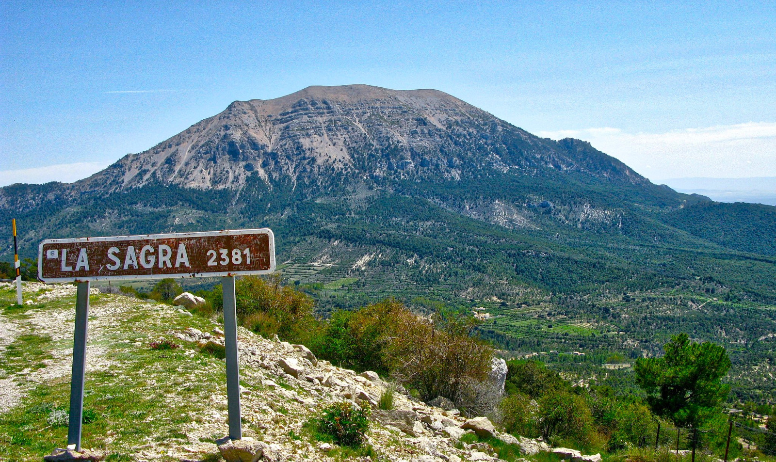
Sierra de la Sagra is an ideal place to see medium and high mountain birds. As height is gained along the indicated route, rock birds take center stage. Having great contrasts in fauna because the mountain range has a final altitude of more than 2300 meters. The proposed route has a height of 1500-2000 meters.
_________________________
Espagnol: La Sagra es una sierra y un pico situados entre Puebla de Don Fadrique y Huéscar, en la Provincia de Granada. Es el punto más alto de la Cordillera Subbética. Se trata de un lugar ideal para ver aves de media y alta montaña. Conforme se adquiere altura en la ruta planteada adquieren protagonismo las aves rupícolas. Teniendo grandes contrastes de fauna debido a que la sierra posee una altitud final de más de 2300 metros. La ruta propuesta tiene una cota de 1500-2000 metros de altura.
Dettagli
Accesso
La Sagra is located between Puebla de Don Fadrique and Huéscar, in the Province of Granada. You can reach the area by car through a forest track to the Sagra mountain refuge. Click on the P in the map for directions. There is no parking as such, but there is plenty of space to leave the vehicle. The area is ideal to explore on foot, since it is a route with quite a slope (500 meters height difference in total), it is not feasible to do it in any other way. The route indicated on the map is 2 km one way. Keep in mind that this is a difficult route due to the unevenness it presents, not suitable for people who are not used to the mountains.
_________________________
Espagnol: La llegada se realiza en vehiculo a través de una pista forestal hasta el refugio de montaña de la Sagra. No hay un estacionamiento como tal, pero si hay espacio de sobra para poder dejar el/los vehículo/s. La zona es ideal explorarla caminando, ya que se trata de una ruta con bastante desnivel (500 metros positivos en total), es inviable realizarla de cualquier otra forma. Tener presente que se trata de una ruta con dificultad debido al desnivel que presenta, no apta para personas que no están habituadas a la montaña.
Terreno e habitat
Foresta , Montagna , Alberi e cespugli sparsi , ValleCaratteristiche dell’area
Montagnoso , Collinoso , RocciosoPercorso ad anello
NoÈ utile un cannocchiale?
Può essere utileBuona stagione per il BW
Primavera , Autunno , InvernoMiglior periodo per visitare
Migrazione autunnale , Autunno , PrimaveraPercorso
Strada sterrata , Sentiero strettoGrado di difficoltà del percorso a piedi
FaticosoModalità di accesso
A piediCapanno/torretta di osservazione
NoInformazioni aggiuntive
Photo La Sagra by Marc Zoutendijk, CC BY-SA 4.0, via Wikimedia Commons


 ) per inserire i nomi delle specie nella tua lingua. I nomi delle specie verranno automaticamente tradotti per gli altri utenti!