Descrizione
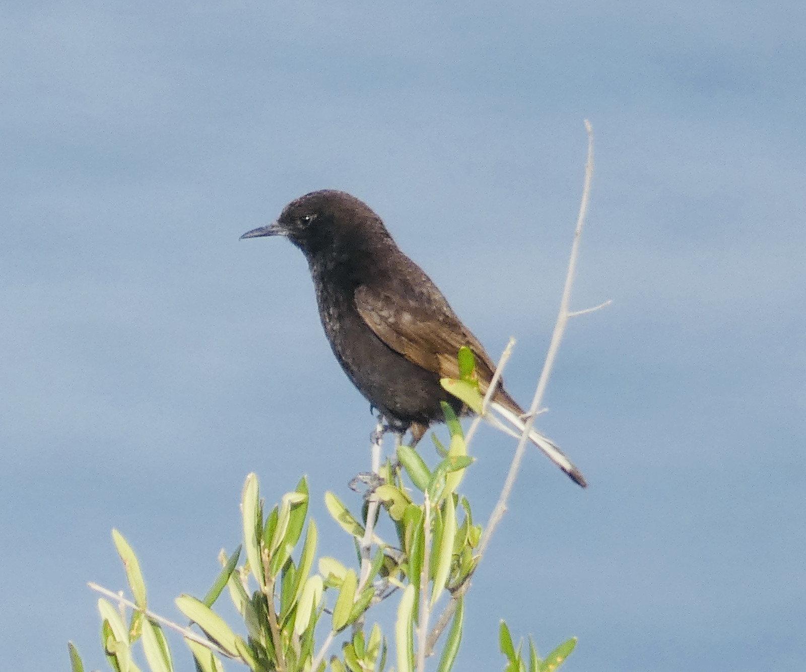
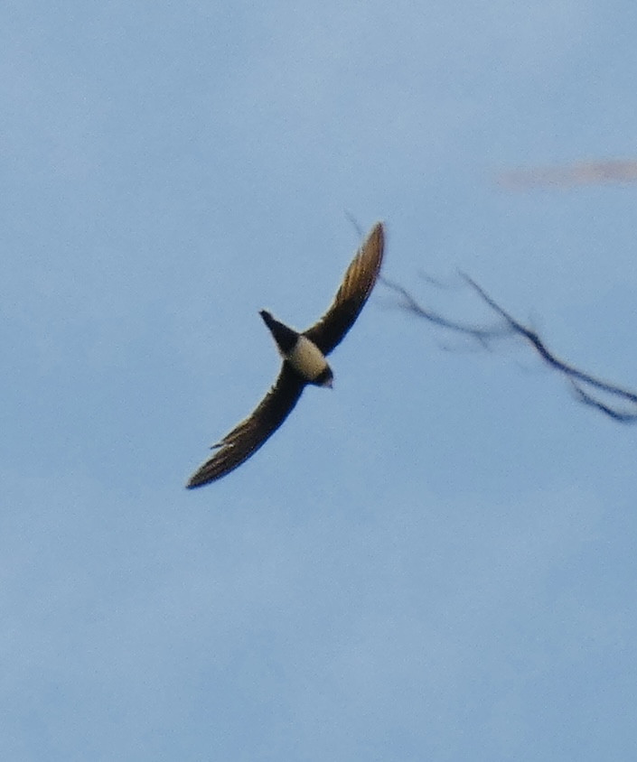
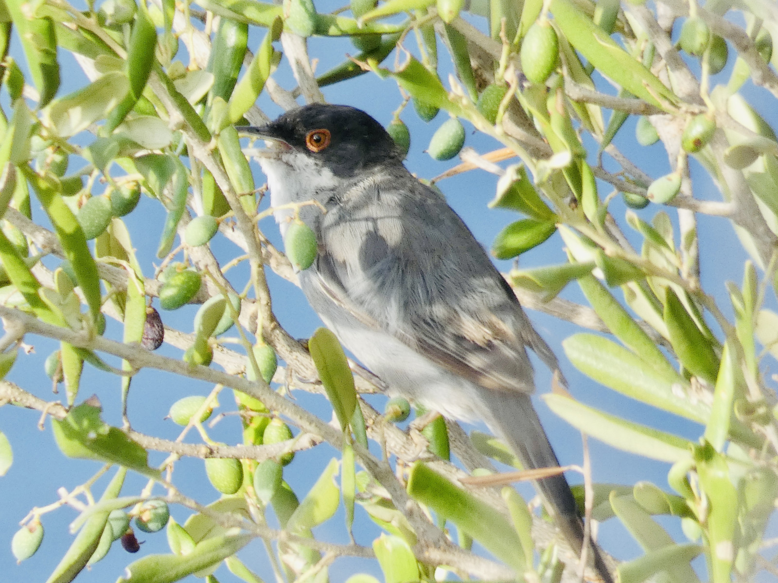
From the Morro de Toix mirador on the 200 metre high clifftop you have great views up and down the coast. In these upper parts of the cliffs of Morro de Toix you can find species as Rondone maggiore, Passero solitario or Monachella nera, as well as typical species of the Mediterranean scrub on its northern slope and the marine species above sea.
_________________________
Espagnol: El Morro de Toix es la terminación en el mar de la Sierra de Bernia. En la parte alta de sus acantilados, de más de 200 metros sobre el mar, encontramos especies tan particulares como el Vencejo real, el Roquero solitario o la Collalba negra además especies típicas del matorral mediterráneo en su ladera norte y las especies marinas que desde allí observaremos sobre la bahía.
Dettagli
Accesso
El Morro de Toix is located midway between Altea and Calpe on the Costa Blanca. To get there take the right turn off the main N332 coast road just north of the Tuneles de Mascarat, signposted Partida Maryvilla. Then follow the signs for the Monte Toix mirador (viewpoint) up the zig-zag of roads which snake up the mountainside, past endless lines of villas, until you can’t get any higher. Click on the P in the map for directions. Park up where you see a chain barring your way. Note that it can get crowded here in summer. From the parking you can walk up to the mirador.
_________________________
Espagnol: El Morro de Toix se encuentra a medio camino entre Altea y Calpe en la Costa Blanca. Haga clic en la P en el mapa para obtener direcciones. Estacione donde vea una cadena bloqueando su camino. Tenga en cuenta que puede llenarse aquí en verano. Desde el parking se puede subir andando hasta el mirador.
Terreno e habitat
Canyon/scogliera , Mare , PianuraCaratteristiche dell’area
Non ombreggiato , Paesaggio aperto , Asciutto , RocciosoPercorso ad anello
NoÈ utile un cannocchiale?
Può essere utileBuona stagione per il BW
Tutto l'annoMiglior periodo per visitare
Migrazione primaverile , Estate , PrimaveraPercorso
Strada sterrataGrado di difficoltà del percorso a piedi
Difficoltà mediaModalità di accesso
Bicicletta , A piediCapanno/torretta di osservazione
NoInformazioni aggiuntive
.


 ) per inserire i nomi delle specie nella tua lingua. I nomi delle specie verranno automaticamente tradotti per gli altri utenti!