
Descrizione
Deliblato Sands Reserve's west borders is an area of steppe, sandy, and agricultural open landscape habitats, as well as patches of black locust, black pine, Scots pine, and various deciduous forest species. More than 120 bird species have been recorded in this part of the Deliblato Sands. Considering that the lack of surface water and the lack of waterbirds in the area, this reflects the very high biodiversity of the region. The area shines in spring when migratory birds come, and it is still not too hot. Also, late September and October are very nice and pleasant.
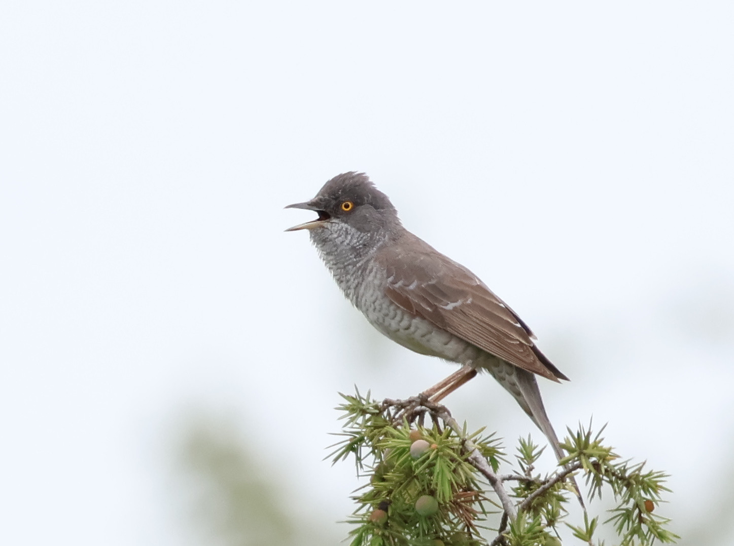
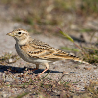
Gruccione, Upupa, Ghiandaia marina, Rigogolo, and Tortora selvatica are common here. Larks include Cappellaccia, Allodola, Tottavilla and Calandrella. From Buntings there are Strillozzo, Ortolano, Zigolo capinero and Zigolo giallo. Also present are Bigia padovana, Beccafico, Stiaccino, Saltimpalo, Calandro, Averla piccola, Averla cenerina and Averla maggiore.
Among other more common birds of prey, the sandy dunes are also patrolled by Biancone, Aquila minore, Albanella minore, and Falco cuculo. Torcicollo in April and Succiacapre after sunset in June are also some of the many highlights of this area.
The area is part of the Deliblatska Peščara Nature Reserve and IBA Deliblatska Peščara.
Dettagli
Accesso
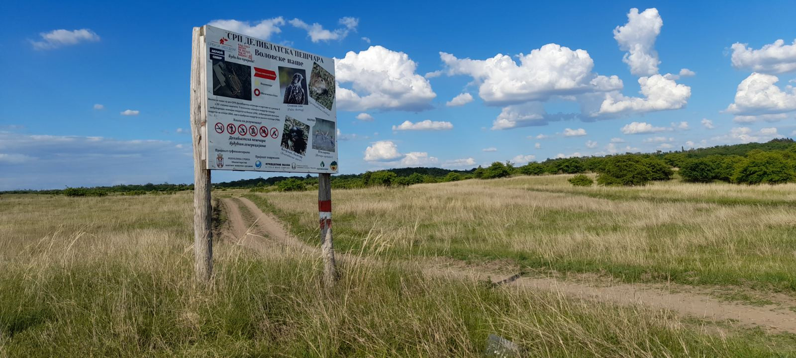
After about a 50-minute drive from Belgrade, there are 3 main access points to the western borders of the Deliblato Sands Nature Reserve: Devojački Bunar ("Girl's Well"), Dolovo ("Valley Village"), and Mramorak ("Marble Pebble"). To access the entrance from Devojački Bunar, head to Vladimirovac village and follow the way to the northern P mark. To access the entrance from Dolovo, head to the Dolovo village and continue straight following the way to the middle P mark. To access the entrance from Mramorak, head to the village with the same name and follow the turn left to the southern P mark. Click on any P in the map to get directions or coordinates.
All three entry points are interesting in different ways, while Devojački Bunar is the most accessible and has the most tourist infrastructure, Dolovo and Mramorak are more productive for birding. There are many, many paths and sandy roads through Deliblato Sands, especially near the borders. Some suggested paths are drawn on the map, but feel free to explore additional paths (as seen on the satellite map) that lead to your preferred habitat, grassland, scattered bushes, low-deciduous forest, or agricultural. Still, put focus on the borders where the sand and forest patches meet agricultural land, as the biodiversity peaks there.
Terreno e habitat
Foresta , Alberi e cespugli sparsi , Prateria/pascolo , Steppa , Dune , Terreni coltivatiCaratteristiche dell’area
Terreno piano , Collinoso , Sabbioso , Asciutto , Paesaggio aperto , Non ombreggiatoPercorso ad anello
SiÈ utile un cannocchiale?
NoBuona stagione per il BW
Primavera , AutunnoMiglior periodo per visitare
Migrazione primaverile , Primavera , AutunnoPercorso
Sentiero ampio , Strada sterrataGrado di difficoltà del percorso a piedi
Difficoltà mediaModalità di accesso
A piedi , Bicicletta , MacchinaCapanno/torretta di osservazione
SiInformazioni aggiuntive
Bring at least 1l of water per person as climate in the Deliblato Sands is dry and hot on sunny days. Always stick to established tracks and respect wildlife!
Link
- "Deliblatska Peščara NR--Devojački bunar" eBird hotspot
- "Deliblatska peščara NR--Volovska paša" eBird hotspot
- "Deliblatska pescara NR--Mramorački vinogradi" eBird hotspot
- "Deliblatska peščara NR--potez Leanka - Prvi bunar" eBird hotspot
- Barchart for all 4 eBird hotspots combined
- IBA Deliblatska Peščara


 ) per inserire i nomi delle specie nella tua lingua. I nomi delle specie verranno automaticamente tradotti per gli altri utenti!