Descrizione
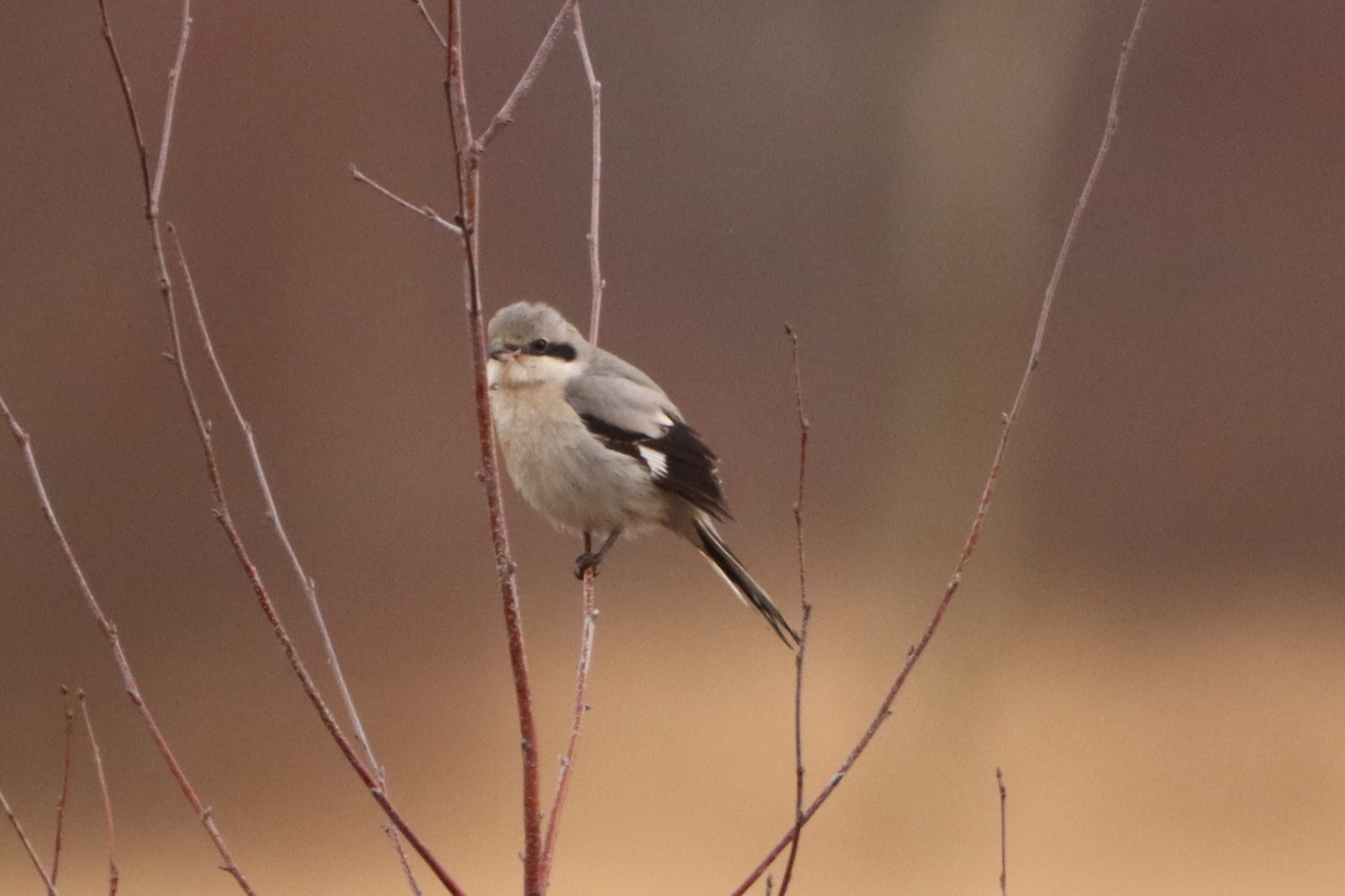
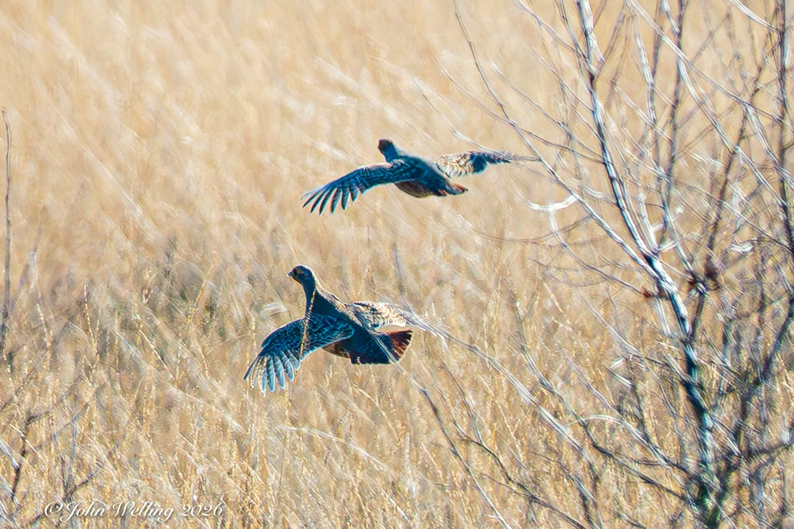
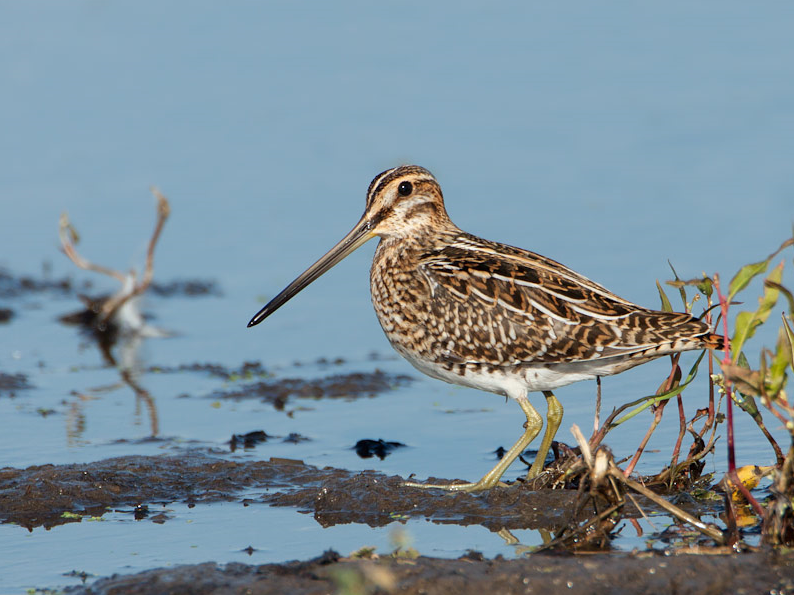
The Wierdense Veld is a raised moor area. Higher, drier parts covered with heather alternate with the lower, wet parts where peat mosses and bog mosses grow. There is often a sheep herd of about 300 sheep on the heath. Birds that can be observed in the area include Falco di palude, Chiurlo maggiore, Pittima reale, Zigolo giallo, Prispolone, Saltimpalo, Lodolaio, Averla piccola, Rigogolo and Beccaccino. In recent years Gru has been successfully breeding in the area. There are several ponds that attract waterfowl such as Tuffetto, Alzavola and Mestolone. In the winter in the Wierdense Veld you have a chance to see Averla maggiore and Albanella reale.
_________________________
Nederlands: Het Wierdense Veld is een wijds, waterrijk hoogveengebied van 440 hectare. Hogere, drogere delen begroeit met heide wisselen af met de lagere, natte stukken waar veenmossen en hoogveenmossen groeien. Je vindt er droge en natte heide, veenputten, plassen en berkenstruwelen. Sinds 1968 wordt dit gebied beheerd door Landschap Overijssel. Op de heide loopt vaak een schaapskudde. Vogels die je in het gebied kunt zien zijn onder meer Falco di palude, Chiurlo maggiore, Pittima reale, Zigolo giallo, Prispolone, Saltimpalo, Lodolaio, Averla piccola, Rigogolo en Beccaccino. De afgelopen jaren heeft Gru succesvol gebroed in het gebied. Er liggen diverse plassen die watervogels zoals Tuffetto, Alzavola en Mestolone aantrekken, maar de meeste plassen zijn vanaf de (zand)wegen nauwelijks te zien. In de winter maak je in het Wierdense veld kans op Averla maggiore en Albanella reale.
Dettagli
Accesso
The Wierdense Veld is located north of national road N35 between Wierden and Nijverdal. A limited number of parking spaces are available in front of the entrance of the site, near the sheepfold. Click on the P in the map for directions. Much of the area is inaccessible, but you can explore the area via the dirt roads that crisscross the area. The distances are considerable, for example the complete route shown on the map is 17 km. Therefore, exploring the area by bike is a good option if you want to see everything. Remember that you do not always have a good view of the Wierdense Veld from the roads and paths due to the storage of birch and other vegetation. The best vantage point is located on the Hortmeerweg, not too far from the parking lot. From this viewing platform you have a beautiful view of the area. The Averla piccola is regularly seen there. We have put the other viewpoint on the Spikkenplasweg on the map, but you could also skip it because it is often quite busy, dogs are allowed to run loose and there is therefore less to see..
_________________________
Nederlands: Het Wierdense Veld ligt ten noorden van rijksweg N35 tussen Wierden en Nijverdal. Voor de ingang van het terrein, ter hoogte van de schaapskooi, zijn een beperkt aantal parkeerplaatsen beschikbaar. Klik op de P in de kaart voor een routebeschrijving. Een groot deel van het gebied is ontoegankelijk, maar je kunt het gebied verkennen via de (zand)wegen en paden die het gebied doorkruisen. De afstanden zijn flink, bijvoorbeeld de complete route die op de kaart is afgebeeld is 17 km. Daarom is het gebied met de fiets verkennen een goede optie als je alles wilt zien. Bedenk dat je vanaf de wegen en paden niet altijd goed uitzicht hebt op het Wierdense Veld door de opslag van berken en andere vegetatie. Het beste uitkijkpunt vind je aan de Hortmeerweg, niet al te ver van de parkeerplaats. Vanaf dit uitkijkplatform kijk je mooi uit over het gebied. Regelmatig wordt daar de Averla piccola gezien. Het andere uitzichtpunt aan de Spikkenplasweg hebben we wel op de kaart gezet, maar zou je ook kunnen overslaan omdat het vaak nogal druk is, honden er los mogen lopen en er dus minder te zien is.


 ) per inserire i nomi delle specie nella tua lingua. I nomi delle specie verranno automaticamente tradotti per gli altri utenti!