
Descrizione
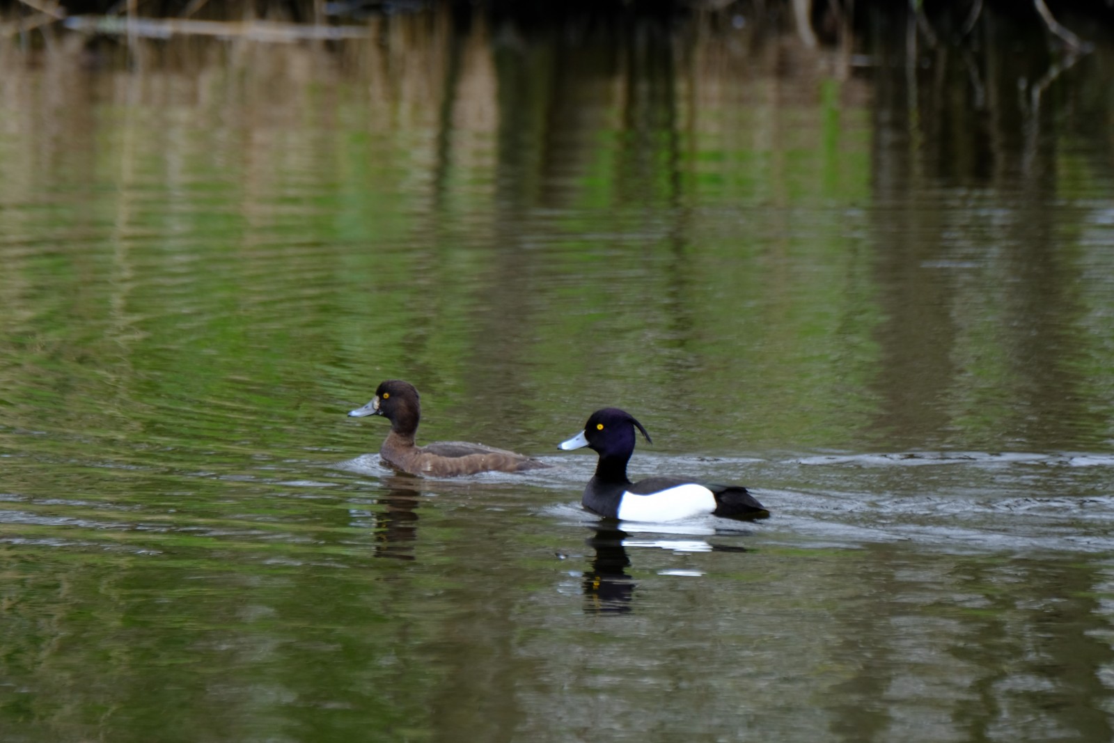
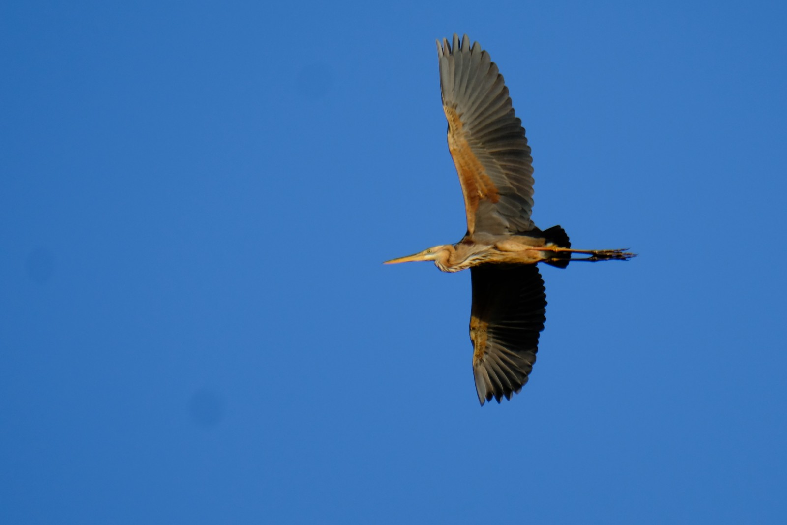
Munnikenland is a wetland nature reserve in the western tip of the province of Gelderland, near the famous Slot Loevestein (castle). Free-living herds of large grazers migrate through the nature reserve, which contribute to the natural wealth in the area and helps to keep the landscape open. It is a nice area for walking and bird watching. Especially in spring , when migrating birds pass through and many birds can be seen. Among the birds you can see here are Oca selvatica, Oca lombardella, Oca facciabianca, Oca canadese, Airone rosso, Garzetta, Tarabuso, Picchio rosso maggiore and Martin pescatore. The Aquila di mare and Falco pescatore are regularly spotted here. You can also see sleeping places of Cormorano and in the right time of the year at sunset swarms of Storno that dive into the reeds to rest.
_________________________
Nederlands: Munnikenland is de naam van het uiterste westen van de Bommelerwaard. Een vogelrijke landtong tussen de samenvloeiende rivieren de Waal en de Afgedamde Maas. Munnikenland ligt vlakbij Slot Loevestein. Kuddes grote grazers trekken door het natuurgebied, wat bijdraagt aan de natuurlijke rijkdom in het gebied en helpt het landschap open te houden. Het is een mooi gebied om te wandelen en vogels te kijken. Vooral in het voorjaar en tijdens de vogeltrek zijn er veel vogels te zien. Vogels die je hier kunt zien zijn Oca selvatica, Oca lombardella, Oca facciabianca, Oca canadese, Airone rosso, Garzetta, Tarabuso, Picchio rosso maggiore en Martin pescatore. De Aquila di mare en Falco pescatore worden hier regelmatig gespot. Ook zie je slaapplaatsen van Cormorano en in de juiste tijd van het jaar bij zonsondergang zie je zwermen Storno die in het riet duiken om te rusten.
Dettagli
Accesso
There is a parking at the beginning of the area (see the P on the map). From there you can explore the area on foot. Depending of the height of the river which parts of the area you can explore. The area may be wet. So bring boots or waterproof high walking shoes! The route that is shown on the map is about 9 km.
_________________________
Nederlands: Er is een parkeerplaats bij het begin van het gebied (zie de P op de plattegrond). Van daaruit kun je de omgeving te voet verkennen. Afhankelijk van de hoogte van het waterpeil kun je de diverse delen van het gebied verkennen. Het gebied kan nat zijn. Dus neem laarzen of waterdichte hoge wandelschoenen mee! De route die op de kaart wordt weergegeven, is ongeveer 9 km.


 ) per inserire i nomi delle specie nella tua lingua. I nomi delle specie verranno automaticamente tradotti per gli altri utenti!