Descrizione
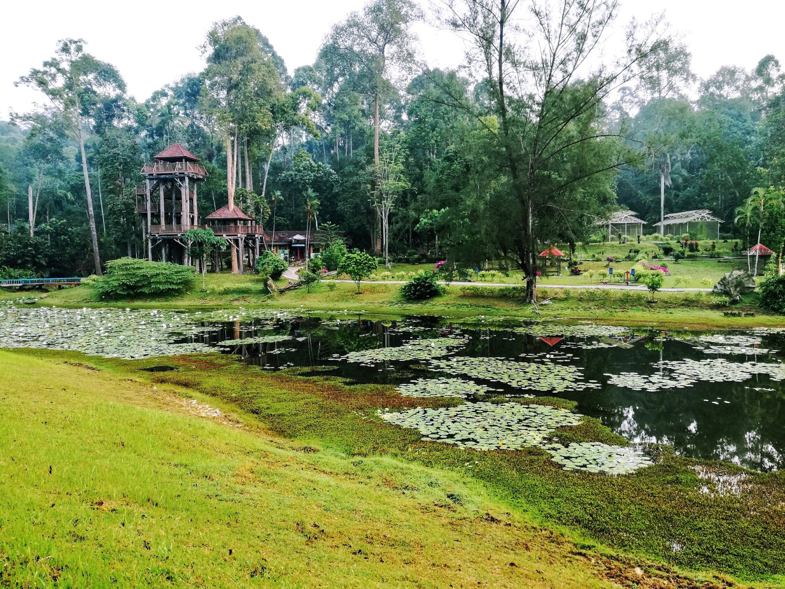
Taman Botani Negara Shah Alam (TBNSA) is a national botanic garden of 817 hectares in Shah Alam. The forest is a red meranti-keruing forest. There are also a few hills that can be hiked along the paved trail. The highest point is the Bukit Sapu Tangan (200m asl). On top of the hill, there's a lookout point that provides a view of the city of Shah Alam. The trails from the hill connect with adjacent forested areas outside TBNSA, including Shah Alam Community Forest.
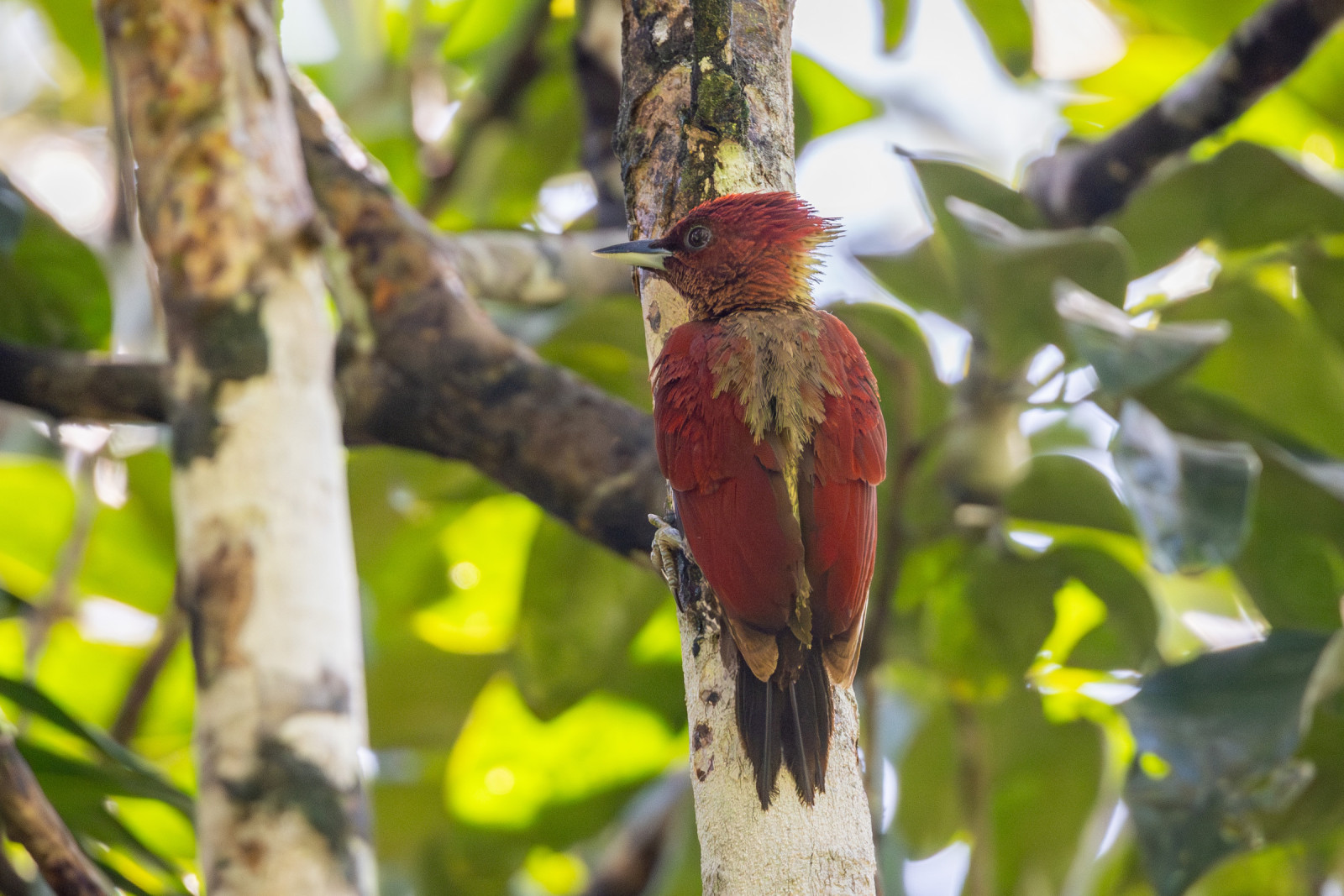
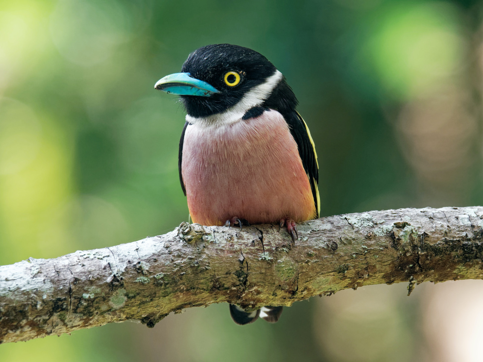
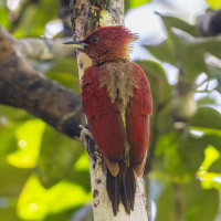
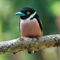
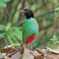
Keep an eye out for munias, broadbills, spiderhunters, barbets, woodpeckers, bulbuls, and malkohas. Two species of pitta (Blue-winged Pitta and Hooded Pitta) are also recorded in the area. Also 4 species of green pigeons can be found here (Little Green-Pigeon, Pink-necked Green-Pigeon, Thick-billed Green-Pigeon and Jambu Fruit-Dove). And the elusive Slaty-legged Crake has been spotted here in recent years. In winter the park has quite a number of wintering migrants such as Siberian Blue Robin.
Dettagli
Accesso
Taman Botani Negara Shah Alam is situated in the north of Shah Alam, it takes approximately 40 minutes to drive from Kuala Lumpur. Click on the P in the map for directions or coordinates. Opening hours: 7.30 am to 5.00 pm. The park is closed on Mondays. Entrance fee RM 3.00 (2024).
There are various tracks and trails. Heading towards the 'agro-forestry' (track to left after entrance) tends to be good, otherwise head directly north, and take the tracks heading north-east, beyond the lake. On the map you see a circular walk of 12 km. This is just a suggestion. There are many other and shorter trails.
 Jacques Popinet.jpg)
 ) per inserire i nomi delle specie nella tua lingua. I nomi delle specie verranno automaticamente tradotti per gli altri utenti!