Carica immagini
I formati di immagine permessi sono jpeg, png, gif
Dimensione massima dei file 20MB
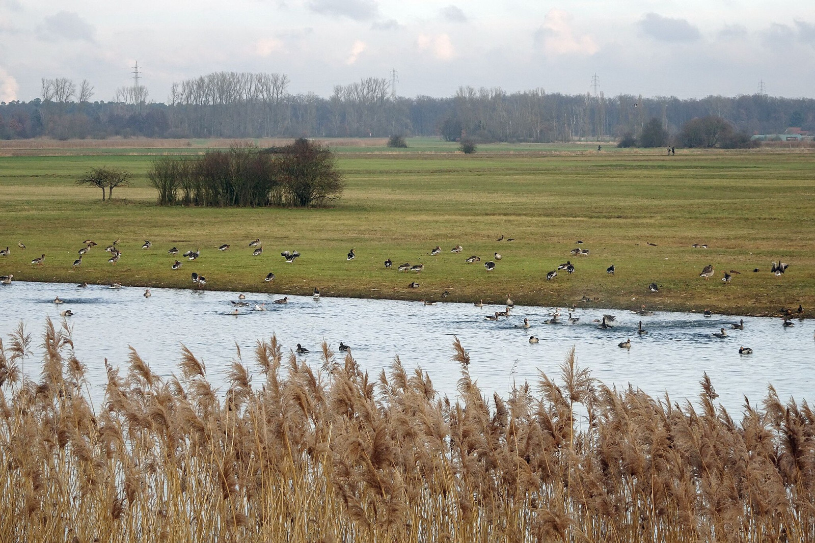
A floodplain area on the lower reaches of the Gersprenz stream with habitat for many bird species, including migratory birds.
The Hergershäuser Wiesen are a floodplain area of approximately 400 hectares and characterized by many different habitats; wet, dry and sandy. Large areas are irrigated with a wind pumping station and several temporary water-retaining ponds and extensive wet meadows are created. NABU Münster (Hesse) has been committed to protecting and caring for these valuable areas for decades and makes the area accessible through a marked circular trail and guided hikes.
Hergershäuser Wiesen is located between Münster, Altheim and Hergershausen. It is easy to explore the area from these places. Press a P in the map for directions to a parking spot. In addition, one of the trails starts from Altheim train station. If you walk all the trails that are shown on the map it is a distance of 11 km, but it is of course easy to make the walk shorter.
Il vostro feedback verrà inviato all’autore dell’area e agli editori di Birdingplaces. Utilizzeranno il tuo feedback per migliorare la qualità delle informazioni. Vuoi pubblicare un commento visibile? Utilizza il pulsante “Commenti” in fondo alla scheda di ciascuna area.
In questa casella puoi rilasciare il tuo feedback sul testo di questa area per il BW.
In questa casella puoi rilasciare il tuo feedback sulla mappa di questa area per il BW.
In questa casella puoi rilasciare il tuo feedback sull’elenco di specie di uccelli di questa area per il BW. (Per condividere i tuoi avvistamenti ti preghiamo di utilizzare il pulsante “Commenti” in fondo alla scheda di ciascuna area)
Clicca sull'icona dell'uccello () per inserire i nomi delle specie nella tua lingua. I nomi delle specie verranno automaticamente tradotti per gli altri utenti!