
Descrizione
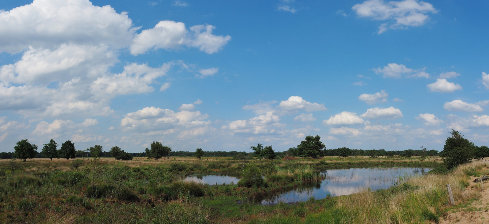
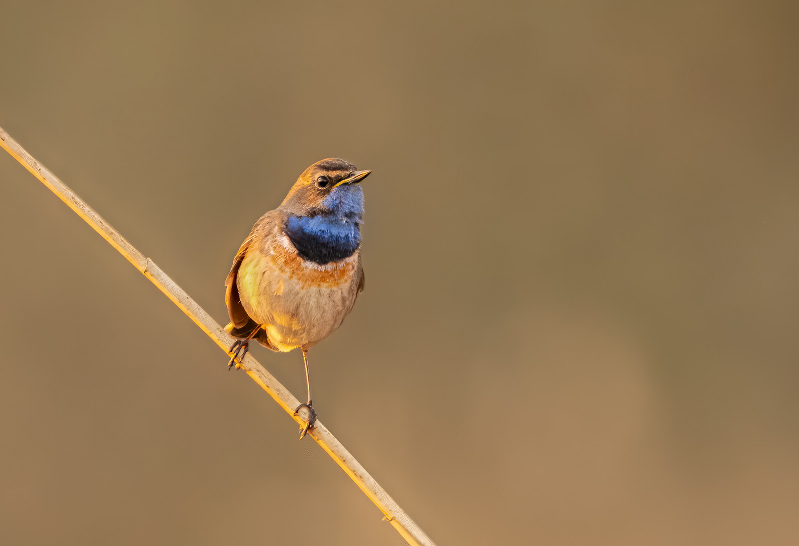
The Hageven-De Plateaux spreads out over Belgium and the Netherlands. It is an oasis of 600 hectares with heathland, fens, forests and grasslands, where the Dommel winds its way through the beautiful landscape. Hageven-De Plateaux is a breeding and staging area for reedbed species and meadow birds. Here one can see birds like Tarabuso, Pettazzurro, Migliarino di palude and Tottavilla.
_________________________
Nederlands: Nederlands-Belgisch natuurgebied van 600 hectare met heide, vennen, bossen en graslanden, waar de rivier de Dommel zich een weg baant door het landschap. Gebied met hoge biodiversiteit. Hageven-De Plateaux is een broed- en rustplaats voor rietsoorten en weidevogels. Hier zijn vogels als Tarabuso, Pettazzurro, Migliarino di palude en Tottavilla te zien.
Dettagli
Accesso
This cross-border nature reserve is located between Valkenswaard and Pelt and is easily accessible. There are several parking spaces, both on the Belgian side of the nature reserve and on the Dutch side. Click on a P in the map for directions. Walking trails are pointed out with different indications for each distance depending between 1,5 km and 9,7 km. The circular walk marked on the map below is approximately 13 km long, but can easily be shortened.
_________________________
Nederlands: Dit grensoverschrijdend natuurgebied is gelegen tussen Valkenswaard in Nederland en Pelt in België is goed bereikbaar. Er zijn diverse parkeerplaatsen, zowel aan de Belgische kant van het natuurgebied als aan de Nederlandse kant. Klik op een P in de kaart voor een routebeschrijving. Er zijn gemarkeerde wandelroutes voor elke afstand van 1,5 km tot 9,7 km. De rondwandeling die is aangegeven op de kaart hieronder is ongeveer 13 km lang, maar kan ook eenvoudig worden ingekort.
Terreno e habitat
Foresta , Zona umida , Lago , Terreni coltivati , Alberi e cespugli sparsi , Prateria/pascolo , Brughiere/lande , Fiume , CannetiCaratteristiche dell’area
Terreno piano , Non ombreggiato , Paesaggio apertoPercorso ad anello
SiÈ utile un cannocchiale?
Può essere utileBuona stagione per il BW
Primavera , EstateMiglior periodo per visitare
Primavera , EstatePercorso
Strada sterrataGrado di difficoltà del percorso a piedi
FacileModalità di accesso
A piediCapanno/torretta di osservazione
SiLink
- Recent bird sightings in the area on Waarnemingen.be
- Natuurpunt: Bezoekerscentrum Hageven
- Gemeente Pelt: Natuurreservaat Hageven - Plateaux
- De Groote Heide Nature Border Park


.jpg)


 ) per inserire i nomi delle specie nella tua lingua. I nomi delle specie verranno automaticamente tradotti per gli altri utenti!