 by John Baas.JPG)
Descrizione
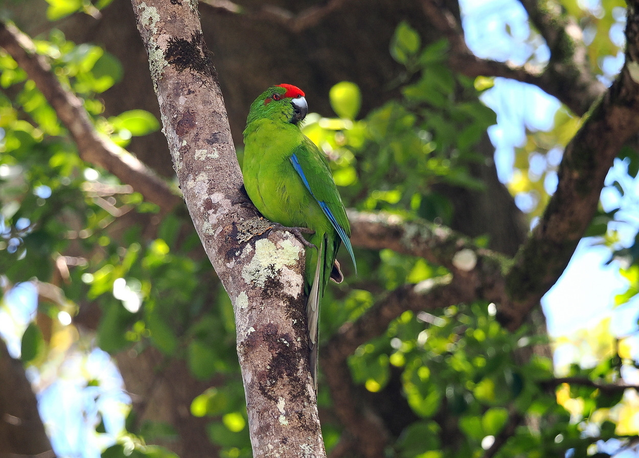
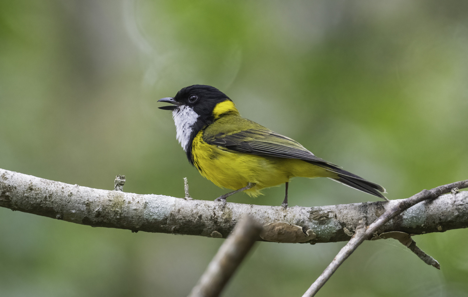
Typical of many of the trails in Norfolk Island National Park, the Mount Bates Track's deep forest is home to many of NI's endemic birds including Norfolk Island Parakeet, Norfolk Island Gerygone, Norfolk Robin and Slender-billed White-eye.
Dettagli
Accesso
From Burnt Pine proceed north on Grassy Road and onto Mount Pitt Road to reach the start of the Mount Bate Track. Note, there is only limited parking available at this site. Press P on the map to access Google mapping.
Terreno e habitat
ForestaCaratteristiche dell’area
Terreno piano , CollinosoPercorso ad anello
SiÈ utile un cannocchiale?
NoBuona stagione per il BW
Tutto l'annoMiglior periodo per visitare
PrimaveraPercorso
Sentiero ampioGrado di difficoltà del percorso a piedi
Difficoltà mediaModalità di accesso
A piediCapanno/torretta di osservazione
NoInformazioni aggiuntive
A loop option can be created by returning to start via Mount Pitt Road. However, better birding will be obtained by simply retracing your steps.
From Wikipedia: " Norfolk Island National Park was established in 1984 and is managed by the Commonwealth of Australia. Mount Pitt and the Botanical Gardens were both established as part of Norfolk Island National Park in 1984.
They were declared a National Park under the National Park and Wildlife Conservation Act of 1975. Before the national park was established, the territory was considered a public reserve under the Commons and Public Reserves Ordinance of 1936.
Due to steep terrain and rocky cliffs, much of the land has remained unfarmable, leaving most of the island untouched. During World War II, a radar station was placed on top of Mount Bates, and can still be visited today".
Link
- Mount Bates Track is an eBird hotspot.
- Parks and Wildlife page.
- Wikipedia page.
- Bird Spots blog re NI birding.

 by John Baas.JPG)

 ) per inserire i nomi delle specie nella tua lingua. I nomi delle specie verranno automaticamente tradotti per gli altri utenti!