
Description
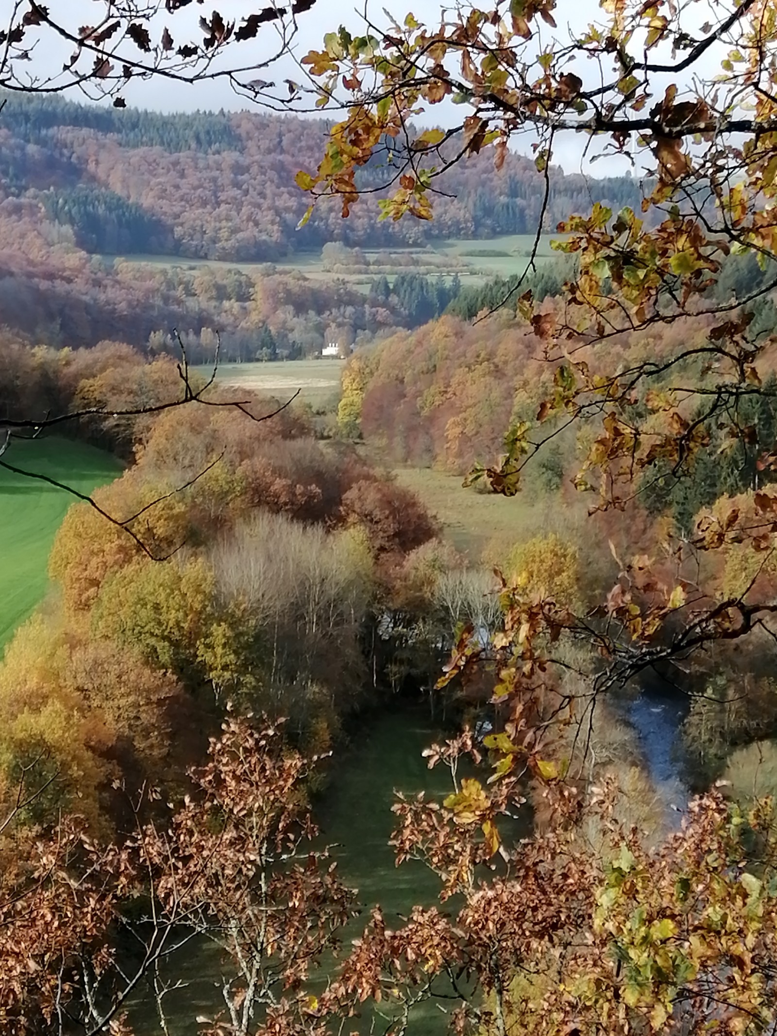
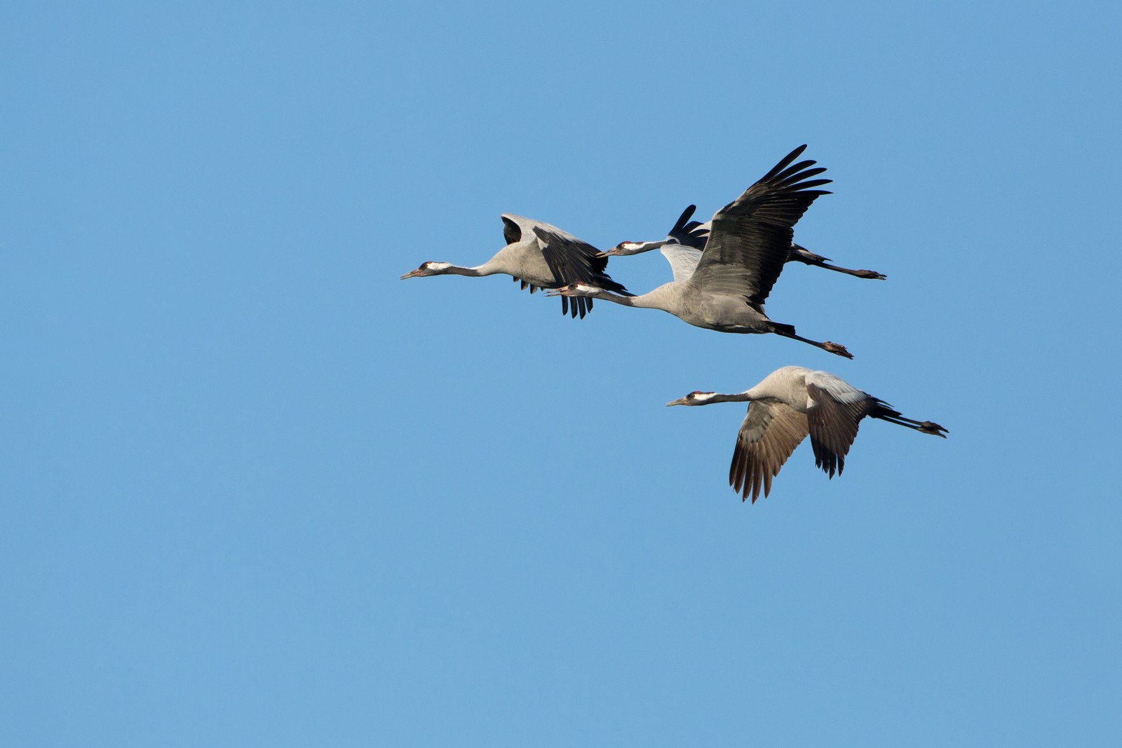
The Valley of the river Our is a beautiful valley that you can also explore further if you cross the border into Luxembourg. There are several routes that connect to each other. From a birding point of view, the valley is especially interesting during the autumn migration. The pristine valley alternates rocky areas with grazing meadows and hay fields. There are also marsh areas and hornbeam, oak and coppice forests on the flanks. At the river Our, you can always see Fossbúi and Bláþyrill and in winter also Gulönd. At night the calling of the Úfur can often be heard. On the plateaus you always find Svölugleða! Other birds incluse Hrafn, Svartspæta and Býþjór. During autumn migration, the valley is a perfect spot for passing Gjóður, Kolstorkur and Grátrana. Sometimes tens of thousands!
_________________________
Nederlands: Prachtige vallei die je ook verder kan verkennen als je de grens oversteekt met Luxemburg. Er zijn verschillende routes die op elkaar aansluiten. Op vogelvlak is de vallei voornamelijk interessant tijdens de najaarstrek. De ongerepte vallei wisselt rostpartijen af met graas- en hooiland. Er zijn oook moeraszones en op de flanken haagbeuken - eiken hakhoutbossen. Bij de rivier de Our kun je steeds Fossbúi en Bláþyrill zien en tijdens de winter ook Gulönd. 'S nachts is de Úfur vaak roepend te horen. Op de plateaus altijd Svölugleða! Verder Hrafn, Svartspæta en Býþjór. Tijdens de najaarstrek is de vallei een perfecte spot voor doorkomende Gjóður, Kolstorkur en Grátrana. Soms wel tienduizenden!
Details
Access
It is best to explore the area on foot. You can park at the 3 country point of Ouren. Following the river downstream brings you adventurous trails and stunning views. Consecutive day marches can be made. Some are tough, but there are also easier routes out of the valley. Hiking maps are plentiful about this area (Süd-Eifel). The route shown on the map below is 12.5 km long.
_________________________
Nederlands: Je kan het gebied het beste te voet verkennen. Je kunt parkeren aan het 3-landenpunt van Ouren. De rivier stroomafwaarts volgen brengt je avontuurlijke paden en schitterende uitzichten. Opeenvolgende dagmarsen zijn te maken! Sommige zijn pittig, maar er zijn ook gemakkelijkere routes de vallei uit. Wandelkaarten zijn er bij de vleet over dit gebied( Süd-Eifel). De route die op de kaart wordt getoond is 12,5 km lang.
Terrain and Habitat
Forest , Scattered trees and bushes , Grassland , Plateau , Valley , River , City/village , Agriculture , Canyon/cliffConditions
Hilly , Rocky , Open landscape , High water possible , Slippery , Wet , Mountainous , FlatCircular trail
YesIs a telescope useful?
NoGood birding season
All year roundBest time to visit
Autumn migrationRoute
Narrow trailDifficulty walking trail
StrenuousAccessible by
FootBirdwatching hide / platform
NoLinks
- Recent bird sightings in the area on Waarnemingen.be
- You can also check www.ornitho.lu for recent sightings in the area


 ) to insert bird names in your own language. The birdnames will automatically be translated for other users!