Description
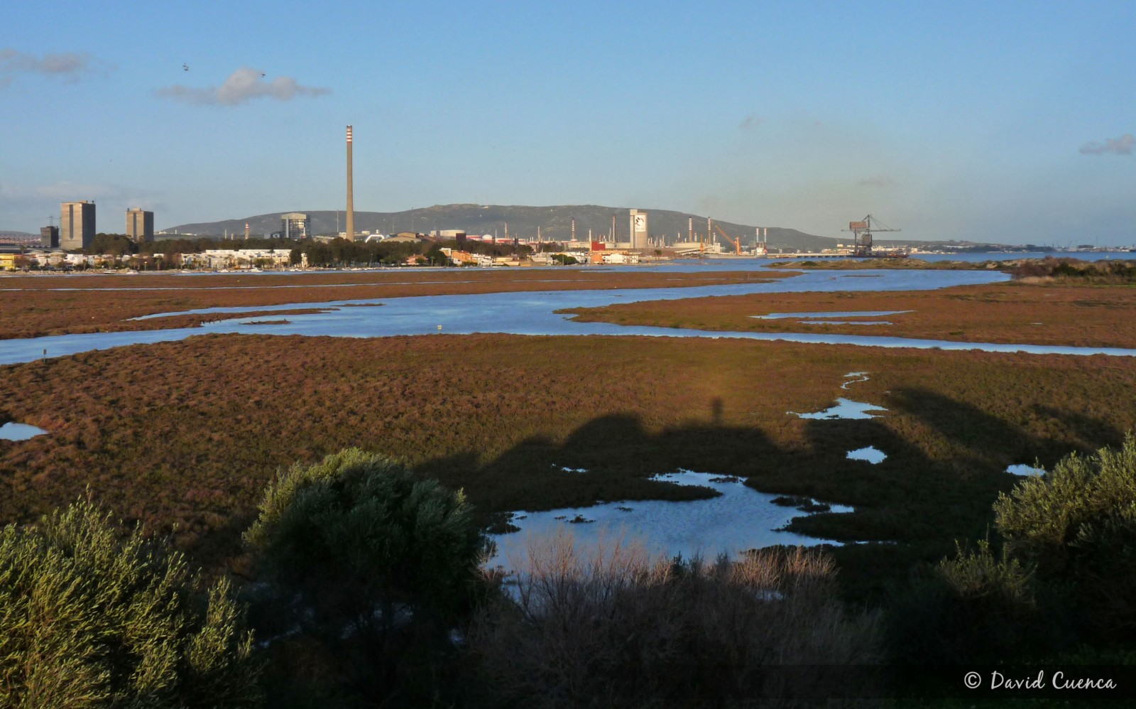
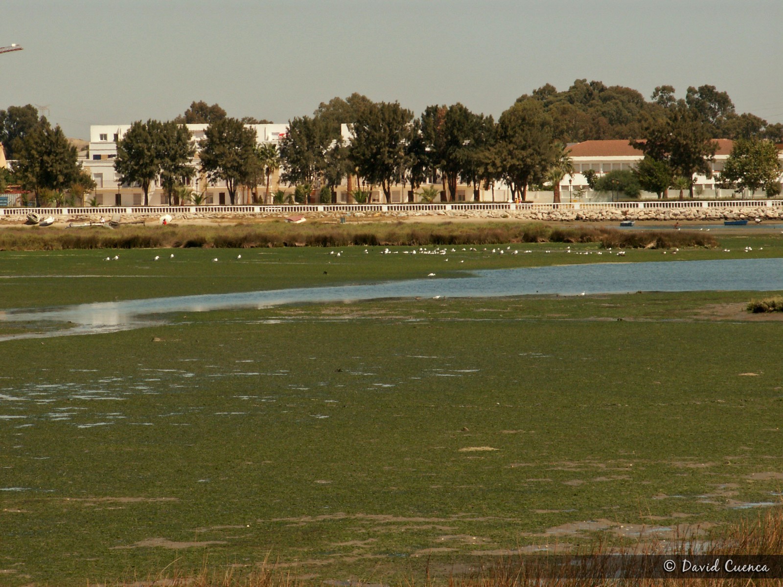
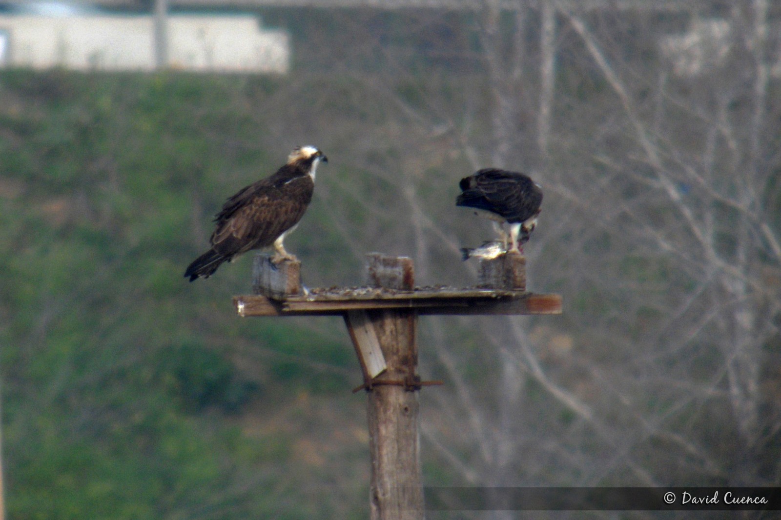
This natural park in the mouth of the river Palmones, covers the only marshes of the whole Strait of Gibraltar. It's an important place for birds, especially in migration periods and in winter, with more than 200 species recorded. The marshes, intertidal zone and coastal dunes attract lots of wildfowl species, herons, gulls, terns and waders. The Kanalasgém is easy to see in small numbers and it's the most important wintering area for Halászsas in the Strait. Some of the main species are: breeding Széki lile, sárga billegető, szikipacsirta and berki veréb (in the orchards); migrants Gólyatöcs, Rózsás flamingó, Székicsér, Küszvágó csér and Bajszos poszáta and wintering Kárókatona, Barna rétihéja, Fütyülő réce, Piroslábú cankó, Nagy póling, Réti fülesbagoly, Bütykös ásólúd (some years), Lócsér and Havasi pityer. The bengáli csér is one of the annual rarities. Moreover, álarcos réce, Erdei szalonka, Kerti geze and Erdei sármány have been seen.
There is an observatory in the place called Torrejon Park, from where you have an excellent panoramic sight of all the area. In early spring, it is easy to see pettyes kakukk and several species of warblers and others songbirds in the forest and scrubland.
Palmones is also a good place to see migration of raptors, storks, swifts and swallows with the west winds.
Details
Access
The best option to visit this area is to access from the south. Take exit number 108 of the A7 motorway towards Embarcadero Avenue. Then, in the first traffic circle turn right until a junction with a stop (you can see a sign for the Observatory for Public Use 1 km. away) where you turn left onto the Mediana road. If you continue along this street until the end, in its final section it continues as a dirt track to the vicinity of the Torrejon Park observatory, which you have to explore walking. If you turn right onto Cabo Ajo street and then turn left onto Cabo Finisterre street, you will come to an orchard area from where you can access, on foot too, the eastern part of the area, with wide intertidal mudflats, the dunes and the beach.
Terrain and Habitat
Wetland , Beach , Mud flats , Agriculture , Scattered trees and bushes , River , DunesConditions
Flat , Sandy , Open landscape , WetCircular trail
NoIs a telescope useful?
YesGood birding season
All year roundBest time to visit
Winter , Spring , Autumn , Spring migration , Autumn migrationRoute
Wide path , Unpaved roadDifficulty walking trail
EasyAccessible by
Foot , CarBirdwatching hide / platform
YesExtra info
If you want to see waders feeding and groups of gulls and terns resting, it is better to visit the eastern part of the area at low tide.
To take advantage of the time it is better to drive to the car parks and walk from there.


.jpg)

 ) to insert bird names in your own language. The birdnames will automatically be translated for other users!