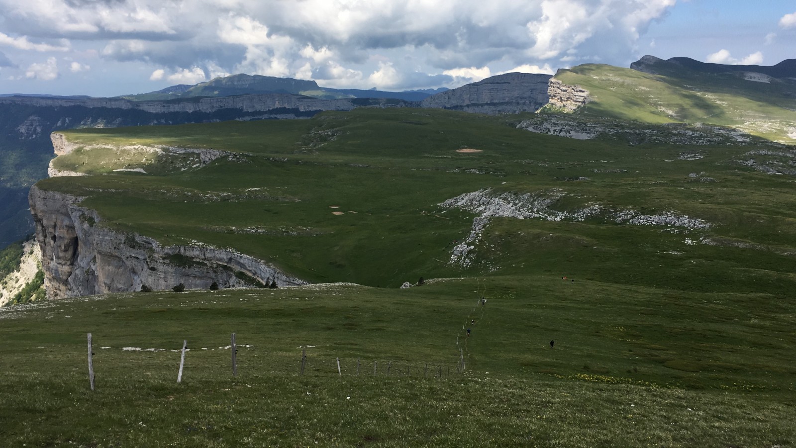

Description
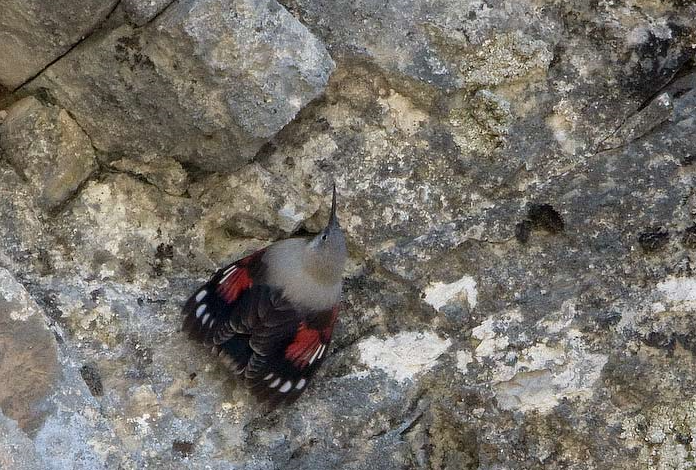
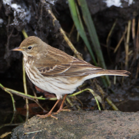
Plateau de Font d'Urle is interesting for the observation of altitude passerines. Prugasta Trepetljka and Planinska trepteljka are numerous accompanied by Poljska Ševa. Also Sivkasta Bjeloguza, Crnoglavi Batić, Grmuša Pjenica, Kamenjar. The huge cliffs are refuge areas for rock species like Crvenokljuna galica, Žutokljuna galica, Sivi Sokol, Crvenokrili litičar and Mrka Crvenrepka. Very often, large raptors fly over the highest rocks like Suri orao and Bjeloglavi sup. The site is also rich for the observation of mammals: mouflon, chamois and marmots.
_________________________
Français: Situé à 1 500 m d'altitude, ce plateau est un site géologique remarquable, de plus sa faune et sa flore sont aussi intéressantes en période estival. Le site est intéressant pour l'observation des passereaux d'altitude, Prugasta Trepetljka et Planinska trepteljka sont nombreux acompagnés de Poljska Ševa aussi Sivkasta Bjeloguza Crnoglavi Batić Grmuša Pjenica Kamenjar . Les immenses falaises sont des zones refuges pour les espèces rupestres Crvenokljuna galica Žutokljuna galica Sivi Sokol Crvenokrili litičar Mrka Crvenrepka . Trés souvent, les grands rapaces survolent le palteau Suri orao Bjeloglavi sup. Le site est aussi riche pour l'obseravtion des mammifères : mouflon, chamois et marmottes.
Details
Access
To get to the site, follow the signs to Font d'urle station (from Saint Jean-en-Royans) then continue on the D76B towards the village (cul-de-sac).
_________________________
Français: Pour se rendre sur le site, suivre les indications station de Font d'urle (depuis Saint Jean-en-Royans) puis continuer sur la D76B en direction du village (cul-de-sac).
Terrain and Habitat
Grassland , Plateau , MountainConditions
Mountainous , No shadow , Open landscapeCircular trail
YesIs a telescope useful?
Can be usefulGood birding season
Summer , SpringBest time to visit
Spring , SummerRoute
Wide pathDifficulty walking trail
Average walkAccessible by
FootBirdwatching hide / platform
NoExtra info
The plateau can be visited on foot from the village of Font d'urle, the path runs along the ridges, take the direction of Puy de la Gagère (summit), possibility of making a loop. Allow 4 hours.
_________________________
Français: Le plateau se visite à pied depuis le village de Font d'urle, le sentier longe les crêtes, prendre la direction du Puy de la gagère (sommet), possibilité de faire une boucle. Prévoir 4h.


 ) to insert bird names in your own language. The birdnames will automatically be translated for other users!