.jpg)
Charger images
Les formats d'image autorisés sont de type jpeg, png ou gif
La taille maximale du fichier doit être de 20MB
.jpg)
Short trail in Merritt Island National Wildlife Refuge that leads to the Mosquito Lagoon.
Merritt Island National Wildlife Refuge is famous among birders. The refuge was established in 1963 for the protection of migratory birds. Consisting of 140,000 acres, the refuge provides a wide variety of habitats of dunes, marshes and forest.
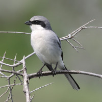
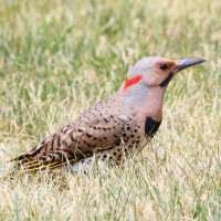
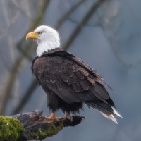
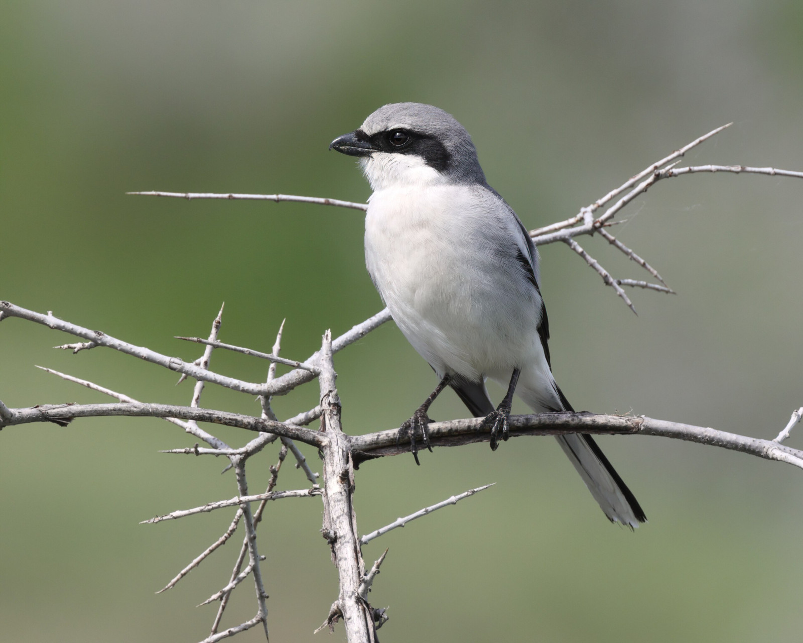
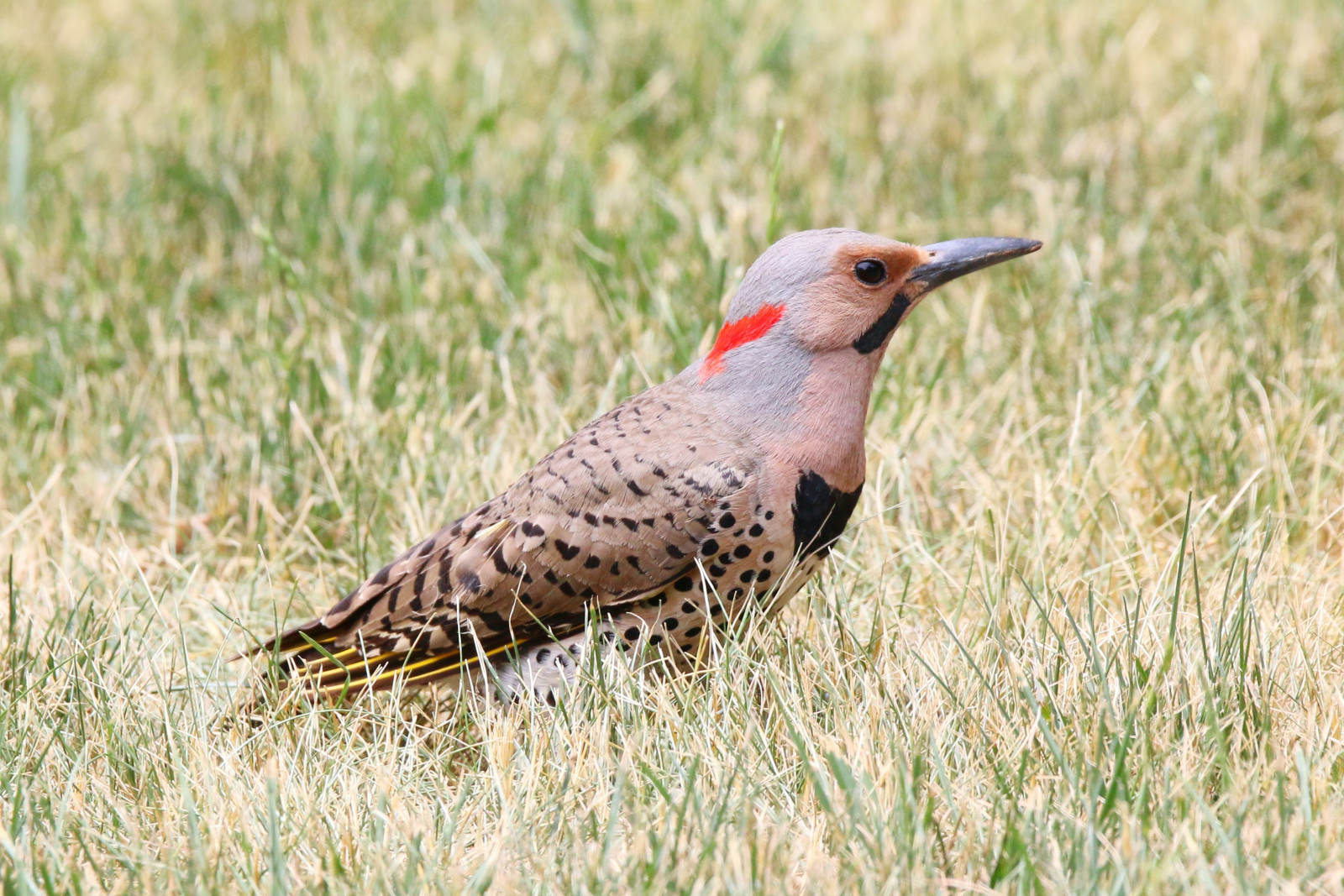
Pine Flatwoods Trail is a short trail along sandy fire breaks with the possibility of a loop. The Mosquito Lagoon viewpoint at the shoreline is unfortunately overgrown with brush and there’s barely a view of the water from behind the bushes. So best to do the loop. The trail passes through a terrain largely comprised of palmettos, gallberry bushes, and wire grass, but larger slash pines and scrub oaks grow as well. This is a strange environment because you aren’t in a forest and you aren’t in a desert. The environment is somewhere in between the two. During the fall, winter and spring look for migratory songbirds, raptors, and Bald Eagle. The rare Florida Scrub-Jay is common all year. Good place also for Loggerhead Shrike, Northern Flicker, Red-bellied Woodpecker, Northern Bobwhite, Pine Warbler and Eastern Towhee.
Merritt Island National Wildlife Refuge is located on Florida’s Central East Coast about 30 minutes south of Daytona Beach at exit 220 on I 95 at State Road 406. The Visitor Center of Merritt Island NWR is open year round, 8 am to 4 pm Tuesday through Saturday. Closed Sunday, Monday, Thanksgiving, Christmas, and New Year's Day. Refuge roads, trails and boat ramps are open from sunrise to sunset daily. To reach the Visitor Information Center from Titusville, continue 4 miles past the Refuge entrance (remain to your right at the fork in the road) and the Visitor Center entrance sign will be on your right.
Parking for the Pine Flatwoods Trail is available at the trailhead parking off of State Route 3. Click on the P in the map for directions or coordinates to the parking. Bring bug spray due to the number of bugs present in the warm months. The entire trail is exposed to the sun, so be prepared with a hat and sunscreen. You can also make a loop when you return from the Mosquito Lagoon (see the map), which doubles the length of the walk.
Photo Loggerhead Shrike by Cephas, CC BY-SA 4.0, https://creativecommons.org/licenses/by-sa/4.0, via Wikimedia Commons
 ) Insérez les noms d'oiseau dans votre langue. Ils seront automatiquement traduits pour les autres usagers !
Votre feedback sera transmis à l’auteur.rice de cette zone et à l’équipe éditoriale de Birdingplaces, qui l’utiliseront pour améliorer la qualité des informations. (Vous souhaitez publier un commentaire visible en bas de page ? Fermez cette fenêtre et choisissez l’Option 1 : « Publier un commentaire, un conseil ou une observation ».)
Veuillez fournir des suggestions d'améliorations ou d'ajouts au texte de ce site ornithologique.
Veuillez fournir vos suggestions d'améliorations ou d'ajouts à la carte.
Veuillez fournir des suggestions d'améliorations ou d'ajouts à la liste des oiseaux.
Cliquez sur l'icône de l'oiseau () Insérez les noms d'oiseau dans votre langue. Ils seront automatiquement traduits pour les autres usagers !