
Charger images
Les formats d'image autorisés sont de type jpeg, png ou gif
La taille maximale du fichier doit être de 20MB
A 400+ acre site with a large number of diverse bird species. Celery Fields is an ideal location for bird watching.
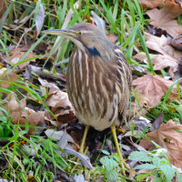
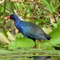
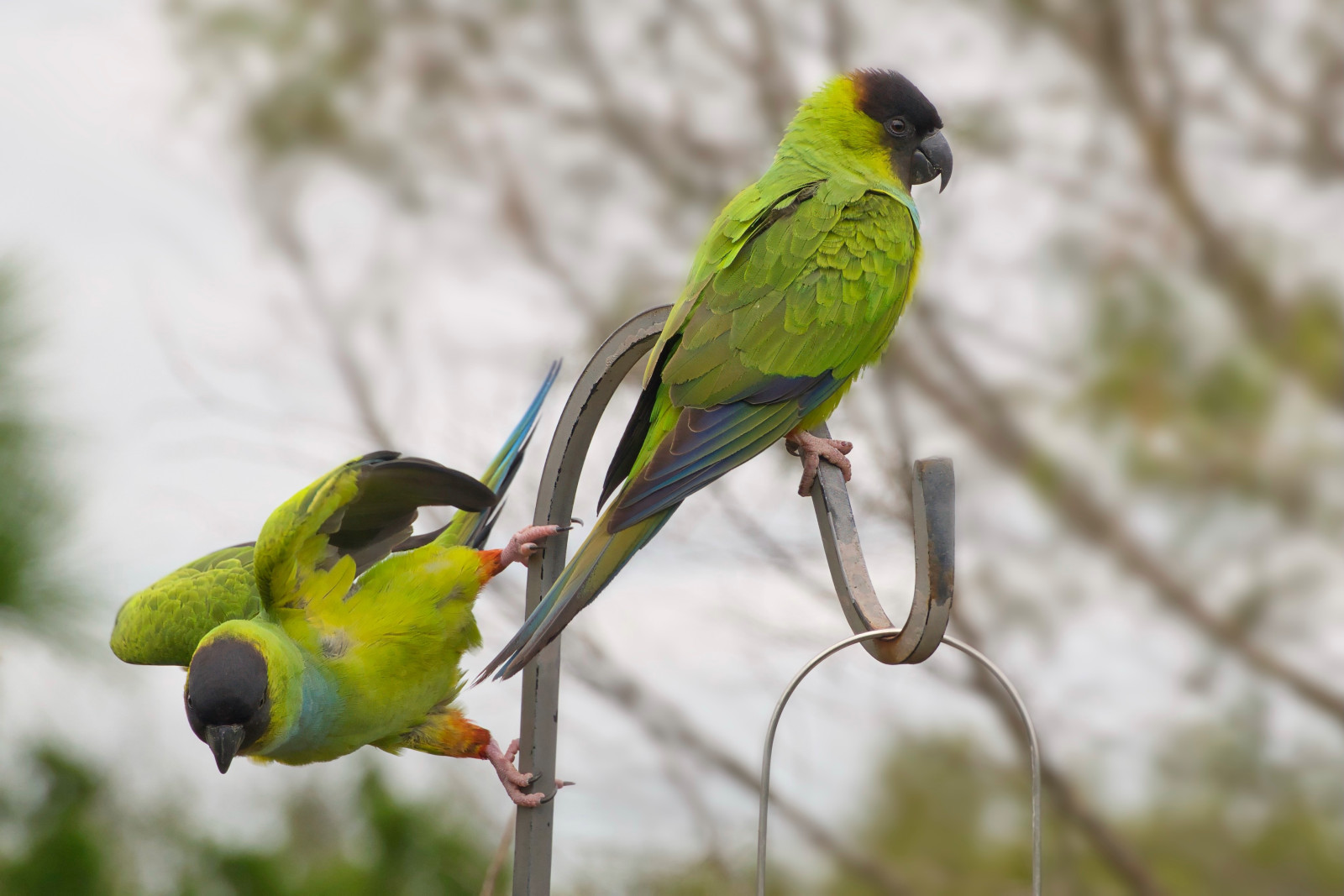
In early 2001, Sarasota Audubon began conducting bird surveys at the Celery Fields in Sarasota. To date, 246 species have been recorded. Wintertime offers particularly good birding, hosting sparrows, Marsh and Sedge Wrens, and several species of rails, including Sora and Virginia. The Fields also host breeding birds, including Black-necked Stilt, King Rail, Least Bittern, Limpkin, Purple Gallinule, Barn Owl and Eastern Meadowlark. Furthermore, Nanday Parakeet is frequently present.
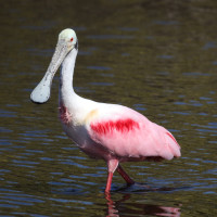
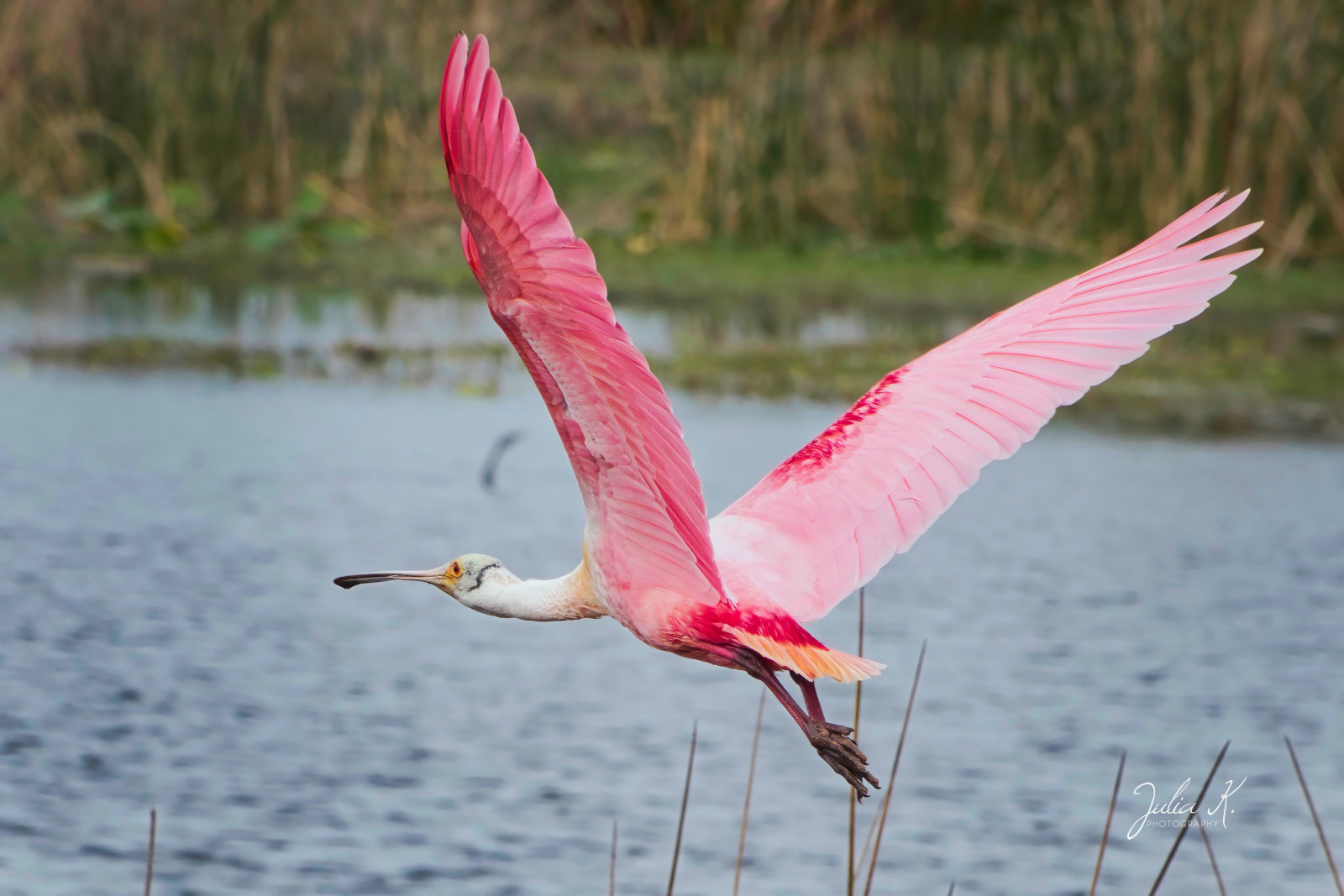
Florida specialties recorded at the fields include Snail Kite, Roseate Spoonbill, Sandhill Crane, Mottled Duck, Black-bellied Whistling-Duck and Bald Eagle. Least Tern breed on nearby buildings and use the ponds as a primary food source. Rarities show up from time to time, including Upland and White-rumped Sandpipers, Short-eared Owl and Nelson’s Sparrow. In the winter of 2018/2019, birders found a Least Flycatcher and an Ash-throated Flycatcher, the first for the Fields, these birds are unusual for Florida and particularly unusual in Sarasota County.
Sarasota County, recognizing the importance of the Celery Fields as a food and habitat source to a wide variety of birds and other wildlife, worked with Sarasota Audubon to restore 100+ acres in the Southern Cells into a more traditional wetland. The County also constructed two boardwalks: one on Palmer Blvd and the other on Raymond Rd. Both boardwalks provide excellent opportunities for wildlife watching.
The Celery Fields are located in Sarasota. From I-75, take Exit 210, Fruitville Road. Go east and make a right at Lakewood Ranch Blvd light, then right at traffic circle onto Apex Road. Follow Apex for one mile and make a left onto Palmer Blvd. After 0.3 mile turn left into parking lot which also has restrooms. Click on the P in the map for directions or coordinates.
 ) Insérez les noms d'oiseau dans votre langue. Ils seront automatiquement traduits pour les autres usagers !
Votre feedback sera transmis à l’auteur.rice de cette zone et à l’équipe éditoriale de Birdingplaces, qui l’utiliseront pour améliorer la qualité des informations. (Vous souhaitez publier un commentaire visible en bas de page ? Fermez cette fenêtre et choisissez l’Option 1 : « Publier un commentaire, un conseil ou une observation ».)
Veuillez fournir des suggestions d'améliorations ou d'ajouts au texte de ce site ornithologique.
Veuillez fournir vos suggestions d'améliorations ou d'ajouts à la carte.
Veuillez fournir des suggestions d'améliorations ou d'ajouts à la liste des oiseaux.
Cliquez sur l'icône de l'oiseau () Insérez les noms d'oiseau dans votre langue. Ils seront automatiquement traduits pour les autres usagers !