


Charger images
Les formats d'image autorisés sont de type jpeg, png ou gif
La taille maximale du fichier doit être de 20MB


Moorland that is part of the South Pennine Moors, the largest area of unenclosed moorland in West Yorkshire.
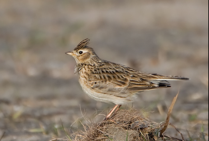
Worsthorne Moor is located east of Burnley and part of The South Pennine Moors. The moor provides habitat for birds such as Courlis cendré, Alouette des champs, Pipit farlouse, Linotte mélodieuse, Traquet motteux, Tarier des prés and Faucon pèlerin.
Worsthorne Moor is located 2 miles (5 km) east of Burnley. The suggested 7,5 mile (12 km) circular walking route indicated on the map starts at Worsthorne Moor car park at the Long Causeway. Click on the P in the map for directions to the car park. The route gradually climbs up, joining a section of The Pennine Bridleway. It also reaches Hurstwood Reservoir and Cant Clough Reservoir. Some parts can get rather muddy during wetter months, so it is best to come prepared with appropriate footwear.
 ) Insérez les noms d'oiseau dans votre langue. Ils seront automatiquement traduits pour les autres usagers !
Votre feedback sera transmis à l’auteur.rice de cette zone et à l’équipe éditoriale de Birdingplaces, qui l’utiliseront pour améliorer la qualité des informations. (Vous souhaitez publier un commentaire visible en bas de page ? Fermez cette fenêtre et choisissez l’Option 1 : « Publier un commentaire, un conseil ou une observation ».)
Veuillez fournir des suggestions d'améliorations ou d'ajouts au texte de ce site ornithologique.
Veuillez fournir vos suggestions d'améliorations ou d'ajouts à la carte.
Veuillez fournir des suggestions d'améliorations ou d'ajouts à la liste des oiseaux.
Cliquez sur l'icône de l'oiseau () Insérez les noms d'oiseau dans votre langue. Ils seront automatiquement traduits pour les autres usagers !