


Charger images
Les formats d'image autorisés sont de type jpeg, png ou gif
La taille maximale du fichier doit être de 20MB


Reserve that covers more than 740 ha, with saltmarsh, mudflats, lagoons and grazing marsh.
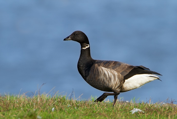
Wallasea Island Wild Coast Project is a landmark conservation and engineering scheme for the 21st century, on a scale never before attempted in the UK and the largest of its type in Europe. The aim of this project is to combat the threats from climate change and coastal flooding by recreating the ancient wetland landscape of mudflats and saltmarsh, lagoons and pasture. It will also help to compensate for the loss of such tidal habitats elsewhere in England. Wallasea Island sits within an SPA which covers the Crouch and Roach estuaries and which is special for overwintering waders and wildfowl including Bernache cravant. The habitat creation has now been completed with the final phase creating a series of shallowly flooded saline lagoons in the southern part of the island to attract over wintering waders and wildfowl and in the summer nesting birds such as Avocette élégante, Petit Gravelot and maybe even Échasse blanche. Other birds you can encounter are Busard des roseaux, Hibou des marais, Sarcelle d'hiver, Canard siffleur, Sterne pierregarin, Barge à queue noire, Chevalier gambette, Huîtrier pie, Courlis cendré, Pluvier argenté, Bécasseau variable and Spatule blanche.
From the historic market town of Rochford take the Ashingdon Road until you see the brown tourism sign at Brays Lane and follow these to the RSPB Wallasea Island Wild Coast. Parking is free and there are designated disabled parking bays. The reserve is free to enter. There is a small surfaced car park and all trails are grass paths. The sea wall footpath which runs along the northern side of the reserve along the River Crouch, providing uninterrupted views to the north of the river, is open at all times. The reserve itself is open at all times between 8am and 8pm or dusk, whichever is earlier.
There are four walking trails – Jubilee Marsh, Allfleets Marsh, Marsh Flats and South Trail. The total length of the walks shown on the map is approximately 18 km. But of course you can choose to explore only part of the area or one trail, if you want to do a shorter walk.
Note: parts of the reserve are seasonally closed or subject to works.
 ) Insérez les noms d'oiseau dans votre langue. Ils seront automatiquement traduits pour les autres usagers !
Votre feedback sera transmis à l’auteur.rice de cette zone et à l’équipe éditoriale de Birdingplaces, qui l’utiliseront pour améliorer la qualité des informations. (Vous souhaitez publier un commentaire visible en bas de page ? Fermez cette fenêtre et choisissez l’Option 1 : « Publier un commentaire, un conseil ou une observation ».)
Veuillez fournir des suggestions d'améliorations ou d'ajouts au texte de ce site ornithologique.
Veuillez fournir vos suggestions d'améliorations ou d'ajouts à la carte.
Veuillez fournir des suggestions d'améliorations ou d'ajouts à la liste des oiseaux.
Cliquez sur l'icône de l'oiseau () Insérez les noms d'oiseau dans votre langue. Ils seront automatiquement traduits pour les autres usagers !