


Charger images
Les formats d'image autorisés sont de type jpeg, png ou gif
La taille maximale du fichier doit être de 20MB
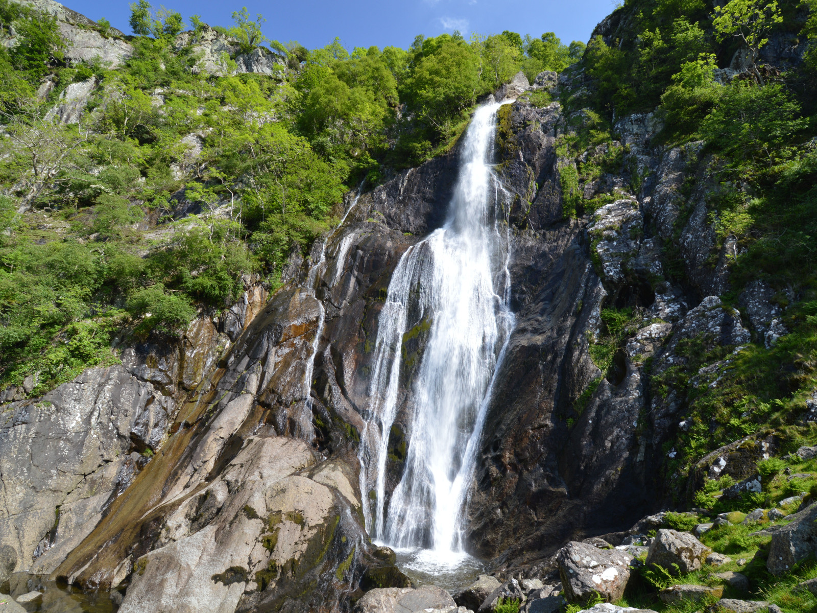

An area of temperate rainforest woodland around a spectacular waterfall, noted for its woodland and mountain birds.
Aber Falls is located in one of the northernmost of Wales' classic hill valley woodlands. Easily accessible from the university city of Bangor and the North Wales coastal road. The semi-natural to natural woods of Oak, Ash, Alder, and Hawthorn are excellent breeding habitat for the four classical upland broadleaf woodland birds, Gobemouche noir, Rougequeue à front blanc, Pipit des arbres and Pouillot siffleur, as well as resident species like Pic vert and Grive draine. The river below the Falls, the Afon Goch, has Cincle plongeur, Bergeronnette des ruisseaux and Chevalier guignette. Around the cliffs beside the Falls, scan for Merle à plastron in spring and summer, and on the screes, Tarier des prés, Tarier pâtre and Traquet motteux. The area is bleak in winter, but flocks of Grive mauvis and Grive litorne can be seen in the open ground, and Tarin des aulnes and Sizerin cabaret feeding on seeds in the Alders and Birches.
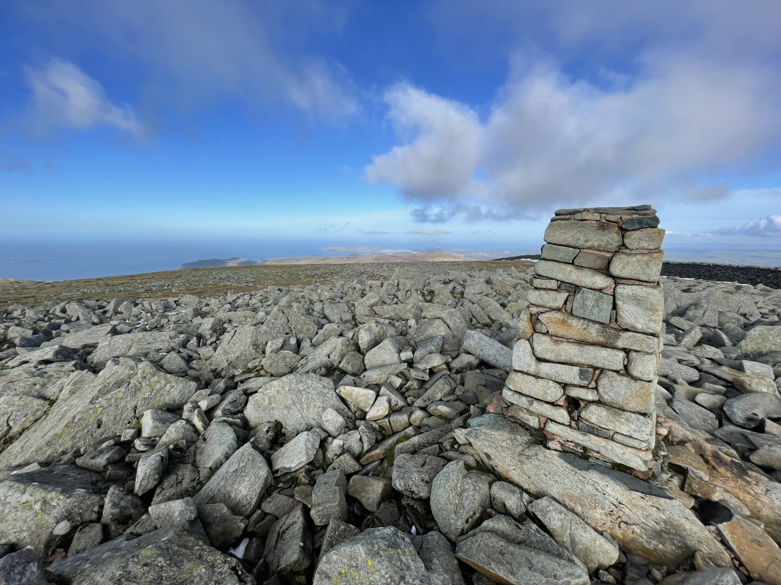
A longer, strenuous option is to continue to the southeast of the falls; climb up the side of the former plantation to the northeast of the Falls, then cut straight up the open moor to Llwytmor (849 m) and on to Foel-fras (944 m) and Foel Grach (974 m), or even to Carnedd Llewelyn (1,064 m). Birds up here are few, but Grand Corbeau is reliable, Faucon pèlerin regular, Crave à bec rouge occasional, and in mid to late May, spring passage Pluvier guignard are frequently seen on the barren high tops. Be careful when descending to follow a safe path, don't try climbing down the cliffs beside Aber Falls!
Take the bus from Bangor to Llanfairfechan (and beyond), alight at Abergwyngregyn and walk from there; alternatively, cycling from either Bangor (10 km) or Llanfairfechan (4 km) rail stations. For cars, see the P sign on the map for directions.
Note that the mountain option should only be attempted during good weather (dry, with cloud base reliably above 1,500 m). With low cloud and rain - frequent at any time of the year - the moors become very dangerous, as it is easy to get lost and fall down any of the many crags. Make sure you are equipped for heavy rain at any time - this is a temperate rainforest area! In winter, deep snow can be expected above 300-400 m; do not attempt the mountains in this without good mountaineering experience!
Photo of Aber Falls by Clive Giddis, cc-by-sa license, from geograph.org.uk (photo 4006020).
 ) Insérez les noms d'oiseau dans votre langue. Ils seront automatiquement traduits pour les autres usagers !
Votre feedback sera transmis à l’auteur.rice de cette zone et à l’équipe éditoriale de Birdingplaces, qui l’utiliseront pour améliorer la qualité des informations. (Vous souhaitez publier un commentaire visible en bas de page ? Fermez cette fenêtre et choisissez l’Option 1 : « Publier un commentaire, un conseil ou une observation ».)
Veuillez fournir des suggestions d'améliorations ou d'ajouts au texte de ce site ornithologique.
Veuillez fournir vos suggestions d'améliorations ou d'ajouts à la carte.
Veuillez fournir des suggestions d'améliorations ou d'ajouts à la liste des oiseaux.
Cliquez sur l'icône de l'oiseau () Insérez les noms d'oiseau dans votre langue. Ils seront automatiquement traduits pour les autres usagers !