


Charger images
Les formats d'image autorisés sont de type jpeg, png ou gif
La taille maximale du fichier doit être de 20MB


Wetland area with flooded meadows that are classified as being of national interest and is included in the Natura 2000 network.
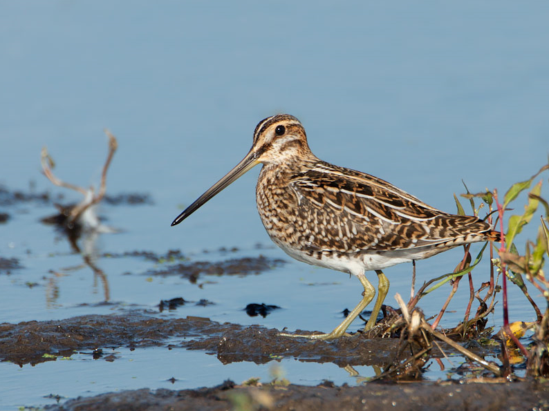
Hörlinge ängar is a wetland area with wet meadows. At periods of high water during spring and autumn, the meadows flood and Vieån amalgamate with Helge å to form an impressive delta. It is a nice wet meadow area that dries out later in the summer and then large parts of the area are mowed. More than 200 species of birds has been documented here, which is a high number for a shore meadow area in the woodlands of northern Skåne. Characteristic species for Hörlinge ängar are primarily wading birds and ducks. Birds such as Bécassine des marais, Chevalier aboyeur, Chevalier arlequin, Courlis cendré, Chevalier gambette, Garrot à oeil d'or, Canard souchet and Sarcelle d'hiver. But also Tarier des prés, Rossignol philomèle, Rousserolle verderolle, Phragmite des joncs, Rousserolle effarvatte and Fauvette grisette.
At Hörlinge meadows, east of Verum and Vittsjö in the northern parts of Hässleholm municipality, there is an outdoor museum and bird tower as part of Vieåleden. The Vieåleden trail (see the map) connects Skeingeborg's unique castle ruin from the Middle Ages with the wetlands and Skåneleden in the north. From the car park it is only about 300 meters to the bird tower. At the parking lot there is also a picnic table and toilet. At the outdoor museum you will have a good view of the extensive meadows and the opportunity to get more information.
On the map you see the circular Vieåleden trail of 12 km through the surrounding area. Note: to get around the entire trail, use a raft to cross the Helge River, which divides the area into two parts. The raft is generally in the river during mid-May to the end of October, but is of course very dependent on water levels, weather and wind. The rest of the year you can unfortunately not walk the trail in its entirety, but you can walk parts of it.
 ) Insérez les noms d'oiseau dans votre langue. Ils seront automatiquement traduits pour les autres usagers !
Votre feedback sera transmis à l’auteur.rice de cette zone et à l’équipe éditoriale de Birdingplaces, qui l’utiliseront pour améliorer la qualité des informations. (Vous souhaitez publier un commentaire visible en bas de page ? Fermez cette fenêtre et choisissez l’Option 1 : « Publier un commentaire, un conseil ou une observation ».)
Veuillez fournir des suggestions d'améliorations ou d'ajouts au texte de ce site ornithologique.
Veuillez fournir vos suggestions d'améliorations ou d'ajouts à la carte.
Veuillez fournir des suggestions d'améliorations ou d'ajouts à la liste des oiseaux.
Cliquez sur l'icône de l'oiseau () Insérez les noms d'oiseau dans votre langue. Ils seront automatiquement traduits pour les autres usagers !