


Charger images
Les formats d'image autorisés sont de type jpeg, png ou gif
La taille maximale du fichier doit être de 20MB

Signposted path that crosses part of the stream channel with the same name. Fantastic area for birdwatching.
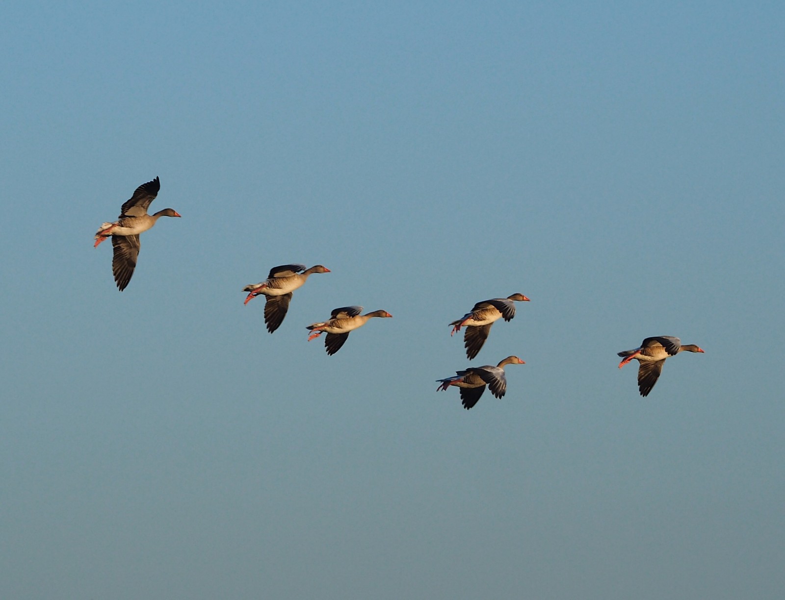
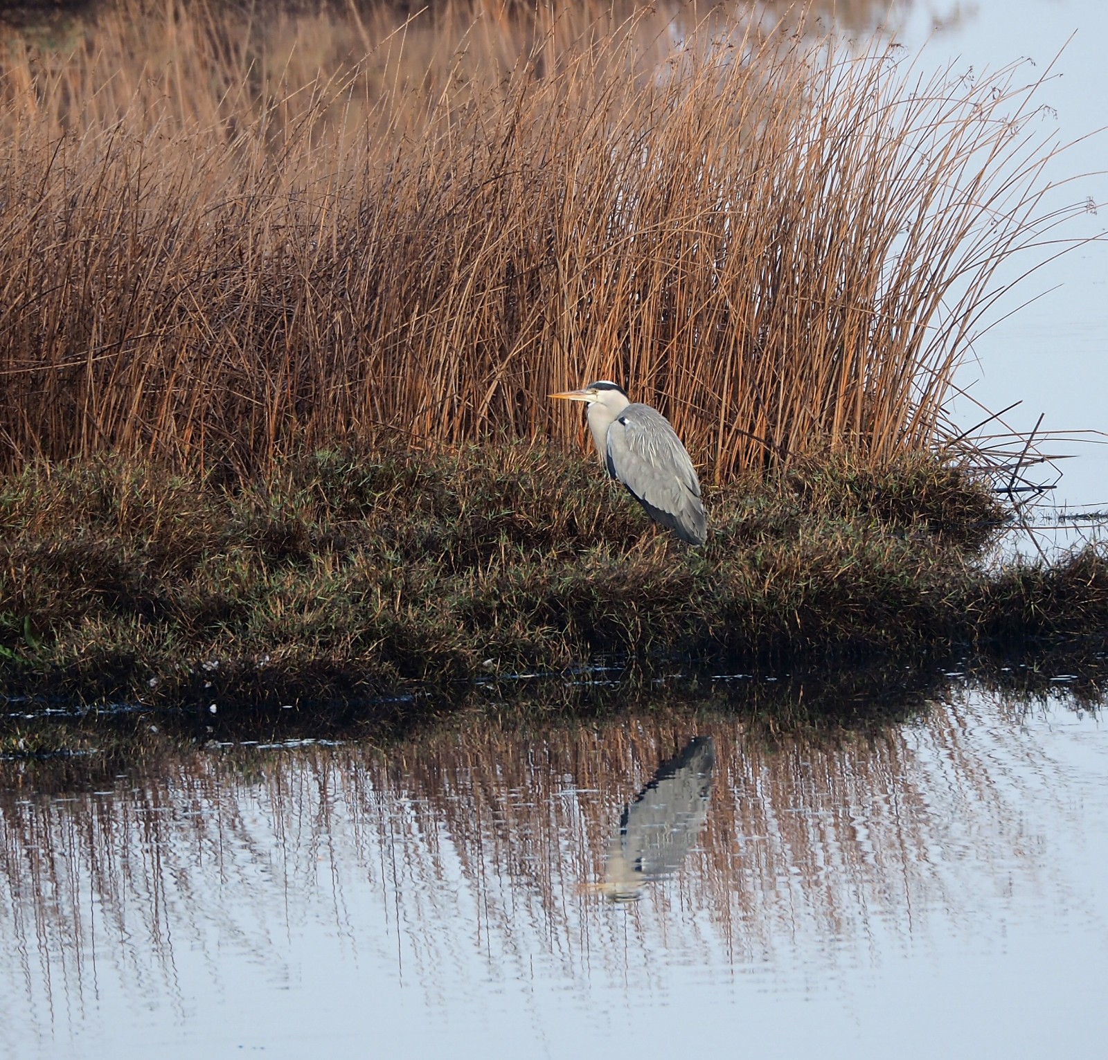
La Rocina represents is the main waterflow that reaches the marsh. It contains a very rich natural environment, with a dense network of small tributaries. A mosaic of different landscapes from pine forests, ferns, heaths, brambles and reeds to the typical vegetation of the white mountain, mainly composed of jaguarzo and aromatic scrub like lavender, rosemary or thyme. The birdwatching is really great here and you can see lot's of migratory and aquatic birds like Héron pourpré, Busard des roseaux, Martin-pêcheur d'Europe, Fuligule nyroca, Talève sultane, Rousserolle turdoïde and Fauvette pitchou.
_________________________
Espagnol: Sendero señalizado que recorre parte del cauce del arroyo que lleva su nombre. La Rocina representa el principal aporte de aguas que llega a la marisma. Contiene un medio natural muy rico, con una tupida red de pequeños afluentes. Se compone de un mosaico de distintos paisajes desde pinares, helechales, brezales, zarzales y carrizales hasta la vegetación típica del monte blanco, integrado principalmente por jaguarzo y matorral aromático como la lavanda, el romero o el tomillo. Además de explicar estas formaciones vegetales, el centro de visitantes también muestra la fauna presente en ellas, donde abundan las aves migratorias y acuáticas como el voluminoso ánsar común, el llamativo calamón o la amenazada garcilla cangrejera. También vemos garza imperial, aguilucho lagunero occidental, martín pescador, pico menor, pico picapinos, porrón pardo, etc.
The A-483 road, which connects the village of El Rocío with the core of Matalascañas, we take the exit that indicates La Rocina and El Acebrón. Just off the road, next to the parking lot, we find the visitor center. The whole path is a wide wooden walkway. The circular walk is 2 km, and you can add 2 km more if you walk to the farthest point.
_________________________
Espagnol: La carretera A-483, que une la Aldea de El Rocío con el núcleo de Matalascañas, tomamos la salida que indica La Rocina y El Acebrón. Nada más salir de la carretera, junto al aparcamiento, encontramos el centro de visitantes. Está habilitado para personas con incapacidad. Todo el sendero es una amplia pasarela de madera.
 ) Insérez les noms d'oiseau dans votre langue. Ils seront automatiquement traduits pour les autres usagers !
Votre feedback sera transmis à l’auteur.rice de cette zone et à l’équipe éditoriale de Birdingplaces, qui l’utiliseront pour améliorer la qualité des informations. (Vous souhaitez publier un commentaire visible en bas de page ? Fermez cette fenêtre et choisissez l’Option 1 : « Publier un commentaire, un conseil ou une observation ».)
Veuillez fournir des suggestions d'améliorations ou d'ajouts au texte de ce site ornithologique.
Veuillez fournir vos suggestions d'améliorations ou d'ajouts à la carte.
Veuillez fournir des suggestions d'améliorations ou d'ajouts à la liste des oiseaux.
Cliquez sur l'icône de l'oiseau () Insérez les noms d'oiseau dans votre langue. Ils seront automatiquement traduits pour les autres usagers !