


Charger images
Les formats d'image autorisés sont de type jpeg, png ou gif
La taille maximale du fichier doit être de 20MB
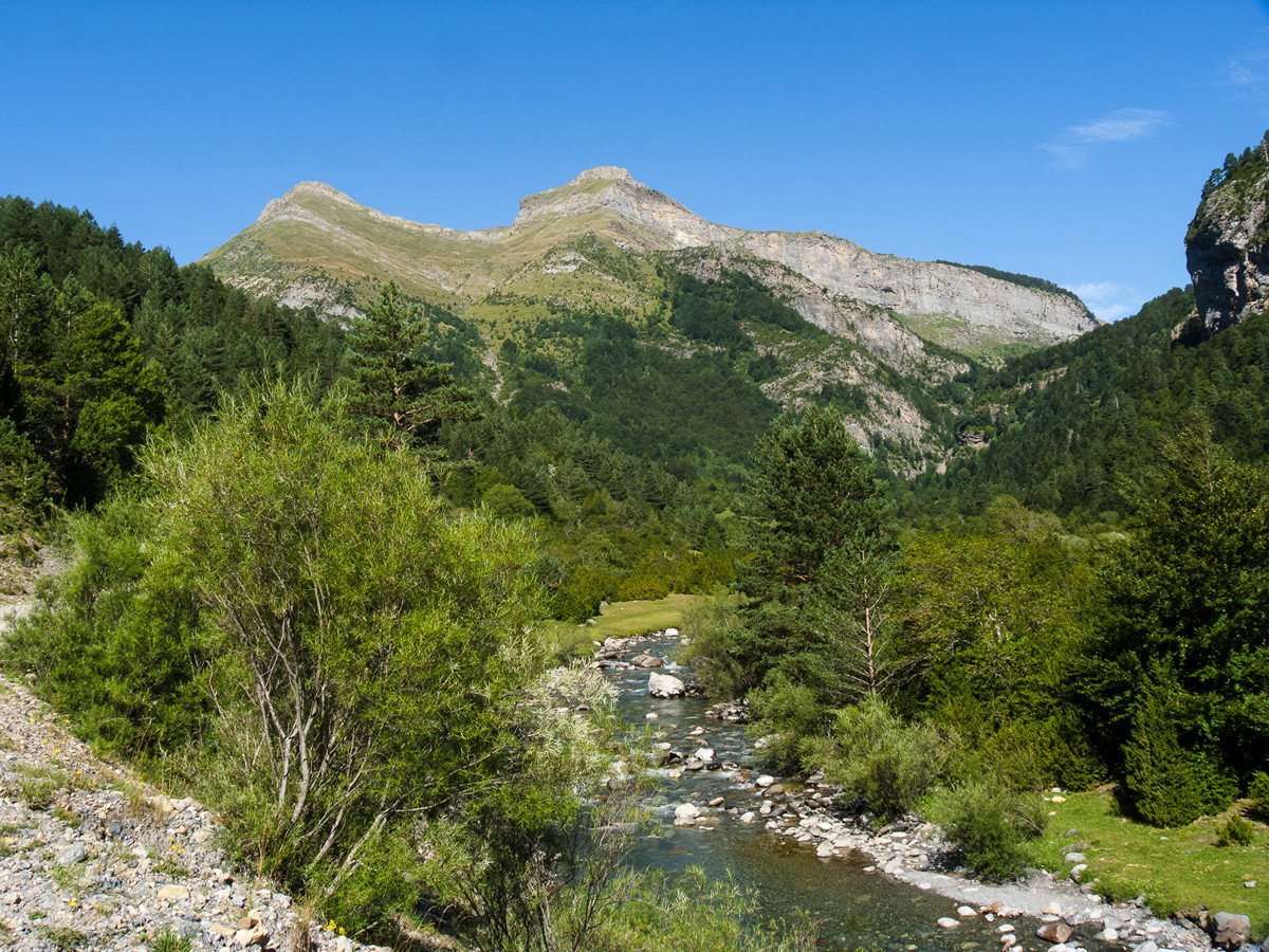


Ara River Valley in the Ordesa-Viñamala Biosphere Reserve. Where you can find the high mountain birds and river birds of these areas.
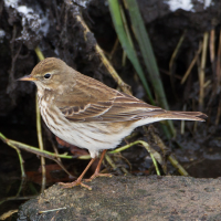
Ruta Ornitologica Valle de Bujaruelo is a birdwatching trail in a valley with a river of crystal clear waters coming from the peaks of the Pyrenees. A biosphere reserve area that is in very good condition and where you can find alpine bird species. The cliffs and aquatic areas that occur in this mountain area attract many birds. In addition, it is a route accessible to almost everyone and allows you to see high mountain species such as Gypaète barbu, Lagopède alpin, Pipit spioncelle, Cincle plongeur, Accenteur alpin, Crave à bec rouge, Chocard à bec jaune and Tichodrome échelette.
_________________________
Español: Valle del rio Ara en la reserva de la biosfera de Ordesa-Viñamala. Donde se pueden encontrar las aves de la alta montaña y las rivereñas de estas zonas. Un valle preciso con un rio de aguas cristalinas procedente de los picos del pirineo. Una zona reserva de la biosfera que se encuentra en muy buen estado. Donde podemos encontrar especies alpinas. Tanto de riscos, como acuáticas que se dan en zonas de montaña. Además, es un recorrido accesible para casi todo el mundo y te permite divisar espcies propias de alta montaña como Gypaète barbu, Lagopède alpin, Pipit spioncelle, Cincle plongeur, Accenteur alpin, Crave à bec rouge, Chocard à bec jaune, Tichodrome échelette ....
Ruta Ornitologica Valle de Bujaruelo is accessible from the refuge of Bujaruelo. To get there, you can take the forest track that begins on the A-135 road, after passing the town of Torla. Click on the P in the map to get directions to the parking next to the refuge. The walking route indicated on the map is about 12 km
_________________________
Español: El refugio es accesible mediante vehículo, contando con un aparcamiento en su costado. Para llegar hasta allí, podrás tomar la pista forestal que comienza en la carretera A-135, tras pasar la localidad de Torla. Haz clic en la P en el mapa para obtener indicaciones para llegar al aparcamiento al lado del refugio. La ruta a pie indicada en el mapa es de unos 12 km.
 ) Insérez les noms d'oiseau dans votre langue. Ils seront automatiquement traduits pour les autres usagers !
Votre feedback sera transmis à l’auteur.rice de cette zone et à l’équipe éditoriale de Birdingplaces, qui l’utiliseront pour améliorer la qualité des informations. (Vous souhaitez publier un commentaire visible en bas de page ? Fermez cette fenêtre et choisissez l’Option 1 : « Publier un commentaire, un conseil ou une observation ».)
Veuillez fournir des suggestions d'améliorations ou d'ajouts au texte de ce site ornithologique.
Veuillez fournir vos suggestions d'améliorations ou d'ajouts à la carte.
Veuillez fournir des suggestions d'améliorations ou d'ajouts à la liste des oiseaux.
Cliquez sur l'icône de l'oiseau () Insérez les noms d'oiseau dans votre langue. Ils seront automatiquement traduits pour les autres usagers !