


.jpg)

Charger images
Les formats d'image autorisés sont de type jpeg, png ou gif
La taille maximale du fichier doit être de 20MB
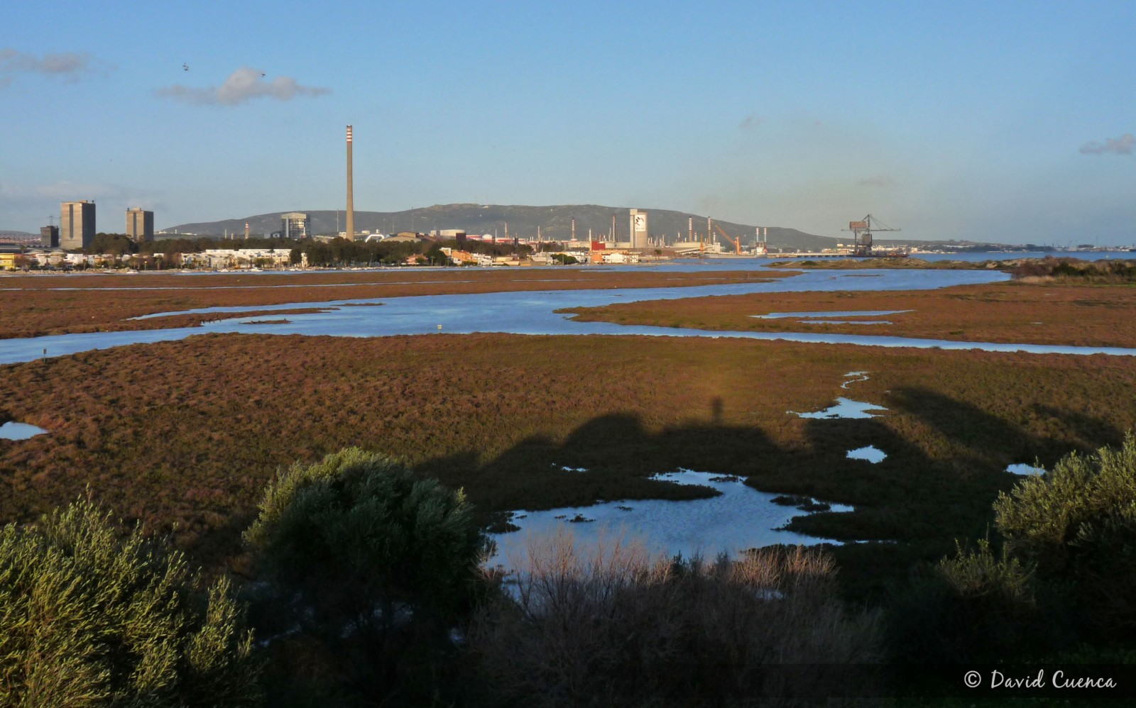
This protected area is located inside the bay of Algeciras, at the east side of the strait of Gibraltar, in the border between Los Barrios and Algeciras.
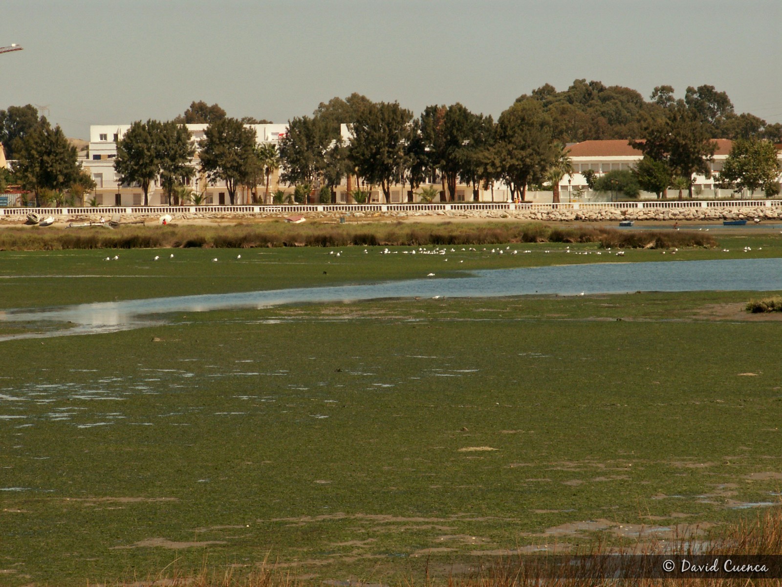
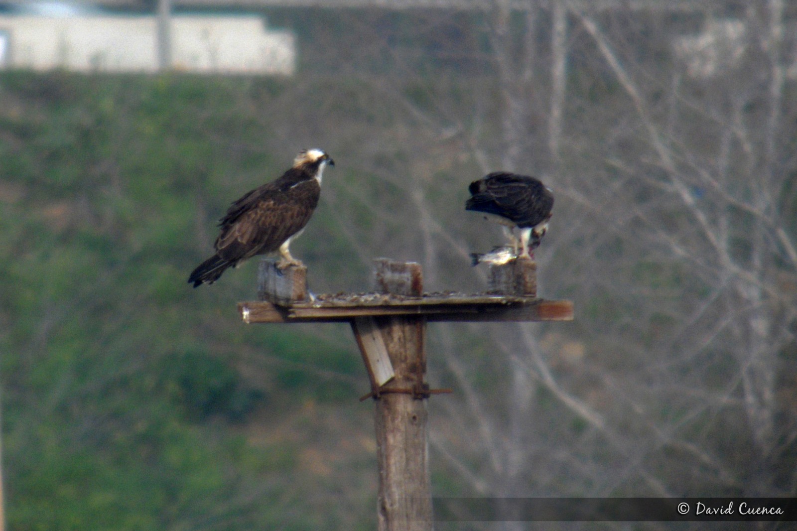
This natural park in the mouth of the river Palmones, covers the only marshes of the whole Strait of Gibraltar. It's an important place for birds, especially in migration periods and in winter, with more than 200 species recorded. The marshes, intertidal zone and coastal dunes attract lots of wildfowl species, herons, gulls, terns and waders. The Spatule blanche is easy to see in small numbers and it's the most important wintering area for Balbuzard pêcheur in the Strait. Some of the main species are: breeding Gravelot à collier interrompu, Bergeronnette printanière, Alouette calandrelle and Moineau espagnol (in the orchards); migrants Échasse blanche, Flamant rose, Glaréole à collier, Sterne pierregarin and Fauvette passerinette and wintering Grand Cormoran, Busard des roseaux, Canard siffleur, Chevalier gambette, Courlis cendré, Hibou des marais, Tadorne de Belon (some years), Sterne caspienne and Pipit spioncelle. The Sterne voyageuse is one of the annual rarities. Moreover, Canard d'Amérique, Bécasse des bois, Hypolaïs ictérine and Bruant rustique have been seen.
There is an observatory in the place called Torrejon Park, from where you have an excellent panoramic sight of all the area. In early spring, it is easy to see Coucou geai and several species of warblers and others songbirds in the forest and scrubland.
Palmones is also a good place to see migration of raptors, storks, swifts and swallows with the west winds.
The best option to visit this area is to access from the south. Take exit number 108 of the A7 motorway towards Embarcadero Avenue. Then, in the first traffic circle turn right until a junction with a stop (you can see a sign for the Observatory for Public Use 1 km. away) where you turn left onto the Mediana road. If you continue along this street until the end, in its final section it continues as a dirt track to the vicinity of the Torrejon Park observatory, which you have to explore walking. If you turn right onto Cabo Ajo street and then turn left onto Cabo Finisterre street, you will come to an orchard area from where you can access, on foot too, the eastern part of the area, with wide intertidal mudflats, the dunes and the beach.
If you want to see waders feeding and groups of gulls and terns resting, it is better to visit the eastern part of the area at low tide.
To take advantage of the time it is better to drive to the car parks and walk from there.
 ) Insérez les noms d'oiseau dans votre langue. Ils seront automatiquement traduits pour les autres usagers !
Votre feedback sera transmis à l’auteur.rice de cette zone et à l’équipe éditoriale de Birdingplaces, qui l’utiliseront pour améliorer la qualité des informations. (Vous souhaitez publier un commentaire visible en bas de page ? Fermez cette fenêtre et choisissez l’Option 1 : « Publier un commentaire, un conseil ou une observation ».)
Veuillez fournir des suggestions d'améliorations ou d'ajouts au texte de ce site ornithologique.
Veuillez fournir vos suggestions d'améliorations ou d'ajouts à la carte.
Veuillez fournir des suggestions d'améliorations ou d'ajouts à la liste des oiseaux.
Cliquez sur l'icône de l'oiseau () Insérez les noms d'oiseau dans votre langue. Ils seront automatiquement traduits pour les autres usagers !