


Charger images
Les formats d'image autorisés sont de type jpeg, png ou gif
La taille maximale du fichier doit être de 20MB

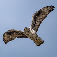
The Montsant mountain range is a rocky territory where many birds of prey and other birds of rocky habitats can be seen. Also a great area for hiking.
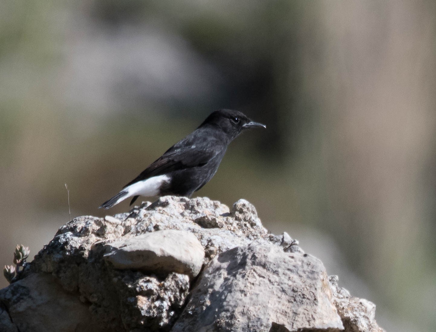
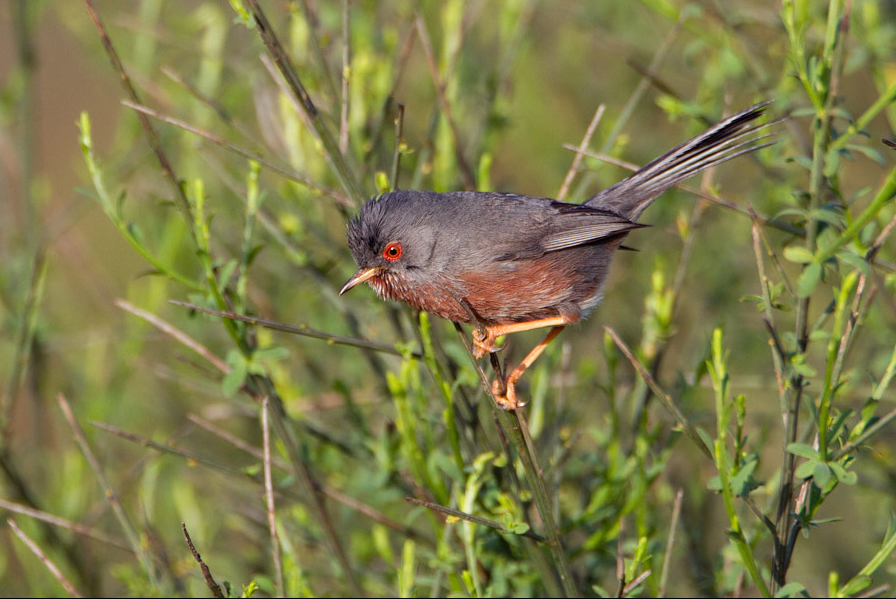
The village of La Morera de Montsant is located on the edge of the Serra de Montsant Natural Park. The Montsant mountain range is an especially rocky territory in the western most part of the Catalan Pre-littoral range. It occupies a total of 9,242 hectares. The rounded abrupt relief is the main characteristic of the massif of calcareous origin. There are many caves and ravines in the area. Most famous is the spectacular rocky walls of the Mayor cliff, on the southern face, which rise to meet the Major mountain range, where the highest peaks are: Cogulla (1,063 metres), the piló dels Senyalets (1,109 metres) and the Corbatera rock (1,163 metres), the highest point of Montsant. The park has a wealth of fauna, with endemic and very rare species in Catalonia. Mammals such as greater horseshoe bats, wild cats or Spanish ibex. But the area is also rich in birds. You can see many birds of prey such as Vautour fauve, Aigle de Bonelli, Aigle royal, Milan royal, Faucon pèlerin as well as other birds like Cochevis de Thékla, Traquet rieur, Traquet oreillard, Martinet à ventre blanc, Fauvette pitchou, Bruant fou, Moineau soulcie and Pipit rousseline. In the winter months Accenteur alpin and the occasional Tichodrome échelette visit the area.
The 8 kilometres drive from Cornudella to Morera de Montsant (Indicated on the map below) is good for birding. Stopping and looking for birds such as Monticole bleu, Loriot d'Europe, Guêpier d'Europe, Circaète Jean-le-Blanc and Bruant zizi on the way. Park in the village and follow on foot towards the rock faces. The office and information centre of the Sierra del Montsant Natural Park is in carrer Major in La Morera de Montsant. From the village you can make many different hikes through the area, or make a stop at the viewpoint near the village. Numerous itineraries run along the paths of the Sierra de Montsant, from simple to very difficult.
For a nice bird walk turn left at the first fork just out of the village, following the GR. Then decide if you want to take a longer walk to the Grau dels Barrots, or the shorter option to the Grau d'Agnet. If taking the latter follow the indication to the Grau de la Grallera (indicated on the map below) and then to Grau de l'Agnet.
 ) Insérez les noms d'oiseau dans votre langue. Ils seront automatiquement traduits pour les autres usagers !
Votre feedback sera transmis à l’auteur.rice de cette zone et à l’équipe éditoriale de Birdingplaces, qui l’utiliseront pour améliorer la qualité des informations. (Vous souhaitez publier un commentaire visible en bas de page ? Fermez cette fenêtre et choisissez l’Option 1 : « Publier un commentaire, un conseil ou une observation ».)
Veuillez fournir des suggestions d'améliorations ou d'ajouts au texte de ce site ornithologique.
Veuillez fournir vos suggestions d'améliorations ou d'ajouts à la carte.
Veuillez fournir des suggestions d'améliorations ou d'ajouts à la liste des oiseaux.
Cliquez sur l'icône de l'oiseau () Insérez les noms d'oiseau dans votre langue. Ils seront automatiquement traduits pour les autres usagers !