


Charger images
Les formats d'image autorisés sont de type jpeg, png ou gif
La taille maximale du fichier doit être de 20MB

A path runs through the bottom of a relatively narrow gorge that serves as a refuge and nesting place for various species of birds.
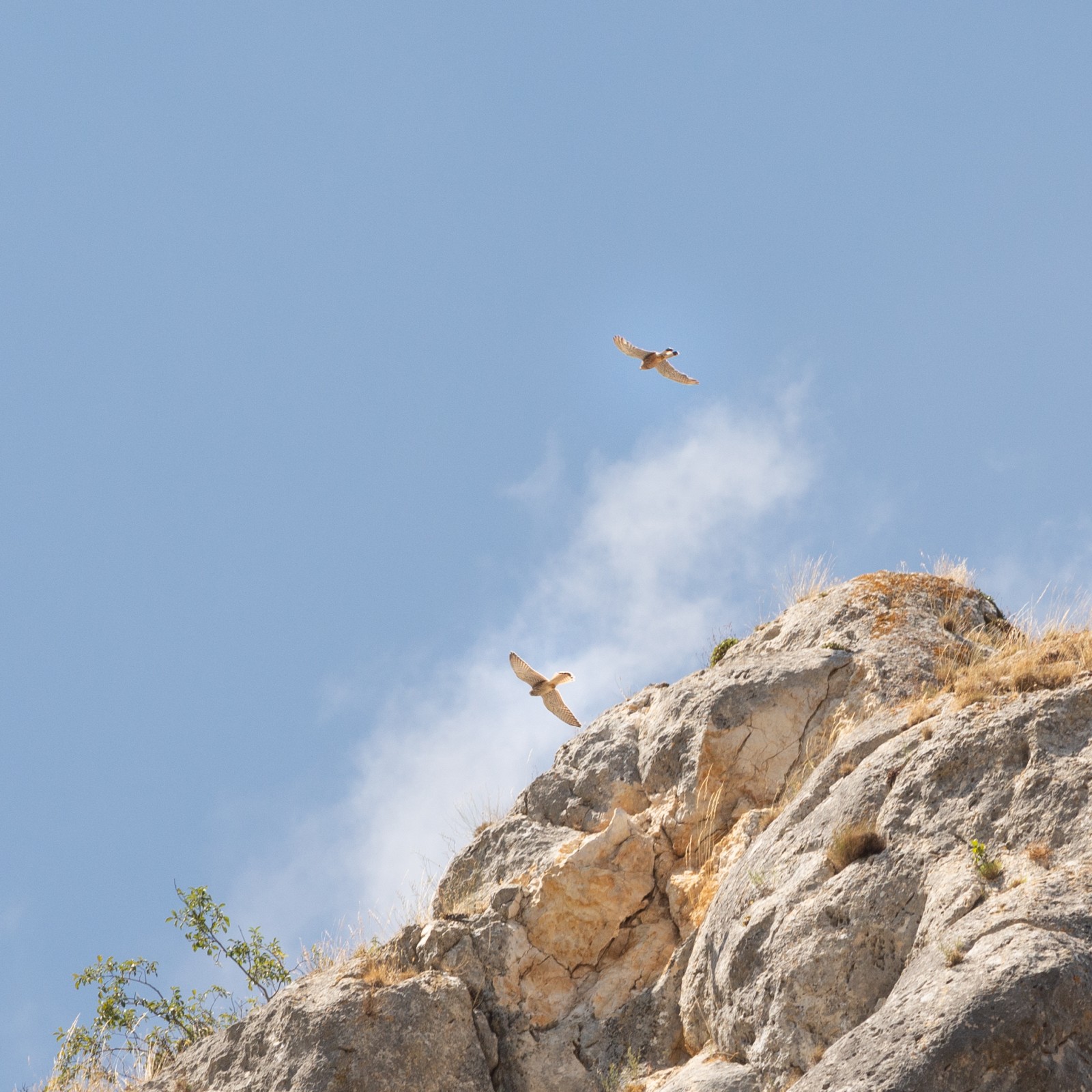
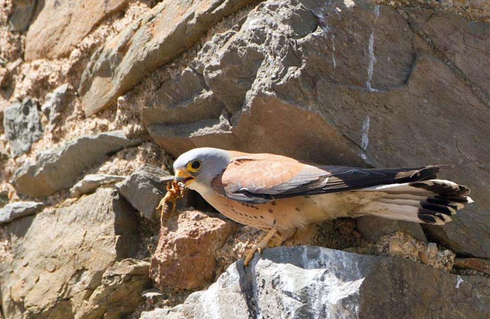
The scenery of the gorge is worth it in itself, but it also allows you to see a large colony of Hirondelle de rochers and Crave à bec rouge. In the area it is also easy to see Vautour fauve. The presence of Vautour percnoptère, Aigle royal and Grand-duc d'Europe has also been recorded. We have seen a breeding pair of Faucon crécerellette and Faucon crécerelle and a Aigle botté.
_________________________
Espagnol: Una senda discurre por el fondo de un desfiladero relativamente estrecho que sirve como refugio y lugar de anidación a diversas especies de aves. El paisaje del desfiladero merece la pena por sí mismo, pero además permite observar una numerosa colonia de Hirondelle de rochers y Crave à bec rouge. En toda la zona es fácil, además, ver Vautour fauve. Se ha registrado también la presencia de Vautour percnoptère, Aigle royal y Grand-duc d'Europe. Nosotros hemos visto una pareja criando de Faucon crécerellette o Faucon crécerelle y un Aigle botté.
You can leave your car in the town of San Martín de Ubierna. From there, a tunnel that passes under the road gives access to the gorge. The route through the gorge is partially signposted. Towards the end, and when the gorge begins to open up and ascend, there are several forks that allow completing a more or less long circular route. From that point on, the orography of the terrain becomes somewhat complicated.
NOTE: in winter and in other seasons after rains, the waters can be high and you have to wade through the river at places. Therefore it is not advised to visit the area in winter as the waters are high and it can be cold, slippery and sometimes dangerous.
_________________________
Espagnol: Se puede dejar el coche en la localidad de San Martín de Ubierna. Desde allí, un túnel que pasa bajo la carretera da acceso al desfiladero. La ruta por el desfiladero está parcialmente señalizada. Hacia el final, y cuando el desfiladero comienza a abrirse y ascender, hay varias bifurcaciones que permiten completar una ruta circular más o menos larga. A partir de ese punto, la orografía del terreno se complica un poco.
NÓTESE BIEN: en invierno y en otras estaciones después de las lluvias, las aguas pueden estar altas y hay que vadear el río en algunos lugares. Por lo tanto no se recomienda visitar la zona en invierno ya que las aguas están altas y puede ser fría, resbaladiza y a veces peligrosa.
 ) Insérez les noms d'oiseau dans votre langue. Ils seront automatiquement traduits pour les autres usagers !
Votre feedback sera transmis à l’auteur.rice de cette zone et à l’équipe éditoriale de Birdingplaces, qui l’utiliseront pour améliorer la qualité des informations. (Vous souhaitez publier un commentaire visible en bas de page ? Fermez cette fenêtre et choisissez l’Option 1 : « Publier un commentaire, un conseil ou une observation ».)
Veuillez fournir des suggestions d'améliorations ou d'ajouts au texte de ce site ornithologique.
Veuillez fournir vos suggestions d'améliorations ou d'ajouts à la carte.
Veuillez fournir des suggestions d'améliorations ou d'ajouts à la liste des oiseaux.
Cliquez sur l'icône de l'oiseau () Insérez les noms d'oiseau dans votre langue. Ils seront automatiquement traduits pour les autres usagers !