


Charger images
Les formats d'image autorisés sont de type jpeg, png ou gif
La taille maximale du fichier doit être de 20MB

Protected and birdrich area next to the Cresta del Gallo, Villares, Altaona and Escalona mountain ranges.
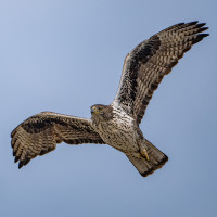
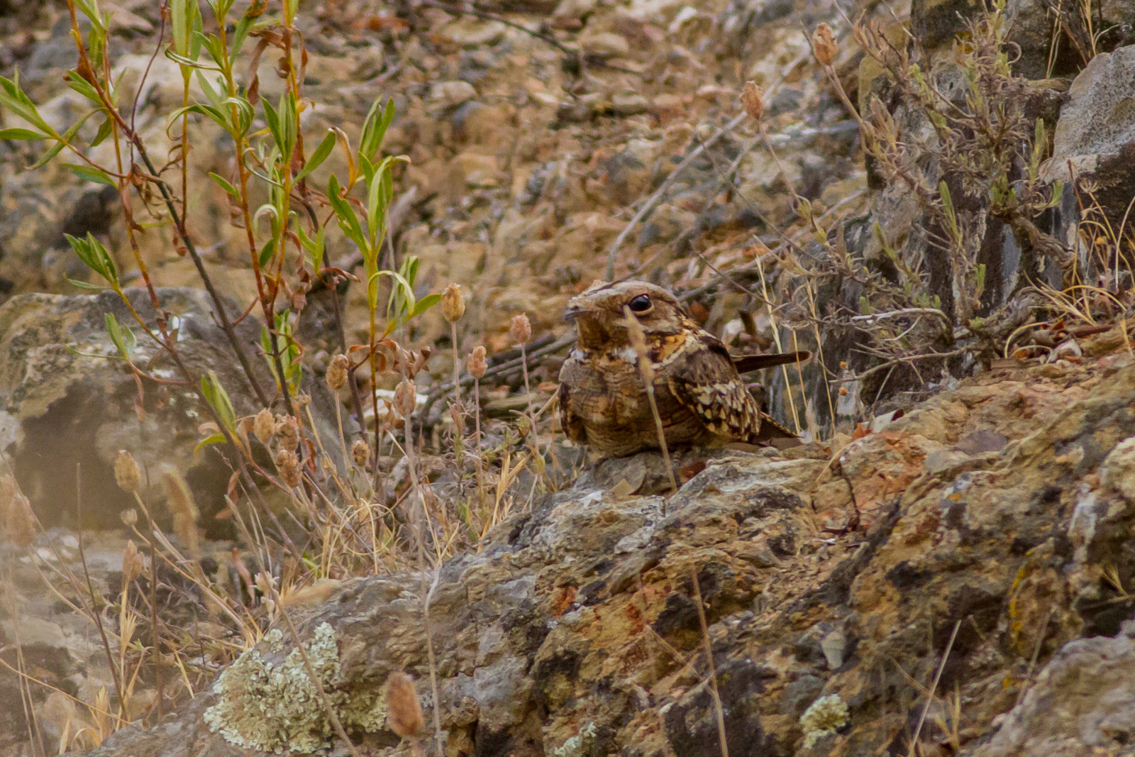
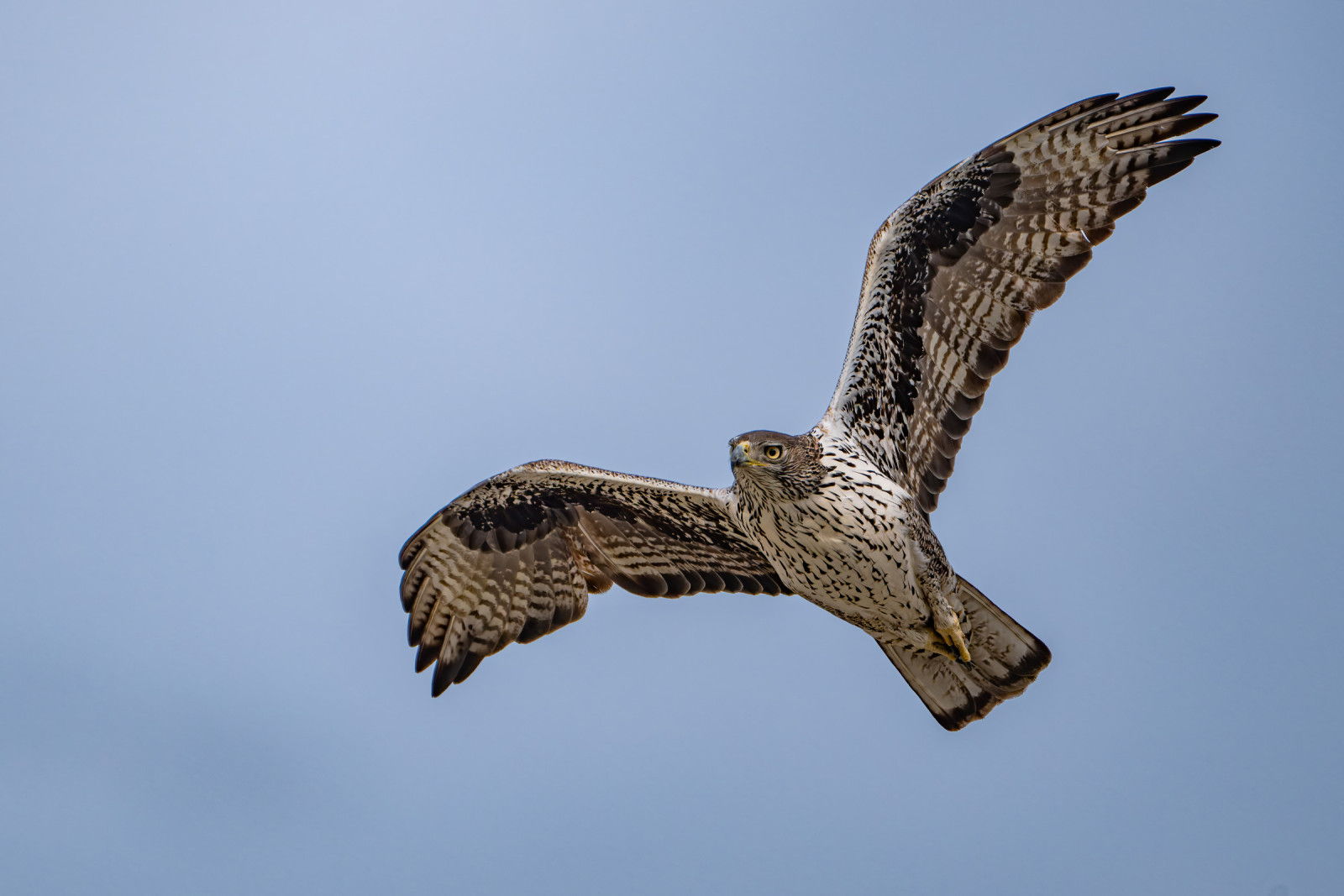
Columbares is an area of great ornithological richness, especially highlighting the group of birds of prey with birds like Aigle royal, Aigle de Bonelli, Buse variable and Grand-duc d'Europe, but also Épervier d'Europe, Faucon crécerelle, Petit-duc scops, Faucon pèlerin, Circaète Jean-le-Blanc and Aigle botté. Other birds in the area include Engoulevent à collier roux, Mésange noire, Grive draine, Grive musicienne, Gobemouche gris, Guêpier d'Europe, Perdrix rouge, Bec-croisé des sapins and Crave à bec rouge.
_________________________
Espagnol: Se encuentra protegida como ZEPA junto a las sierras de la Cresta del Gallo, Villares, Altaona y Escalona. Es un zona de gran riqueza ornitológica, destacando especialmente el grupo de las rapaces: águila real, águila de Bonelli, busardo ratonero o búho real.
From the district of San José de la Vega, along the F-3 highway and in the direction of Balsicas, after passing through San José de la Montaña you continue along the F-13 highway, which runs parallel to the Rambla del Garruchal. You continue along this road from Puerto del Garruchal until you pass the area called "El Estrecho" and shortly after you will arrive at Venta del Garruchal. In front of it there is a large space of land, horizontal, without scrub, this being an ideal place to leave the vehicle and in turn, will be the starting and ending point of this route. Click on the P in the map for directions. The circular walk shown on the map is about 9 km.
_________________________
Espagnol: Desde la pedanía de San José de la Vega, por la carretera F-3 y en dirección hacia Balsicas, después de pasar por San José de la Montaña continuamos por la carretera F-13, que circula paralela a la rambla del Garruchal. Continuamos por esta carretera del Puerto del Garruchal hasta pasar la zona llamada “El Estrecho” y poco después llegaremos a la Venta del Garruchal, frente a ella hay un espacio grande de tierra, horizontal, sin matorral, siendo este un lugar ideal para dejar el vehículo y a su vez, será el punto de inicio y finalización de esta ruta. Haga clic en la P en el mapa para obtener direcciones. El paseo circular que se muestra en el mapa es de unos 9 km.
 ) Insérez les noms d'oiseau dans votre langue. Ils seront automatiquement traduits pour les autres usagers !
Votre feedback sera transmis à l’auteur.rice de cette zone et à l’équipe éditoriale de Birdingplaces, qui l’utiliseront pour améliorer la qualité des informations. (Vous souhaitez publier un commentaire visible en bas de page ? Fermez cette fenêtre et choisissez l’Option 1 : « Publier un commentaire, un conseil ou une observation ».)
Veuillez fournir des suggestions d'améliorations ou d'ajouts au texte de ce site ornithologique.
Veuillez fournir vos suggestions d'améliorations ou d'ajouts à la carte.
Veuillez fournir des suggestions d'améliorations ou d'ajouts à la liste des oiseaux.
Cliquez sur l'icône de l'oiseau () Insérez les noms d'oiseau dans votre langue. Ils seront automatiquement traduits pour les autres usagers !