


Charger images
Les formats d'image autorisés sont de type jpeg, png ou gif
La taille maximale du fichier doit être de 20MB
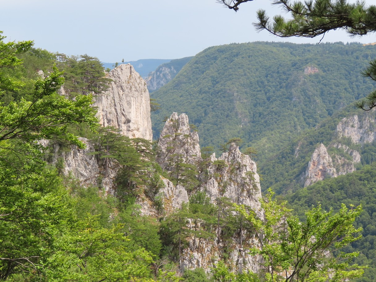
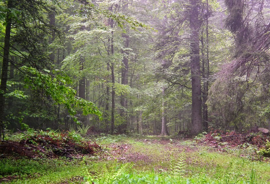
Tara Mountain slopes are clad in dense forests with numerous high-altitude clearings and meadows, steep cliffs, deep ravines and many limestone caves.
In Tara Mountain National Park 80% of the area is covered by forest, 85% of it consisting of Norway Spruce, Silver Fir and the European Beech. Altitude ranges from medium 1000 m up to the 1591 m high Kozji Rid peak.
There are 140 bird species recorded within the national park, 96 of them breeding in recent years. Among the reasonably frequent in the right habitat (= possible and, with some focused effort, realistic) to even common species are Gélinotte des bois (beech and mixed forests), Râle des genêts (larger meadows), Chouette de l'Oural (with over 70 territories, the commonest owl in the park’s mixed forests), Pic cendré (mixed forests), Pic vert (forest edges) and Pic noir (all forests), Cassenoix moucheté (conifer and mixed forests), Mésange noire, Mésange huppée, Mésange boréale, Mésange lugubre, Roitelet huppé, Roitelet triple-bandeau, Grive draine, Bouvreuil pivoine, Serin cini and Bec-croisé des sapins. Also, breeding Merle à plastron and Bécasse des bois. The rarest species are Gobemouche nain, Pic à dos blanc , Chevêchette d'Europe and Chouette de Tengmalm.
Some of the mammalian highlights of the national park are brown bear (relatively numerous, but rarely seen), chamois (frequent), roe deer (common), wildcat, European pine marten, and Eurasian otter.
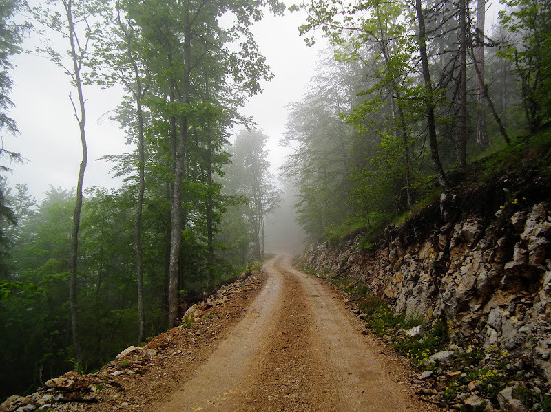
Photos by Mileta Cekovic and Dragan Simic.
Tara National Park lies four hours southwest / 205 km away from the capital of Serbia, Belgrade (260 km by the new highway, or 3 and a half driving hours in both cases) . Access to Tara is possible from three directions: via Bajina Bašta - Kaluđerske bare 16 km, Kremna - Kaluđerske bare 9 km, Bajina Bašta - Mitrovac 27 km.
There are 290 km of marked dirt roads and hiking trails in the park, as well as 75 km of mountain biking routes (most of these tracks are also passable by ordinary cars). Excellent and constantly updated 1:50,000 hiking maps of the park are obtainable at the visitor’s centre in Mitrovac (find the NP authorities at www.nptara.rs, see the link below). The one of many possible routes, circular route shown on the map is about 20 km long.
For driving directions, zoom in on the map and click on the "P" (parking) sign.
To be properly explored, Tara National Park requires at least four days or, better, a week.
 ) Insérez les noms d'oiseau dans votre langue. Ils seront automatiquement traduits pour les autres usagers !
Votre feedback sera transmis à l’auteur.rice de cette zone et à l’équipe éditoriale de Birdingplaces, qui l’utiliseront pour améliorer la qualité des informations. (Vous souhaitez publier un commentaire visible en bas de page ? Fermez cette fenêtre et choisissez l’Option 1 : « Publier un commentaire, un conseil ou une observation ».)
Veuillez fournir des suggestions d'améliorations ou d'ajouts au texte de ce site ornithologique.
Veuillez fournir vos suggestions d'améliorations ou d'ajouts à la carte.
Veuillez fournir des suggestions d'améliorations ou d'ajouts à la liste des oiseaux.
Cliquez sur l'icône de l'oiseau () Insérez les noms d'oiseau dans votre langue. Ils seront automatiquement traduits pour les autres usagers !