


Charger images
Les formats d'image autorisés sont de type jpeg, png ou gif
La taille maximale du fichier doit être de 20MB

High mountain habitat around Golija Mountain's highest peak Jankov Kamen.
Golija (from old Serbian 'golema' - huge) stretches for 32 km (20 mi) between the towns of Ivanjica and Novi Pazar in a C-shape. The highest peak is Jankov Kamen at 1833 meters (Janko's Stone, which Janko allegedly carried to the mountaintop as a part of a bet with his brother Rajko).
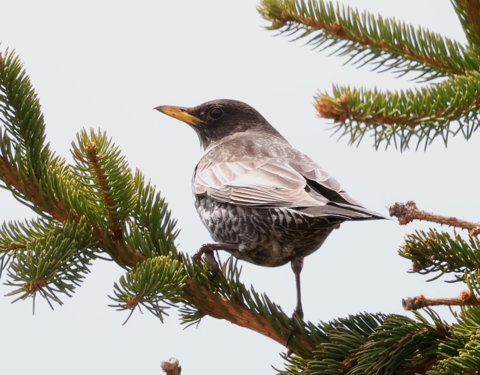
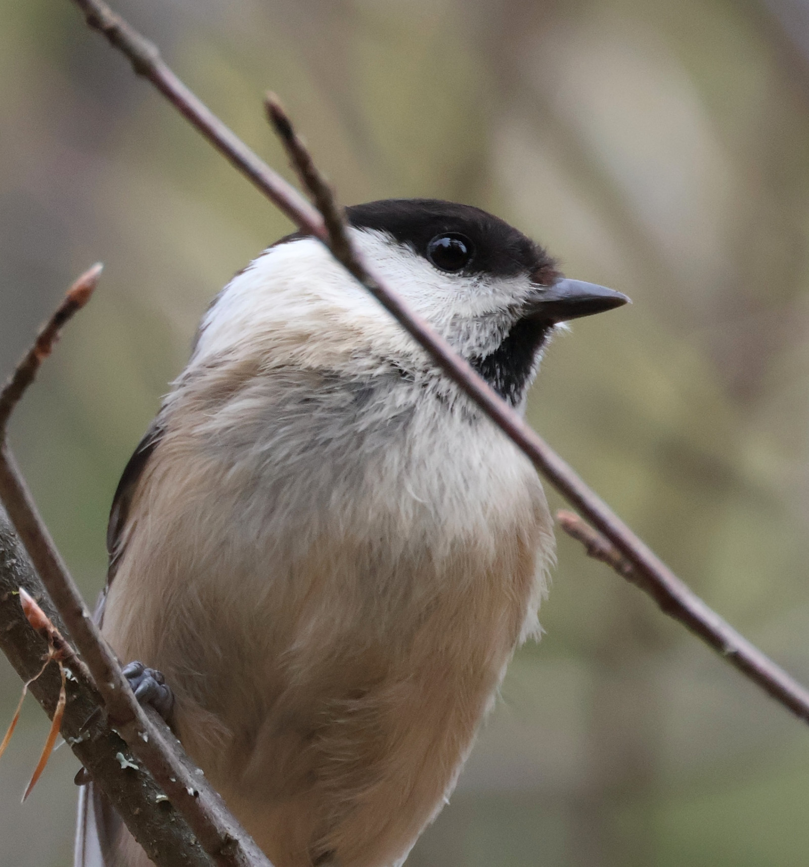
The northern slopes of Jankov Kamen are overgrown with Spruce forests in which you can find Grive draine, Merle à plastron, Cassenoix moucheté, Mésange noire, Mésange huppée, Mésange boréale, Roitelet triple-bandeau, Accenteur mouchet and Bécasse des bois. Southern slopes are mostly covered by meadows and scrubs, hosting Alouette des champs, Pipit spioncelle, and sometimes Alouette haussecol. Golijska Reka (Golija's Stream) is just one of many streams descending northern Golija slopes, usual suspects like Cincle plongeur and Bergeronnette des ruisseaux can be found there.
Jankov Kamen and its surroundings are part of the protected area Golija Nature Park and IBA Golija.
Jankov Kamen can be accessed from four sides, from the town of Ivanjica from the north, from the town of Novi Pazar from the southeast, from the town or Raška from the east, and from the village of Duga Poljana from the southwest. Note that the road from Duga Poljana to Jankov Kamen is not fully paved, with a section of ~5km dirt road (soon to be paved too, but not yet as of writing this guide).
Golija, while not very high in altitude, is a huge mountain. There are more than 25km of paved road over 1500 meters passing through high mountain forests and along the forest edge, making it an ideal place for birding high mountain habitats while not needing to walk around a lot. The paved road from Ivanjica passes 1500m mark around Golijska Reka, continues up to 1750m below the Jankov Kamen peak, then follows the famous Golija C shape over Odvraćenica and Crni Vrh to Jadovita peak.
 ) Insérez les noms d'oiseau dans votre langue. Ils seront automatiquement traduits pour les autres usagers !
Votre feedback sera transmis à l’auteur.rice de cette zone et à l’équipe éditoriale de Birdingplaces, qui l’utiliseront pour améliorer la qualité des informations. (Vous souhaitez publier un commentaire visible en bas de page ? Fermez cette fenêtre et choisissez l’Option 1 : « Publier un commentaire, un conseil ou une observation ».)
Veuillez fournir des suggestions d'améliorations ou d'ajouts au texte de ce site ornithologique.
Veuillez fournir vos suggestions d'améliorations ou d'ajouts à la carte.
Veuillez fournir des suggestions d'améliorations ou d'ajouts à la liste des oiseaux.
Cliquez sur l'icône de l'oiseau () Insérez les noms d'oiseau dans votre langue. Ils seront automatiquement traduits pour les autres usagers !