


Charger images
Les formats d'image autorisés sont de type jpeg, png ou gif
La taille maximale du fichier doit être de 20MB
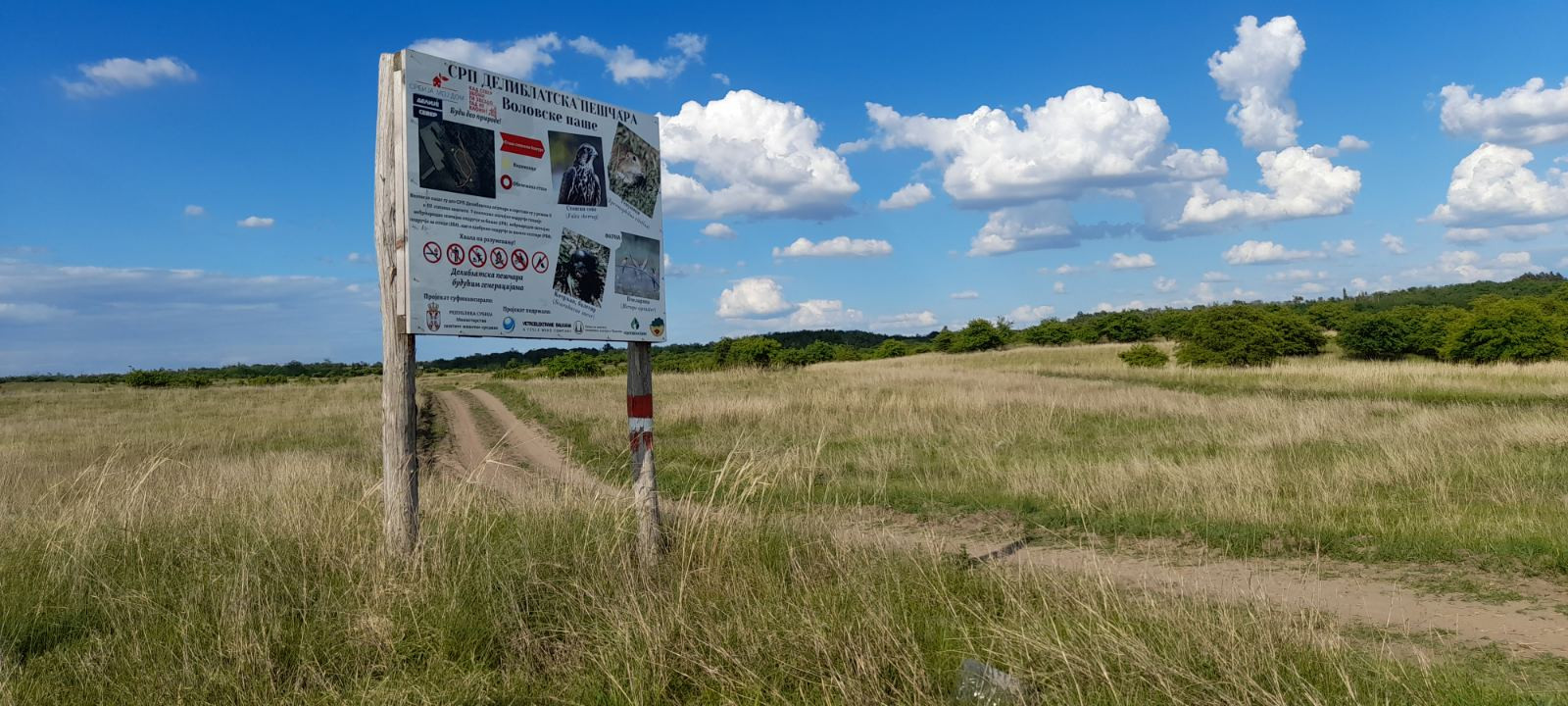

Easily accessible western borders of Deliblato Sands Reserve with a unique and diverse flora and fauna.
Deliblato Sands Reserve's west borders is an area of steppe, sandy, and agricultural open landscape habitats, as well as patches of black locust, black pine, Scots pine, and various deciduous forest species. More than 120 bird species have been recorded in this part of the Deliblato Sands. Considering that the lack of surface water and the lack of waterbirds in the area, this reflects the very high biodiversity of the region. The area shines in spring when migratory birds come, and it is still not too hot. Also, late September and October are very nice and pleasant.
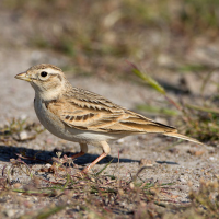
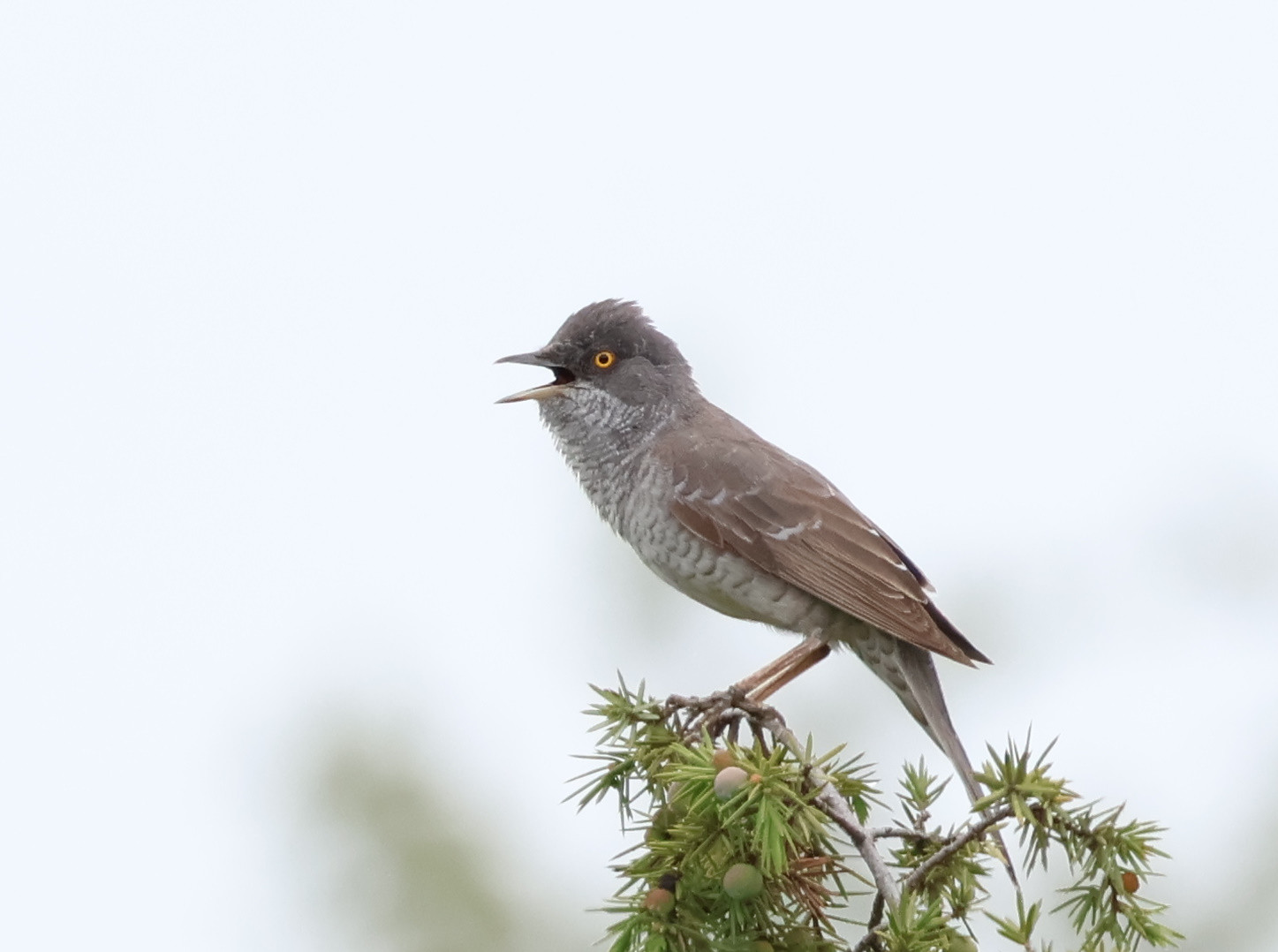
Guêpier d'Europe, Huppe fasciée, Rollier d'Europe, Loriot d'Europe, and Tourterelle des bois are common here. Larks include Cochevis huppé, Alouette des champs, Alouette lulu and Alouette calandrelle. From Buntings there are Bruant proyer, Bruant ortolan, Bruant mélanocéphale and Bruant jaune. Also present are Fauvette épervière, Fauvette des jardins, Tarier des prés, Tarier pâtre, Pipit rousseline, Pie-grièche écorcheur, Pie-grièche à poitrine rose and Pie-grièche grise.
Among other more common birds of prey, the sandy dunes are also patrolled by Circaète Jean-le-Blanc, Aigle botté, Busard cendré, and Faucon kobez. Torcol fourmilier in April and Engoulevent d'Europe after sunset in June are also some of the many highlights of this area.
The area is part of the Deliblatska Peščara Nature Reserve and IBA Deliblatska Peščara.
After about a 50-minute drive from Belgrade, there are 3 main access points to the western borders of the Deliblato Sands Nature Reserve: Devojački Bunar ("Girl's Well"), Dolovo ("Valley Village"), and Mramorak ("Marble Pebble"). To access the entrance from Devojački Bunar, head to Vladimirovac village and follow the way to the northern P mark. To access the entrance from Dolovo, head to the Dolovo village and continue straight following the way to the middle P mark. To access the entrance from Mramorak, head to the village with the same name and follow the turn left to the southern P mark. Click on any P in the map to get directions or coordinates.
All three entry points are interesting in different ways, while Devojački Bunar is the most accessible and has the most tourist infrastructure, Dolovo and Mramorak are more productive for birding. There are many, many paths and sandy roads through Deliblato Sands, especially near the borders. Some suggested paths are drawn on the map, but feel free to explore additional paths (as seen on the satellite map) that lead to your preferred habitat, grassland, scattered bushes, low-deciduous forest, or agricultural. Still, put focus on the borders where the sand and forest patches meet agricultural land, as the biodiversity peaks there.
Bring at least 1l of water per person as climate in the Deliblato Sands is dry and hot on sunny days. Always stick to established tracks and respect wildlife!
 ) Insérez les noms d'oiseau dans votre langue. Ils seront automatiquement traduits pour les autres usagers !
Votre feedback sera transmis à l’auteur.rice de cette zone et à l’équipe éditoriale de Birdingplaces, qui l’utiliseront pour améliorer la qualité des informations. (Vous souhaitez publier un commentaire visible en bas de page ? Fermez cette fenêtre et choisissez l’Option 1 : « Publier un commentaire, un conseil ou une observation ».)
Veuillez fournir des suggestions d'améliorations ou d'ajouts au texte de ce site ornithologique.
Veuillez fournir vos suggestions d'améliorations ou d'ajouts à la carte.
Veuillez fournir des suggestions d'améliorations ou d'ajouts à la liste des oiseaux.
Cliquez sur l'icône de l'oiseau () Insérez les noms d'oiseau dans votre langue. Ils seront automatiquement traduits pour les autres usagers !