


Charger images
Les formats d'image autorisés sont de type jpeg, png ou gif
La taille maximale du fichier doit être de 20MB
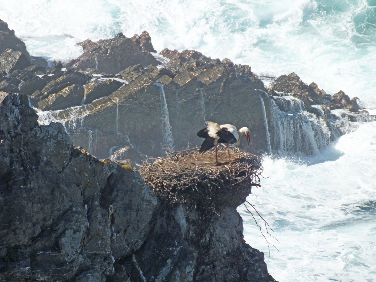
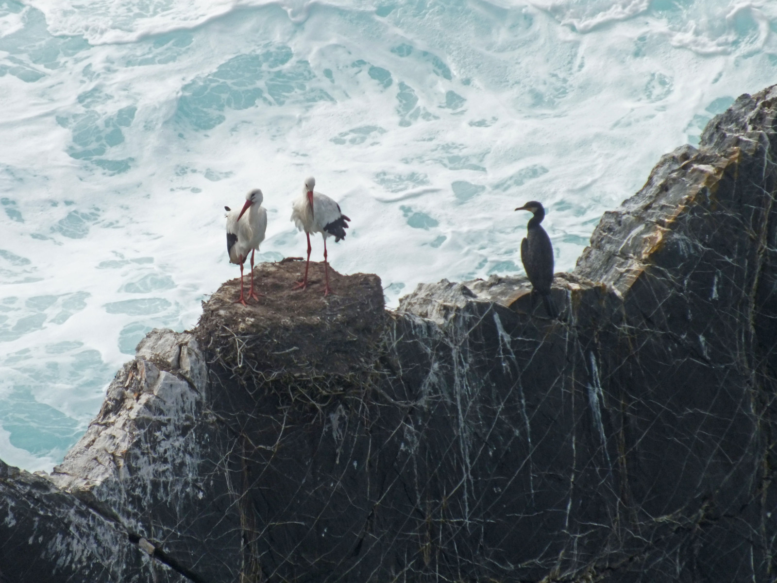
The coast near Cavaleiro is characterised by steep cliffs of about 40 - 50 m high and individual rock columns standing out in the sea.
On these cliffs you can observe many Cigogne blanche nesting in late winter and spring. Above this coast a narrow path leads, which shows new rock formations, bays and a wild ocean. Be careful with the cliffs! Most of them are safe, however all off them must be taken with caution.
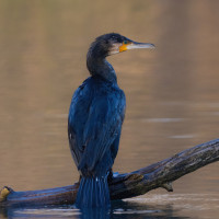
In addition to birds of rocky slopes (Faucon crécerelle, Faucon pèlerin and Monticole bleu) birds of rough areas can also be seen inland. In addition to Tarier pâtre and Rougequeue noir, the Outarde canepetière also occurs here. Furthermore, this is an area where you can observe marine seabirds passing.
_________________________
Português: Nestes penhascos, é possível observar muitas Cigogne blanche a nidificar no final do inverno e na primavera. Acima desta costa, há um caminho estreito que revela novas formações rochosas, enseadas e um oceano selvagem. Cuidado com as arribas. A maioria delas são seguras, contudo, devem ser encaradas com cautela.
Além de aves características de encostas rochosas (Faucon crécerelle, Faucon pèlerin e Monticole bleu ), também é possível observar aves de zonas agrestes no interior. Para além do Tarier pâtre e do Rougequeue noir, o Outarde canepetière também ocorre nesta área. Para além disto, é uma zona onde é possível observar passagem de aves marinhas.
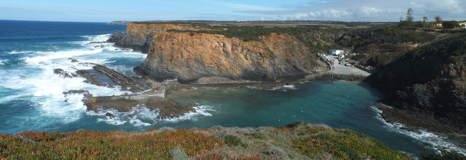
From Cavaleiro, the CM 1124 takes you to the Farol do Cabo Sardão. Parking is available at the football stadium just south of the lighthouse. Press P on the map for directions. The walk below takes 2 to 3 hours. The coastal path here is much longer, allowing for much longer walks.
_________________________
Português: De Cavaleiro, a CM 1124 leva-o ao Farol do Cabo Sardão. Há estacionamento disponível no campo de futebol, a sul do farol. O percurso indicado abaixo demora entre 2 a 3 horas. O caminho costeiro nesta área é muito mais extenso, permitindo caminhadas bem mais longas.
 ) Insérez les noms d'oiseau dans votre langue. Ils seront automatiquement traduits pour les autres usagers !
Votre feedback sera transmis à l’auteur.rice de cette zone et à l’équipe éditoriale de Birdingplaces, qui l’utiliseront pour améliorer la qualité des informations. (Vous souhaitez publier un commentaire visible en bas de page ? Fermez cette fenêtre et choisissez l’Option 1 : « Publier un commentaire, un conseil ou une observation ».)
Veuillez fournir des suggestions d'améliorations ou d'ajouts au texte de ce site ornithologique.
Veuillez fournir vos suggestions d'améliorations ou d'ajouts à la carte.
Veuillez fournir des suggestions d'améliorations ou d'ajouts à la liste des oiseaux.
Cliquez sur l'icône de l'oiseau () Insérez les noms d'oiseau dans votre langue. Ils seront automatiquement traduits pour les autres usagers !