


Charger images
Les formats d'image autorisés sont de type jpeg, png ou gif
La taille maximale du fichier doit être de 20MB

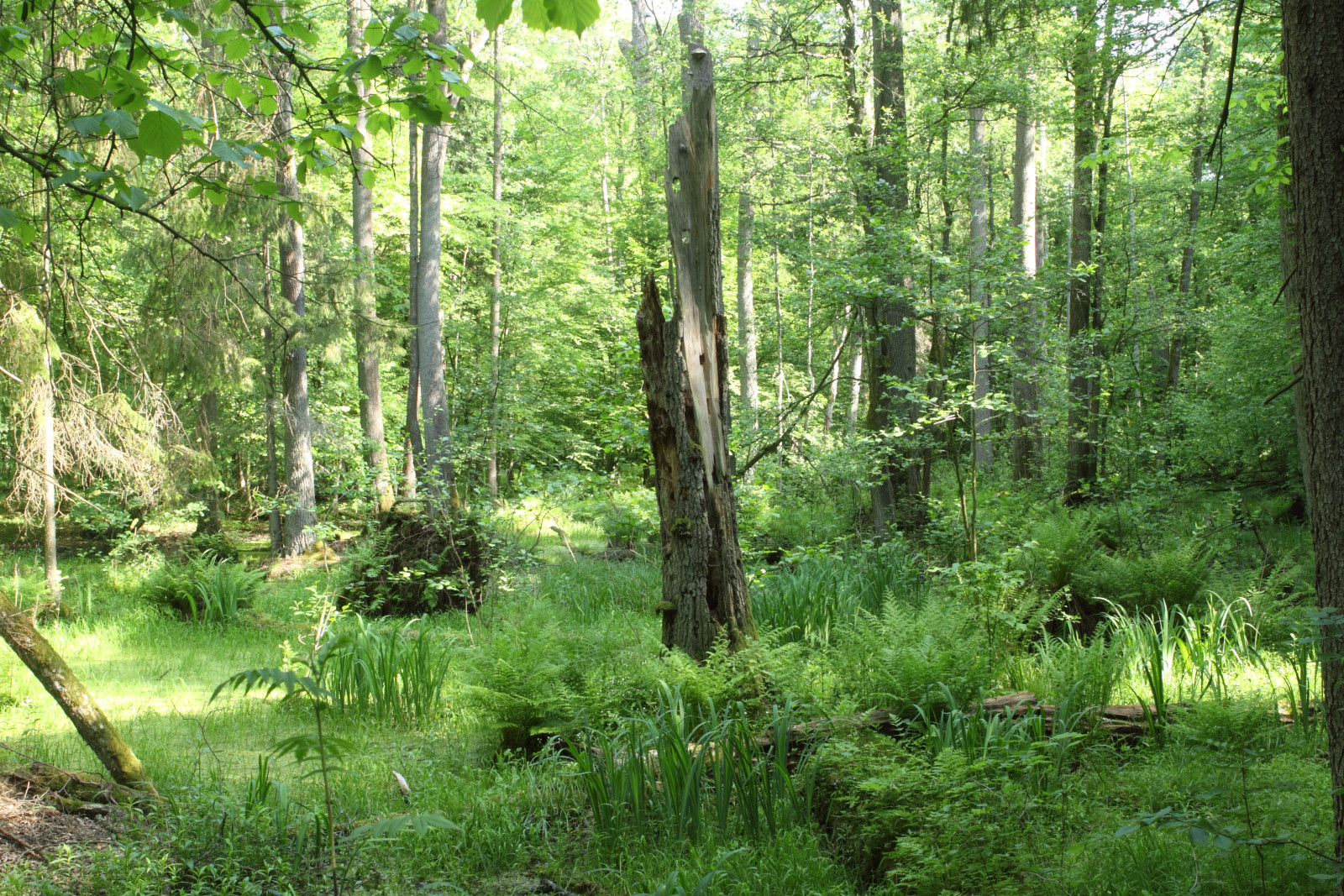
The Żebra Żubra trail traverses some of the finest stands of old growth forest one can find outside of the National Park Białowieża's strict reserve.
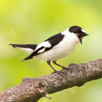
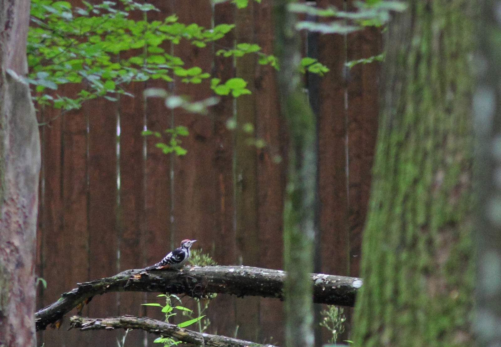
The first stretch of Żebra Żubra trail traverses a magnificent, ancient patch of alder carr forest. Dikes and boardwalks allow you to keep your feet dry. Many of Białowieża's specialties can be found here, including Pic tridactyle, Pic à dos blanc, Pic cendré, Pic épeichette and Gélinotte des bois. After passing Białowieża's little zoo, the trail traverses another superb patch of old-growth forest, this time of the Oak-Linden-Hornbeam variety. It immediately becomes apparent that the higher, drier soils here give rise to a completely different type of vegetation. Because of this the bird community here differs slightly from that of the alder carr forest. Pic à dos blanc, Pic mar, Pic noir, Gobemouche à collier and Gobemouche nain are among the possibilities here.
Just before entering the village of Białowieża proper, it is possible to cut back to the car park though the meadows of Zastawa. These wet meadows, with interspersed trees and bushes, are home a different ensemble of birds altogether. Pie-grièche écorcheur and Rossignol progné are fairly common while Roselin cramoisi and Fauvette épervière require more luck to spot. From the car park it is a short walk to a nearby watchtower. This spacious platform is a nice spot to have a break and maybe something to eat or drink. The tower overlooks the valley of the Narewka and is an excellent spot to do some more birdwatching. Here, a telescope might come in handy. With a bit of luck, Cigogne noire or Aigle pomarin can be seen soaring overhead and in late spring or summer evenings, a choir of Râle des genêts can usually be heard.
From Białowieża village, take the road heading to Pogorzelce, Teremiski and Budy. Some 100 meters after entering the forest (immediately after passing Skansen Open Air Museum), a small car park on the left hand side marks the beginning of the trail. Alternatively, continue down the same road for another 700 meters to find the car park of the watchtower on your right hand side. Click on the P in the map to get directions. The length of the walking route indicated on the map is about 9 km.
 ) Insérez les noms d'oiseau dans votre langue. Ils seront automatiquement traduits pour les autres usagers !
Votre feedback sera transmis à l’auteur.rice de cette zone et à l’équipe éditoriale de Birdingplaces, qui l’utiliseront pour améliorer la qualité des informations. (Vous souhaitez publier un commentaire visible en bas de page ? Fermez cette fenêtre et choisissez l’Option 1 : « Publier un commentaire, un conseil ou une observation ».)
Veuillez fournir des suggestions d'améliorations ou d'ajouts au texte de ce site ornithologique.
Veuillez fournir vos suggestions d'améliorations ou d'ajouts à la carte.
Veuillez fournir des suggestions d'améliorations ou d'ajouts à la liste des oiseaux.
Cliquez sur l'icône de l'oiseau () Insérez les noms d'oiseau dans votre langue. Ils seront automatiquement traduits pour les autres usagers !